Refine Search
- hike 21
- mountain bike 8
- disc golf 4
- swim 3
- cross-country ski 2
- horseback 2
- hot springs 2
- snowshoe 1
- dive 1
- camp 1
- sled 1
- backpack 1
- rock climb 1
- canoe 1
- kayak 1

Lone Star Geyser Trail
Old Faithful, Yellowstone National Park
3.1 miles S of Old Faithful, Yellowstone National ParkLone Geyser Star Trail is a hiking and mountain biking trail that leads through the forest to the colorful Lone Star Geyser. The Geyser here has beautiful white, yellow and orange colors in the surrounding rock buildup. The geyser erupts once approximately every 3 hours with an impressive 30-45 foot spray. Those who witness an eruption should note the time and report their sighting at the Old Faithful Visitor Education Center.
The trail is 4.8 miles round trip and allows bikes along the entire trail, and mountain bikes are recommended. Bikes are not allowed past the geyser barrier. The trail takes approximately 2-4 hours to complete. This mostly dirt trail is fairly level with scattered patches of pavement. This is a long but easy hike, and a good mountain bike trail for bikers of any level. This trail is open during daylight hours in the summer and fall.
Visitors should be on the lookout for wildlife and keep a safe distance from any animals.
Mr. Bubbles Hot Spring
Old Faithful, Yellowstone National Park
24.0 miles SW of Old Faithful, Yellowstone National ParkMr. Bubbles is one of the few places you can actually soak in the thermal waters of Yellowstone National Park. The Bechler area of Yellowstone is one of the best kept secrets of the otherwise densely populated park. It's off the beaten path far from paved roads, boardwalks, tour busses and gift shops. In the backcountry, you'll walk singletrack dirt trails and see natural features not included on any brochure. There's also a good chance you'll see wildlife outside the safe comforts of your car door. Be aware of the animals around you (like bears, moose and bison). Give animals their space as to not threaten them.
You'll find the hot spring about halfway between the Bechler Ranger station and Old Faithful on the Bechler River Trail. (If you want to camp along the trail, you'll need to make a reservation with one of the parks backcountry offices)
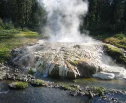
This is a 15 mile hike to the attractions and another 15 to get out. Along the trail, you'll see several waterfalls and will have to cross the river multiple times. Some crossings are on logs while others are on bridges. Plan to get your feet wet. There is an impressive thermal feature near the hot springs.This is not the hot spring. This thermal feature is what pours into and heats up the small stream where you will soak in. Do not mistake this for the soaking pool you're looking for. The feature is dangerous because it will scald and can kill you. Mr. Bubbles will relax you. Don't mix them up!
CAUTION: WATER TEMPERATURES CHANGE AND ARE NOT ALWAYS SAFE. CHECK WITH THE RANGER STATION TO MAKE SURE IT'S SAFE BEFORE YOU PLAN YOUR TRIP.
CAUTION: NEVER HIKE AT NIGHT IN THE HOTSPOT AREAS OF YELLOWSTONE.. YOU WOULDN'T BE THE FIRST EXPERIENCED HIKER TO BE SCALDED TO DEATH IN AN UNEXPECTED THERMAL FEATURE.
Check https://www.nps.gov/yell/planyourvisit/swimming-soaking.htm for closures, regulations, and conditions.
Union Falls & Ouzel Pool
Grant Village, Yellowstone National Park
26.6 miles SW of Grant Village, Yellowstone National Park
Mallard Lake
Old Faithful, Yellowstone National Park
0.3 miles SE of Old Faithful, Yellowstone National ParkThe Mallard Lake trail is majestically lined with trees both old an new. This is a 5 mile leading to the beautiful Mallard lake, making it a 10 mile round trip. The trail is most popularly used for hiking, running, camping, and is best to hike from May-September. The Mallard lake trail gives a spectacular birds eye view of Yellowstone's Old Faithful. The trail is known to change scenery every mile or so, ranging from young and old pine, to rocky terrain, and then grassy meadows. Wildflowers are in abundance on this hike as well. These flowers can be found along the trail and surrounding the lake. The lake is calm, and only experiences disturbances when the wind causes ripples or when the fish create bubbles.
This lake is a little more private, which means it does not get very crowded during the warmer seasons. You can hike to the lake and enjoy a meal with a view, or let all of your senses indulge in the scenic creations. Many of the trees that were knocked down from the Yellowstone fires in 1988 can be used as seats or tables by the lake. Since the fire, the forest along the creek and surrounding the lake has developed into a beautiful, youthful, green woodland.
The lake itself was once known to be overly populated with fish.The rangers in the area tried to combat the over population and saw little success in the past. However when Yellowstone opened the area for public fishing the solution was found. the Mallard Lake is still brimming with lake trout. If you being your fishing gear on this hike, you might come home with dinner!
Packsaddle Lake
Tetonia, Idaho
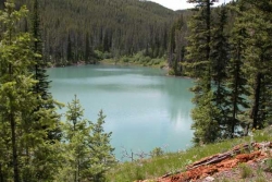
9.3 miles W of Tetonia, IdahoPacksaddle is one of the less well known lakes/trails in the area. If you've got a good offroad vehicle, you can probably make it all the way to the end of the road, otherwise, it's just an extra 0.5 miles up the hill. Even to get to that point though, you may push the limits of your car or mini van and be required to do some pretty technical driving. There are plenty of good spots to park along the road if you decide that's as far as you can drive. The descent to the lake is pretty steep (300ft elevation drop) but less than a 1/2 mile to the lake. You'll be able to see the lake from the top of the trail. There's a little camp area on the eastern edge of the lake.
Mountain Bike Trail (From Lower Trailhead)
It starts on a slight incline and then gets gradually steeper. Trail is pretty smooth. After a tough climb, you get a downhill followed by a field. Then there's a fork in the road. If you actually want to get to the lake, take a left at the fork. Climb some more. View the beautiful Tetons on your left. You'll come to a clearing at the top. If you look down to the left, the lake is between the trees down the steep decline singletrack. Don't ride right into the lake. It's freezing, and does a quick dropoff. Courtesy of Singletracks.com
Riddle Lake Hike
Grant Village, Yellowstone National Park
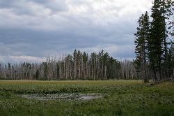
2.8 miles S of Grant Village, Yellowstone National ParkRiddle Lake hike is a 5 mile roundtrip hike. Riddle Lake is an alluring body of water with a sandy beach. The hiker gets the best of both worlds on this hike. Impressive pine and mountain views, meadows, and a lake with a mini beach area.The trail is an easy hike because elevation is hardly detectable, and allows the hiker to focus on the scenery.This hike takes you through a blanket of forest, then a dirt trail. You will pass several tree trunks covered in scratch marks, offering fresh evidence that bears frequent this area*. This hike is closed for a majority of the hiking season due to swans nesting in that area. To know if it is available to hike, contact a park ranger.
The history of Riddle lake dates back a few centuries. It was named by early explorers in the 1800's who were uncertain about which ocean the lake drained toward because it sits so close to the Continental Divide- it was believed flow toward both the east and west oceans and then later discovered that it actually flowed into Yellowstone Lake.
This area does attract a lot of wildlife such as Elk, Moose and Grizzly bears. Upon reaching the lake you can see the Red Mountains to the south. The trail then follows the shore and eventually ends at a black sand beach on the northeast side. Many people stop their hike when they approach the lake, but you can continue around the lake to enjoy the scenery.
This is considered an easy hike with little elevation difference.
*WARNING: To stay extra safe, it is smart to have bear spray with you on your hike and also to make noise while you are on your hike to keep wildlife away. When it comes to wildlife, if you see them on your hike, do not approach them, for your own safety. You can take pictures of wild life but do not approach to pet.
Duck Lake
Grant Village, Yellowstone National Park
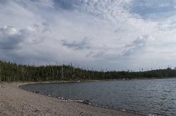
1.5 miles N of Grant Village, Yellowstone National ParkDuck Lake Trail is located near Grant Village and West Thumb. This is a simple 0.8 miles hike that takes you through the Lodgepole pine forest. This hike is special because the surrounding forest details the catastrophic effects of 1988 wildfires. The forest also displays its resilience as saplings push through the soil to replenish the forest. The path for the trail begins on the main road across from the parking lot.The trail itself goes up a hill and then as you reach the peak of the hill, the beautiful Duck Lake is exposed.The hill then slopes onto the shore of Duck Lake creating a sandy beach feel.There are many tress that have fallen along the shoreline due to the fire. These trees can be used as a seating area, or picnic area.This trail is great for hikers of all ages.The hardest portion of the hike is the beginning, but making it over the hill will be well worth it. The lake can be enjoyed for its scenic value. Duck Lake has many calming properties because it is a very still lake. Apart from wind forming ripples, you won't see much action in the lake itself. If you'd like, you can also take a stroll along the beach and relax.
Except for the occasional buzz of cars near the west end of the lake, you might have little idea that this lake is just 100 yards from the highway. Many hikers have said that the most peaceful time is during the evening right before the sun sets over the lake.
WARNING: This location is not considered a swimming area and would be best if you wore closed-toe shoes and kept shoes on because leeches have been reported.
Fairy Falls
Old Faithful, Yellowstone National Park
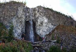
3.8 miles N of Old Faithful, Yellowstone National ParkFairy Falls is something out of a fantasy novel. Fairy Falls is a wonderful portion of Yellowstone. It has stolen the hearts of many who have had a little pixie dust sprinkled on them from the mist of the waterfall. Fairy Falls is one of the tallest waterfalls in Yellowstone, it stands 197 feet high. The river that feeds this waterfall is naturally thin, which is what gives Fairy Falls its wispy nature. The waterfall is smaller in nature during the dyer months, however in the spring when the snow melts, it is a delightful sight.
The trail to Fairy Falls is also extremely scenic. There are many hot springs that can be spotted, including the famous Grand Prismatic Spring. Because there are many natural springs and sights along the trail, you may find the trail to be quite crowded in the beginning. As you continue on the trail, you will find a much quieter experience. The trail is mostly flat only reaching an incline as you progress into the thicket of the trees. You will then be graced by the majestic view of Fairy Falls.
To get there, you'll cross the steel bridge over Firehole River, then pass over the Grand Prismatic Spring. You will then turn left at the junction and go through the Lodgepole forest near the Fairy Meadows until you reach Fairy Falls. Don't worry, there's no trolls under the bridge, you shouldn't have to answer any riddles, and as far as we know, these are the nice kind of fairies*.
Most of the amazing pictures you see of the Grand Prismatic Spring were taken from somewhere along this trail. There's an overlook just off the trail about 0.75 miles into the trail if you want an even better view.
Fairy Falls gets its name from the "graceful beauty with which the little stream [drops] down a clear descent" and was named by members of the 1871 Hayden Survey. At only 5 miles round trip and only 279 feet of elevation gain, this is one of the more popular non-boardwalk hikes in Yellowstone National Park.
* FREEARENAS.COM IS NOT LIABLE IN THE EVENT THAT YOU OR ONE OF YOUR LITTLE ONES IS CARRIED OFF BY A NOT-SO-NICE FAIRY.
Sentinel Meadows & Queen's Laundry
Madison, Yellowstone National Park
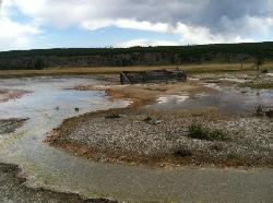
5.5 miles S of Madison, Yellowstone National ParkThe hike to Sentinel Meadows and Queens Laundry gives you a level trail with wide open meadows, hot springs, ponds, birds, and a little bit of Yellowstone National Park history. The trail can be done by hiking directly to Queens Laundry and back or made into a little loop that’s a bit longer through another meadow. Courtesy of hike734.com
Sentinel Meadows and Queen's Laundry is a hiking trail that follows the Firehole River. Flaming red hot springs and beautiful oat colored meadows can be seen on this trail. The construction of Queen's Laundry, is a historic site that dates back to the 1800's when people used the geothermal pools to bathe. The thermal water provided a relaxing bathing experience, while having amazing cleansing properties.The idea behind the laundry was that it was the first structure built at its time that was a hot spring fed bathing pool. Half of the structure was intended to be for bathing, while the other half was for the laundry. Unfortunately, the laundry was never completed, and as ownership of the park changed overtime, the structure remained a half finished bath/laundry. What is left of the structure can still be seen today in almost perfect condition. The minerals emitted from the hot springs surrounding the area preserved the structure, and it is now considered a historic site.
It is important to know that going off trail is not permitted on this hike. There are dangerous hydrothermal areas that can cause injury if they are encountered. However these areas are a beautiful sight from the trail, as it glows shades of orange, burnt orange, and copper.This is a moderate hike, and is 4.7 mile trail that leads straight to the hydrothermal springs. There is little change in elevation, which makes this hike brilliant for all ages. Bison have been seen here as well as other deer and caribou species. This hike is extremely scenic, and true of Yellowstone's beauty.

Howard Eaton Trail
Canyon Village, Yellowstone National Park
0.7 miles W of Canyon Village, Yellowstone National ParkThe Howard Eaton Trail is a hike with a variety of destinations along a 10 mile trail. The trail can be entered and exited at several points but is most commonly started near Canyon Village. The trailhead can be found about a half mile west of Canyon Village on Norris Canyon Road. There is a turn out by the trailhead where parking is available.
Along the trail, hikers pass Cascade Lake, Grebe Lake and Wolf Lake. These are beautiful lakes where hikers can stop and fish. Anyone wishing to fish must comply with Yellowstone’s fishing rules and guidelines.
The Howard Eaton Trail is open during the summer and fall months. Hikers can enjoy this warmer weather as they hike through miles of forests and meadows along the trail.
Hikers wishing to hike the entire trail should prepare for a long hike. Howard Eaton Trail is 10 miles in one direction. Hikers can prepare by leaving a vehicle at the other end of the trail or packing enough supplies to hike the full 20 miles.
The Howard Eaton Trail is a beautiful, challenging trail with a variety of views. The forests, lakes and meadows of this trail make this unique hike a wonderful Yellowstone adventure.

Observation Peak Trail
Canyon Village, Yellowstone National Park
1.3 miles N of Canyon Village, Yellowstone National ParkObservation Peak Trail is one of the most famous hikes in Yellowstone National Park. The hike is an almost 10 miles there and back hike that starts and ends at the same trailhead.
Observation Peak Trail starts out at the same trailhead as Cascade Lake Trail. There is parking available at the trailhead.
Hikers on this trail can expect to enjoy forests, meadow and a beautiful view of Cascade Lake. The trail to Cascade Lake is about two miles. This is the easy part of the trail. It is well paved and has very little elevation change. At the end of this part of the hike, hikers can rest next to the beautiful Cascade Lake.
From Cascade Lake the trail splits off onto Observation Peak Trail. From the lake the trail is 2.6 miles long and ascends 1,400 feet. This is the more difficult part of the trail but ends with an incredible view from the peak of the mountain.
The trail is only open during the summer and fall, due to heavy snow in the winter and spring. During these warmer months hikers can enjoy the forests, meadows and wildflowers along the trail.
Observation Peak Trail is an incredible hike for people in Yellowstone wanting to connect with nature and see Yellowstone from above the park.

Lewis River Channel / Dogshead Loop
Grant Village, Yellowstone National Park
5.6 miles S of Grant Village, Yellowstone National ParkAnyone who doesn't want to backpack through Yellowstone but is looking to experience the real beauty of Yellowstone will truly love this hike.
Walking along the Lewis Channel is one of the best parts of this hike. After passing the trailhead, Lewis Lake shines brightly as the sun hits it. This is the perfect scenery and views of the Grand Teton. If you head west on your hike, you will soon come to the river channel which is very serene because the trail brings you right along the edge of the lake.
As you reach the end of the Lewis Channel trail you’ll see the Outlet Patrol Cabin and Shoshone Lake. The lake is a shimmering lake of crystal clear water and is surrounded by mountains covered in tall trees. There is a lot of driftwood along the shore which offers a wonderful spot to stop for lunch. One of the Shoshone Lake’s claim to fame is that it’s the largest lake in the continental United States without a road to it. Spend some time listening to the silence and feeling peace surround you.
This is a favorite hike and scenic area filled with birds like Osprey, Bald eagles and Ravens. Don't forget to pack your inflatable kayak to enjoy the water and nature around you.

Lake Overlook
Grant Village, Yellowstone National Park
1.4 miles N of Grant Village, Yellowstone National ParkThis trail is located in the southern part of the park, with the trailhead in the West Thumb Geyser Basin parking lot. This is about a 1.7 mile hike, roundtrip, that starts and ends at the trailhead. This is considered a moderately harder hike, that can take from 1 to 3 hours to do, depending on your speed.
West Thumb Geyser Basin is a big draw of the crowds during the summer. This hike is the perfect little escape from the crowds. It allows you to see the beauty of the park and you can go at your own pace. This hike leads to a mountain top meadow that gives a remarkable overlook of West Geyser and Yellowstone Lake.
NOTE: Pets are not allowed on this trail. Always make sure that you are making noise and carry bear spray, just in case. If you see wildlife, do not approach them to ensure yours and their safety. If you get the day hike map that is handed out at the visitor center, it was found to be inaccurate for this trail. The trail is actually 1 mile from the parking lot to the top of the hill, not 0.3 miles as the map claims.
Lower Falls of the Yellowstone
Canyon Village, Yellowstone National Park
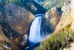
1.1 miles S of Canyon Village, Yellowstone National ParkLower Yellowstone Falls is one of the most popular places to visit in Yellowstone, coming in just behind the geyser, Old Faithful. The tallest waterfall in the park, Lower Yellowstone Falls is about 308 ft. Upper Yellowstone Falls feeds this waterfall and can be accessed through a trail before reaching Lower Yellowstone Falls. Because of a turn in the river, both waterfalls are not visible at one time, instead visitors can see just one waterfall at a time.
Both falls are located in a 20 mile long canyon nicknamed the Yellowstone Grand Canyon. The Yellowstone River feeds the falls and it is the longest undamed river in the continental United States. The canyon was created through water eroding the volcanic rock. Lower Yellowstone Falls is particulary beautiful because the large waterfall contrasts with the yellow "rusting" rocks that make up the canyon walls. The iconic "yellow" color in Yellowstone is from the many rocks that oxidize because of the rust and iron found in the rock.
The 308 foot waterfall is taller than Niagra Falls and has many lookout points, offering a variety of views from up close to miles away. There are several trails that can be taken to experience all the views, each with a parking lot before the trailhead. The trails are still open in the winter, however please be aware that they may be icy, as well there are steep drops and switchbacks. In the winter, the trails can only be accessed by snowmobile or snow coaches.
Following the Grand Loop Road, visitors will be able to see the waterfall and access the various trailheads. The summer time will be the busiest time as toursits from all over are enjoying the park. Spring and Fall are especially beautiful, however the road to access the falls opens in mid-April and closes in late October. Turning onto North Rim Drive, visitors will have access to all the view points on that side of the waterfall. The first viewpoint is the Brink of the Lower Falls. Visitors are able to get quite close to the falls, putting them right next to the mouth of the falls as the water goes cascading down below them. The trail is a steep hike down, but a must see. While right at the mouth of the waterfall, visitors can turn and look out at the canyon and see it continue on its 20 mile journey.
Next is the Lookout Point. This offers a panoramic view of the surrounding canyons and waterfall. Though it is several miles away from the actual waterfall, visitors can still hear the booming of water flowing over the falls. The Lookout Point is also the trailhead for Red Rock Point, which gives the closest full view of the waterfall for visitors. It is a steep trail as well, with a sign warning "A steep descent to Red Rock will take you to the North Rim’s closest full view of Lower Falls. Please be prepared for steep grades, steps, and a rough surface. The trail descends rapidly—about 500 feet (150 m) in 3/8 mile (0.6 km). Wear sturdy walking shoes with good tread, and be prepared for a steep uphill return".
Grandview is another lookout point along the North Rim Drive. It provides another panoramic view of Lower Falls, though not as close as the one found at lookout point.
Inspiration Point is the last viewpoint along North Rim Drive. Not much of the Lower Falls are visible from here, but a panoramic view of the canyon reminds visitors just how small they really are when compared to the towering canyon walls.
On the opposite side of the Lower Falls are two additional trails, Uncle Tom's Trail and Artist Point. Taking South Rim Road, visitors will first see the trailhead for Uncle Tom's Trail. This trail consists of 328 steel steps that take visitors about 3/4 of the way down the Canyon. Like the view from the Brink of Lower Falls, visitors will be very close to the falls as the water goes tumbling down below them.
Artist Point is one of the most photographed views in Yellowstone. It is a very easy hike with little elevation gain. Visitors will be awed when looking at the canyon from Artist Point, for it shows just how wide and deep the canyon has become from thousands of years of erosion.

Shoshone Lake (via DeLacy Creek)
Old Faithful, Yellowstone National Park
6.3 miles E of Old Faithful, Yellowstone National ParkIf you are just coming from Old Faithful and want a break from the crowds, this hike is a perfect leg-stretching, moderate 6.1 mile hike. This hike takes you through the forest and grassy trail. As the hike comes to an end, the trail gets wider and leads you to the edge of Shoshone Lake.
The name "DeLacy Creek Trail" comes from Walter Washington DeLacy, who was the leader of an expedition going through the Yellowstone region in 1863. He was credited for the first reliable map of Yellowstone two years after his expedition. Shoshone Lake used to be know as "DeLacy Lake" for a while. By 1872, Shoshone Lake held five or six different names until Park Superintendent P.W. Norris thought the name Shoshone Lake was fitting because of the Indians that frequently were found nearby.
Fishing at Shoshone Lake is allowed if you have received a fishing permit from the park. If you catch a native fish to the park, you can catch and release it. If it is nonnative, there is no limit to how many fish you can catch. Native fish include the cutthroat trout, mountain whitefish and Arctic grayling. Nonnative fish include: brown trout, brook trout, rainbow and lake trout. Fisherman are asked to only fish with single, pointed, barbless hook and lead-free artificial lures. All watercraft needs to have a permit purchased from the park service
REMEMBER: Backcountry hydrothermal areas do not have boardwalks like the park does. Scalding-hot water and/or steam can lie beneath a thin crust. Be careful and use caution when entering Shoshone Geyser Basin. Stay away from areas that do not have vegetation, as that is a sign of a natural hydrothermal area. Carelessness in the backcountry thermal areas is dangerous and destructive to these rare features.
John Bryan State Park
Yellow Springs, Ohio
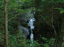
1.8 miles SE of Yellow Springs, OhioThe most scenic state park in western Ohio just one mile from Yellow Springs. The 752-acre park contains a remarkable limestone gorge cut by the Little Miami Scenic River. Campgrounds, hiking, mountain biking, rock climbing and rappelling, fishing, canoeing and picnicking. Pets allowed.Courtesy of yellowspringsohio.org
There are ~12 miles of mountain biking trails at John Bryan State Park. The trails were built and are maintained by the Miami Valley Mountain Bike Association (MVMBA) in partnership with the Park. Courtesy of MTBProject.com
Its a pretty simple trail, theres really no elevation changes or tough obstacles besides a few log jums and some small ramps. Theres one creek crossing. There are three loops you can ride with a total of 12.4 miles. There are a lot of tight turns on the longest loop so its hard to gain some good speed. Courtesy of Singletracks.com
City Creek
Pocatello, Idaho
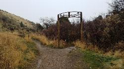
1.3 miles S of Pocatello, IdahoThe City Creek Management Area (CCMA) Trail System is a vast network of trails maintained by the City of Pocatello. There are trails to go up and others to come down. Most trails come back to the parking lot, making it much like a ski-hill setup, only without the lift and expense.
Trails
- City Creek Trail: (2.75 miles)
Main single track trail which meanders along City Creek. Total elevation gain for the Trail is 930 feet. - Lower City Creek Trail: (1.21 miles)
Lower portion of the City Creek Trail from the Grant Street Parking Lot to Bridge 10. Some rocks and obstacles are present as well as a few small steep grades. This section recommended as a Biker-One-Way-Uphill from bridge 1 to bridge 10. Use special caution at bridges 7, 8,& 9. - Upper City Creek Trail: (1.54 miles)
Upper portion of the City Creek Trail from Bridge 10 to the connection to Kinport Road. Some rocks, roots and obstacles are present as well as a few steep grades. Use caution for the hill section between bridges 10 & 11. - 911 & Lifeflight: (0.76 miles)
911 is a downhill only, classic CCMA roller coaster ride for skilled bikers. The adjacent Lifeflight trail is an escape route for 911, is less challenging, and bi-directional. - Bench Trail: (1.21 miles)
Alternate to the “up the gut” section of the City Creek Trail, this trail can be rocky and rutty. - Black Cairn: (1.37 miles)
Fast single track leading from the top of the Outlaw Trail towards the “old dairy”. Check your brakes! - Bump Trail: (0.65 miles)
Main single track connector to Cusick Creek. - Burrito: (0.71 miles)
Single track “side loop” around Death Valley. - Cusick Creek Road: (3.72 miles)
This is an alternate route to Kinport Peak, although the upper reach is very rocky and technical. Only the lower 2.13 mile section is within the CCMA. - Death Valley: (1.08 miles)
Challenging single track up a small ravine. - City Creek/Kinport Road: (5.38 miles)
The longest road/trail in the CCMA which accesses Kinport Peak. Only the lower 3.4 mile stretch is within the CCMA. - The Grove: (0.90 miles)
This serpentine, technical single track travels through an aspen grove and is a great alternative to the North Fork road for hikers/bikers. - Lichen: (0.39 miles)
Anice single track for hiking and biking, this trail winds through a shallow draw filled with flowers. - Mushroom: (0.87 miles)
Tough, single track alternative to the last mile of the Upper City Creek Trail. - North Fork: (1.92 miles)
Main motorized route north of City Creek. The majority of this route travels through BLM land which begins a short distance east of the cattle guard crossing. - Over the Top: (3.77 miles)
Challenging climb with switchbacks and views. - Prison Trail: (0.69 miles)
One of the original biking “loops”, this single track provides the most direct access to Cusick Creek via the Bump Trail. Although most of the trail is easy, watch for the steep section through Death Valley. - Serengeti: (1.23 miles)
This combination of single and double track provides motorized access to the southern portion of the CCMA. Tread lightly here as it travels through sensitive wildlife habitat. The length of South Serengeti is approximately 1.18 miles. - Sullivan’s: (1.20 miles)
Arguably the CCMA’s most scenic trail, this carefully carved, technical single track connects Serengeti to Mushroom and the main City Creek Trail. - Switchback: (1.55 miles)
This great climbing run connects Black Cairn to - White Cairn: (1.43 miles)
White Cairn: Fun, single track connector to Bridge 11.
City of Pocatello CCMA Trail Maps
- CCMA Trail Map (PDF) - Basic map with trail key (8 1/2 x 11)
- Alternative Satellite CCMA Trail Map (PDF) - Basic map with trail key (8 1/2 x 11)
- CCMA Trail Map Brochure (PDF) - Map with major trail descriptions and CCMA facts, trail designations and hints on how to get the most out of your trail experience (8 1/2 x 14)

Bicentennial Park
Provo, Utah
1.9 miles SE of Provo, UtahBicentennial Park is a favorite among disc golfers and families in the Provo area. The park has a 16-hole golf course, a duck pond, a playground, and a nature trail which features natural springs and a wetland area with a convenient boardwalk.
Mature landscape, moderate hole lengths, but many obstacles - OB, mandos, monstrous trees and a big spring-fed pond. Truly challenging experience. *May 2013 - Course constricted by construction issues. Use map to make 9. Public (No Fee)Courtesy of DiscGolfUnited.com

Rock Canyon Disc Golf
Provo, Utah
2.8 miles NE of Provo, UtahIt is located at the mouth of Rock Canyon above BYU. It is very hilly and there are a fair amount of trees. This location is NOT FOR BEGINNERS at disc golf.
At this course, there are only 10 holes/baskets.
On the hillside above. Up and down with lots of scrub oak. First 6 holes blind tee shots - have a spotter or extra plastic! Not for beginners. Bring course map to aid navigation. Public (No Fee)Courtesy of DiscGolfUnited.com
Champoeg State Park
Saint Paul, Oregon
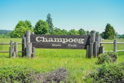
4.9 miles NE of Saint Paul, OregonChampoeg State Park (commonly pronounced SHAM-poo-EE) is a historic pioneer site as well as a beautiful outdoor recreational area. The Native Americans originally pronounced it CHAM-po-EGG, but it can be said either way. It was originally the homeland of the Tualatin Kalapuya tribe. In 1811, fur trappers arrived by canoe and discovered open prairies and lush land next to the Willamette River. In 1830, the French-Canadians began farming and raising families with their Indian wives once they retired from the Hudson Bay Company. Champoeg became a shipping and commercial centre with steamboat landings and ferry crossings. In 1851, local tribes and U.S government established six treaties at Champoeg. A flood in 1861 destroyed the Hudson Bay Company's granary and townsite. The historical interest draws many people to this location.
At Champoeg State Park, many people enjoy camping, boating, fishing, hiking, trail running, biking, and disc golf. There is also an amphitheatre where outdoor concerts are held during the summer months. The park also has 6 yurts and 6 cabins to stay the night in. They are usually reserved in advance so try to book a stay ahead of time. There are also 79 campsites, most all of which are RV friendly. Flushing toilets and hot showers are available.
The scenery at Champoeg is fairly diverse. There are many open field areas, as well as a lot of areas that are heavily wooded with tall trees and various vegetation. The hiking/walking trails lead through the wooded areas, but also through the open fields. The trails are easy to hike with small children. Just make sure to hold their hands or watch them carefully near the steep areas.
The park is home to the oldest operating store in Oregon, the Historic Butteville Store. Back in the day, it used to be a general store. You can walk or bike ride to the store and enjoy a cold drink or ice cream bar while learning about the local history of the area.
The disc golf course has 15 baskets. There are a couple baskets which are on top of stumps making the baskets a bit more difficult. Par: 45. The playing field is open in some areas, but there are quite a few trees in other areas.
There is a boardwalk and boat access on the calm Willamette River.
Level terrain with tall, thick oaks. Good length and fair fairways. 18 long concrete tees and 11 shorter ones with multiple pin placements. We share this park with other users - please yield to picnickers, walkers and bikers. Vehicle fee; $5/day, $30/annual. Public ($3.00)Courtesy of DiscGolfUnited.com


