Lewis River Channel / Dogshead Loop
Grant Village, Yellowstone National Park
| Address: | Continental Divide Trail, Yellowstone National Park, WY 82190, USA |
| GPS: |
44°19'12.7"N 110°35'58.8"W Maps | Directions |
| State: | Wyoming |
| Trail Length: | 10.00 miles |
| Trail Type: | Loop |
| Hike Difficulty: | Intermediate |
| Elevation Gain: | 3 feet |
| Trails/Routes: | 2.1-11.5 mi |
Lakes Rivers Trails Motorized Use
Canoe, Hike, and Kayak
Anyone who doesn't want to backpack through Yellowstone but is looking to experience the real beauty of Yellowstone will truly love this hike.
Walking along the Lewis Channel is one of the best parts of this hike. After passing the trailhead, Lewis Lake shines brightly as the sun hits it. This is the perfect scenery and views of the Grand Teton. If you head west on your hike, you will soon come to the river channel which is very serene because the trail brings you right along the edge of the lake.
As you reach the end of the Lewis Channel trail you’ll see the Outlet Patrol Cabin and Shoshone Lake. The lake is a shimmering lake of crystal clear water and is surrounded by mountains covered in tall trees. There is a lot of driftwood along the shore which offers a wonderful spot to stop for lunch. One of the Shoshone Lake’s claim to fame is that it’s the largest lake in the continental United States without a road to it. Spend some time listening to the silence and feeling peace surround you.
This is a favorite hike and scenic area filled with birds like Osprey, Bald eagles and Ravens. Don't forget to pack your inflatable kayak to enjoy the water and nature around you.
More Information
Be courteous, informed, and prepared. Read trailhead guidelines, stay on the trail, and don't feed the wildlife.
Read MoreDirections
From Grant Village, Yellowstone National Park
- Head south on Grant Campground Rd (0.7 mi)
- Turn right onto Grant Village Rd (1.0 mi)
- Turn left onto US-191 S/US-287 S/US-89 SPartial toll roadParts of this road may be closed at certain times or days(5.2 mi)
- Turn right (374 ft)
- Turn right (46 ft)
From Cody take the North Fork Highway to the East Entrance. At the Fishing Bridge Junction turn left onto the Grand Loop Road to the West Thumb Junction. Turn left again. Grant Village is two miles and the trailhead is another five miles past Grant. Look for the sign on the right stating “Lewis Channel and Dogshead.”

Trails
Distance ?
11.5 milesElevation Gain ?
2 feetReal Ascent ?
934 feetReal Descent ?
932 feetAvg Grade (0°)
0%Grade (-13° to 9°)
-23% to 17%Distance ?
2.1 milesElevation Gain ?
-16 feetReal Ascent ?
58 feetReal Descent ?
74 feetAvg Grade (0°)
0%Grade (-4° to 1°)
-7% to 3%Elevation differences are scaled for emphasis. While the numbers are accurate, the cut-away shown here is not to scale.
Other Hiking Trails, Canoeing Areas, and Kayaking Areas Nearby

Heart Lake Trail
Grant Village, Yellowstone National Park
0.2 miles SThe trail is very clear and leads to a moderate eight mile hike to Heart Lake. This hike has many possibilities. Day hikers need to push their time to make sure they are on the trail early to allow...
Backpack, Camp, Hike, Hot Springs 4.8 mi
Riddle Lake Hike
Grant Village, Yellowstone National Park
2.8 miles NRiddle Lake hike is a 5 mile roundtrip hike. Riddle Lake is an alluring body of water with a sandy beach. The hiker gets the best of both worlds on this hike. Impressive pine and mountain views,...
Hike 0.1 mi
Lewis Lake Campground
Grant Village, Yellowstone National Park
3.0 miles SWLewis Lake is located in the southern part of Yellowstone National Park. It is 4 miles southeast of Shoshone Lake. Lewis Lake offers a plethora great water activities. This lake offers...
Camp, Canoe, Kayak
Grant Village
Grant Village, Yellowstone National Park
5.4 miles NGrant Village was built in 1984 and named after Ulysses S. Grant, president when Yellowstone became the world’s first national park in 1872. Located near the West Thumb of Yellowstone Lake,...
Camp, Canoe, Kayak 1.4 mi
Yellowstone Lake Overlook Trail
Grant Village, Yellowstone National Park
6.7 miles NYellowstone Lake Overlook Trail is a 1.7 mile loop trail that is easy and great for beginner hikers. The trail begins near the West Thumb Geyser Basin Parking Lot and is open in the summer and fall.
Hike
Lake Overlook
Grant Village, Yellowstone National Park
6.7 miles NThis trail is located in the southern part of the park, with the trailhead in the West Thumb Geyser Basin parking lot. This is about a 1.7 mile hike, roundtrip, that starts and ends at the...
Hike 0.4 mi
West Thumb Geyser Basin
Grant Visitor's Center, Yellowstone National Park
6.7 miles NWest Thumb Geyser Basin is one of the smaller geyser basins in Yellowstone, yet its location along the shore of Yellowstone Lake and is ranked as the most scenic. This area was formed by volcanic...
Hike 0.4 mi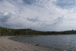
Duck Lake
Grant Village, Yellowstone National Park
6.8 miles NDuck Lake Trail is located near Grant Village and West Thumb. This is a simple 0.8 miles hike that takes you through the Lodgepole pine forest. This hike is special because the surrounding...
Hike 6.1 mi
Shoshone Lake (via DeLacy Creek)
Old Faithful, Yellowstone National Park
10.1 miles NWIf you are just coming from Old Faithful and want a break from the crowds, this hike is a perfect leg-stretching, moderate 6.1 mile hike. This hike takes you through the forest and grassy trail. As...
Hike 2.6 mi
Lone Star Geyser Trail
Old Faithful, Yellowstone National Park
12.3 miles NWLone Geyser Star Trail is a hiking and mountain biking trail that leads through the forest to the colorful Lone Star Geyser. The Geyser here has beautiful white, yellow and orange colors in the...
Hike, Mountain Bike 3.1 mi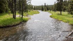
Mallard Lake
Old Faithful, Yellowstone National Park
14.6 miles NWThe Mallard Lake trail is majestically lined with trees both old an new. This is a 5 mile leading to the beautiful Mallard lake, making it a 10 mile round trip. The trail is...
Hike 6.2 mi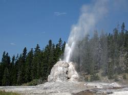
Howard Eaton Trail
Old Faithful, Yellowstone National Park
14.6 miles NWThe Howard Eaton Trail in the Old Faithful Area is a hike with incredible geothermic features and other natural views. This hike is a moderately difficult 6.5 mile there and back trail, that...
Hike 1.5 mi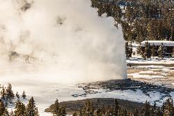
Observation Point Trail
Old Faithful, Yellowstone National Park
14.8 miles NWObservation Point Trail is an just over 2 mile loop that passes several geysers along the way to Solitary Geyser. Observation Point Trail provides up close views of several geysers as well as...
Hike
Old Faithful Geyser
Old Faithful, Yellowstone National Park
14.9 miles NWOld Faithful is a cone geyser located in Yellowstone National Park in Wyoming, United States. It was named in 1870 during the Washburn-Langford-Doane Expedition and was the first geyser in the park...
Hike 2.3 mi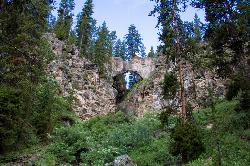
Natural Bridge Trail
Lake Village, Yellowstone National Park
16.6 miles NENatural Bridge Trail is an exciting and easy 2 mile trail to the beautiful rock formation that is Natural Bridge Yellowstone. This Natural Bridge was formed by Bridge Creek as it wore a hole in...
Hike, Mountain Bike 0.3-0.5 mi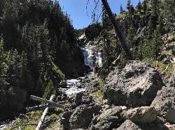
Mystic Falls
Old Faithful, Yellowstone National Park
16.9 miles NWMystic Falls is a 70-foot cascading waterfall on Little Firehole River. The area around the falls is quiet and beautifully forested. Mystic Falls is a lesser known spot in Yellowstone National Park....
Hike 2.0 mi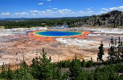
Grand Prismatic Spring Overlook Trail
Old Faithful, Yellowstone National Park
17.7 miles NWThe Grand Prismatic Spring Overlook Trail gives hikers an opportunity to see the famous aerial view of the Grand Prismatic Spring. The vibrant rainbow waters of the Grand Prismatic Spring are...
Hike 0.3-5.0 mi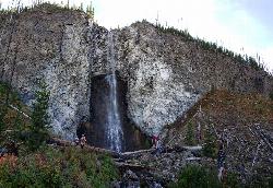
Fairy Falls
Old Faithful, Yellowstone National Park
17.7 miles NWFairy Falls is something out of a fantasy novel. Fairy Falls is a wonderful portion of Yellowstone. It has stolen the hearts of many who have had a little pixie dust sprinkled on them...
Hike 1.9 mi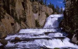
Terraced Falls
Grant Village, Yellowstone National Park
18.1 miles SW3.6 mile easy out and back trail. 430 ft Elevation gain. The trailhead is off Ashton-Flagg Ranch Road along Yellowstone's South border. Ashton-Flagg Ranch Road is closed during the winter.
Hike 0.7 mi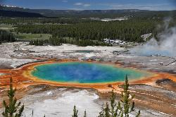
Grand Prismatic Spring
Old Faithful, Yellowstone National Park
18.5 miles NWThe Grand Prismatic Spring in Yellowstone National Park is the largest hot spring in the United States, and the third largest in the world, after Frying Pan Lake in New Zealand and Boiling Lake...
HikeNearby Campsites

Heart Lake Trail
Grant Village, Yellowstone National Park
0.2 miles SThe trail is very clear and leads to a moderate eight mile hike to Heart Lake. This hike has many possibilities. Day hikers need to push their time to make sure they are on the trail early to allow...
Backpack, Camp, Hike, Hot Springs 0.1 mi
Lewis Lake Campground
Grant Village, Yellowstone National Park
3.0 miles SWLewis Lake is located in the southern part of Yellowstone National Park. It is 4 miles southeast of Shoshone Lake. Lewis Lake offers a plethora great water activities. This lake offers...
Camp, Canoe, Kayak
Grant Village
Grant Village, Yellowstone National Park
5.4 miles NGrant Village was built in 1984 and named after Ulysses S. Grant, president when Yellowstone became the world’s first national park in 1872. Located near the West Thumb of Yellowstone Lake,...
Camp, Canoe, Kayak
Bridge Bay
Lake Village, Yellowstone National Park
16.8 miles NEBridge Bay Campground was named for its proximity to Bridge Bay Marina on Yellowstone Lake. The area is quite scenic, with wooded areas, open meadows and some limited views of the lake. Because of...
Camp 14.8 mi
Biscuit Basin to Fairy Falls and Firehole Meadows
Old Faithful, Yellowstone National Park
19.8 miles NWFreight Road trail is a almost 15 mile hike that leaves from Biscuit Basin or Fountain Flats Drive. This hike is a beautiful remote hike that passes several unique landmarks, breaking up this hike...
Backpack, Camp, Hike
Fishing Bridge RV Campground
Lake Village, Yellowstone National Park
20.3 miles NEThe Fishing Bridge Recreational Vehicle Park is located near the mouth of the Yellowstone River as it leaves Yellowstone Lake. The RV park is named after the Fishing Bridge, a wooden vehicle bridge...
Camp
Loon Lake
Ashton, Idaho
22.5 miles SWCamp, Kayak, and Swim near Ashton, Idaho
Camp, Kayak, Swim
Cave Falls of Yellowstone
Ashton, Idaho
23.3 miles SWThis campgrond is situated on the banks of Fall River in Wyoming along the south border of Yellowstone National Park. Cave Falls Campground has 23 single site units and a terrific area for...
Camp, Hike
Madison Campground
Madison, Yellowstone National Park
26.0 miles NWMadison Campground is named for its proximity to the Madison River, which runs through the area in a lush mountain setting rich in wildlife. Madison Campground is at an elevation of 6,800’ and...
Camp 17.5 mi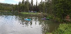
Tear Drop Lake
Ashton, Idaho
27.0 miles WNestled in the Targhee National Forest just off of Ashton's Fish Creek Road, this tear drop shaped lake is a family adventure waiting to happen. The lake isn't very big but it is teeming with...
Camp, Canoe, Hike, Kayak, Mountain Bike, Swim 1.5-3.8 mi
Little Gibbon Falls
Norris, Yellowstone National Park
27.2 miles NIce Lake and Little Gibbon Falls Loop is a 4.5 mile loop trail located near Yellowstone National Park, Wyoming. The trail is good for all skill levels and primarily used for hiking, but there are...
Camp, Canoe, Hike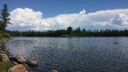
Horseshoe Lake
Ashton, Idaho
27.2 miles SWHorseshoe Lake is hidden back in the Targhee National Forest. It's a beautiful lake with plenty of lily pads. The road to get there is well maintained and there are many options for pull-outs...
Camp, Canoe, Dive, Swim
Canyon Campground
Canyon Junction, Yellowstone National Park
29.2 miles NCanyon Campground is a popular choice for visitors to Yellowstone National Park, and it's easy to see why. Located in the heart of the park, the campground offers easy access to some of the...
Camp
Norris Campground
Norris, Yellowstone National Park
29.2 miles NNorris campground is centrally located in Yellowstone National Park and offers a good spot for those planning to visit many of the most famous features in Yellowstone. Norris is a relatively short...
Camp
Sheep Falls on Fall River
Ashton, Idaho
29.5 miles SWThe lesser known Sheep Falls on Fall River is a local treasure off of Cave Falls road. There are primitive campsites and beautiful views for a great picnic spot. The water splits and comes down in...
Camp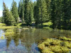
Big Springs
Island Park, Idaho
34.6 miles WThere's also a great little walking trail along the river with placards that tell about the ecosystem and history of the area. There's about a 1/2 mile that's paved and then a 1/2 mile...
Camp, Hike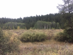
Porcupine Creek
Ashton, Idaho
34.7 miles SWPorcupine Creek is a hunting, fishing, camping, and swimming spot near Ashton, Idaho in Fremont County within Targhee National Forest. It's surrounded by forests, meadows, and a creek...
Camp, Swim 0.3-0.6 mi
Bear Gulch
Ashton, Idaho
36.0 miles WBear Gulch is an abandoned ski hill out of operation since 1969. While the vegetation is beginning to take over, there's still some great sledding to be had. It's just far enough into the...
Camp, Cross-country Ski, Hike, Sled
Warm River Campground
Ashton, Idaho
37.8 miles WWarm River Campground is located nine miles northeast of Ashton, Idaho, along the slow-moving Warm River at an elevation of 5,200 feet. Willows line the riverbanks and pine trees offer partial...
Camp 0.9 mi
Buffalo River Campground
Island Park, Idaho
38.4 miles WThe float here is nice and easy. It's a great early season float. Later in the season the shallow spots will force you to walk a good chunk of the float. The water is super clear and often pretty...
Camp, Canoe, Kayak, Swim


