


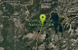
Shoshone Lake (via DeLacy Creek)
Old Faithful, Yellowstone National Park
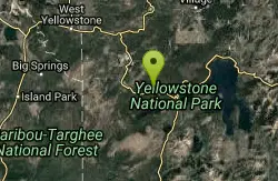
| Address: | Shoshone Lake, Wyoming 82190, USA |
| GPS: |
44°26'48.4"N 110°42'5.8"W Maps | Directions |
| State: | Wyoming |
| Trails/Routes: | 6.1 mi |
Lakes Trails Fishing Pet Friendly Motorized Use
Hike
If you are just coming from Old Faithful and want a break from the crowds, this hike is a perfect leg-stretching, moderate 6.1 mile hike. This hike takes you through the forest and grassy trail. As the hike comes to an end, the trail gets wider and leads you to the edge of Shoshone Lake.
The name "DeLacy Creek Trail" comes from Walter Washington DeLacy, who was the leader of an expedition going through the Yellowstone region in 1863. He was credited for the first reliable map of Yellowstone two years after his expedition. Shoshone Lake used to be know as "DeLacy Lake" for a while. By 1872, Shoshone Lake held five or six different names until Park Superintendent P.W. Norris thought the name Shoshone Lake was fitting because of the Indians that frequently were found nearby.
Fishing at Shoshone Lake is allowed if you have received a fishing permit from the park. If you catch a native fish to the park, you can catch and release it. If it is nonnative, there is no limit to how many fish you can catch. Native fish include the cutthroat trout, mountain whitefish and Arctic grayling. Nonnative fish include: brown trout, brook trout, rainbow and lake trout. Fisherman are asked to only fish with single, pointed, barbless hook and lead-free artificial lures. All watercraft needs to have a permit purchased from the park service
REMEMBER: Backcountry hydrothermal areas do not have boardwalks like the park does. Scalding-hot water and/or steam can lie beneath a thin crust. Be careful and use caution when entering Shoshone Geyser Basin. Stay away from areas that do not have vegetation, as that is a sign of a natural hydrothermal area. Carelessness in the backcountry thermal areas is dangerous and destructive to these rare features.
More Information
Be courteous, informed, and prepared. Read trailhead guidelines, stay on the trail, and don't feed the wildlife.
Read More- Plan Ahead and Prepare
- Travel & camp on durable surfaces
- Dispose of waste properly
- Leave what you find
- Minimize campfire impacts
- Respect wildlife
- Be considerate of other visitors
Directions
From Old Faithful, Yellowstone National Park
- Head east on Pyramid Rd (0.2 mi)
- Turn left onto Geyser View Ave (0.2 mi)
- Geyser View Ave turns left and becomes Old Faithful Rd (0.6 mi)
- Take the ramp to US-191 S/US-287 S/US-89 S/Hwy 20 E (0.4 mi)
- Keep left at the fork and merge onto US-191 S/US-287 S/US-89 S/Hwy 20 EPartial toll roadParts of this road may be closed at certain times or daysDestination will be on the right(9.1 mi)
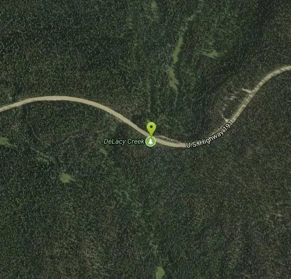
Trailhead: The signed trailhead for DeLacy Creek is located halfway between Old Faithful and West Thumb on Grand Loop Road.Courtesy of hike734.com
Trails
Distance ?
6.1 milesElevation Gain ?
-26 feetReal Ascent ?
768 feetReal Descent ?
794 feetAvg Grade (0°)
0%Grade (-7° to 10°)
-12% to 17%Elevation differences are scaled for emphasis. While the numbers are accurate, the cut-away shown here is not to scale.
Other Hiking Trails Nearby
Lone Star Geyser Trail
Old Faithful, Yellowstone National Park
5.5 miles WLone Geyser Star Trail is a hiking and mountain biking trail that leads through the forest to the colorful Lone Star Geyser. The Geyser here has beautiful white, yellow and orange colors in the...
Hike, Mountain Bike 3.1 mi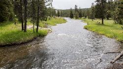
Mallard Lake
Old Faithful, Yellowstone National Park
6.0 miles WThe Mallard Lake trail is majestically lined with trees both old an new. This is a 5 mile leading to the beautiful Mallard lake, making it a 10 mile round trip. The trail is...
Hike 1.5 mi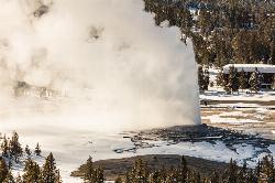
Observation Point Trail
Old Faithful, Yellowstone National Park
6.3 miles WObservation Point Trail is an just over 2 mile loop that passes several geysers along the way to Solitary Geyser. Observation Point Trail provides up close views of several geysers as well as...
Hike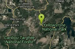
Old Faithful Geyser
Old Faithful, Yellowstone National Park
6.3 miles WOld Faithful is a cone geyser located in Yellowstone National Park in Wyoming, United States. It was named in 1870 during the Washburn-Langford-Doane Expedition and was the first geyser in the park...
Hike 6.2 mi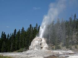
Howard Eaton Trail
Old Faithful, Yellowstone National Park
6.3 miles WThe Howard Eaton Trail in the Old Faithful Area is a hike with incredible geothermic features and other natural views. This hike is a moderately difficult 6.5 mile there and back trail, that...
Hike 0.4 mi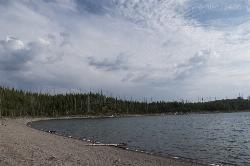
Duck Lake
Grant Village, Yellowstone National Park
6.6 miles EDuck Lake Trail is located near Grant Village and West Thumb. This is a simple 0.8 miles hike that takes you through the Lodgepole pine forest. This hike is special because the surrounding...
Hike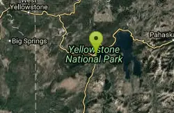
Lake Overlook
Grant Village, Yellowstone National Park
6.6 miles EThis trail is located in the southern part of the park, with the trailhead in the West Thumb Geyser Basin parking lot. This is about a 1.7 mile hike, roundtrip, that starts and ends at the...
Hike 1.4 mi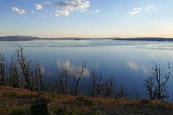
Yellowstone Lake Overlook Trail
Grant Village, Yellowstone National Park
6.7 miles EYellowstone Lake Overlook Trail is a 1.7 mile loop trail that is easy and great for beginner hikers. The trail begins near the West Thumb Geyser Basin Parking Lot and is open in the summer and fall.
Hike 0.4 mi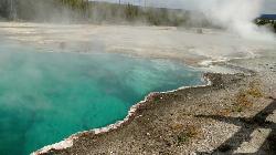
West Thumb Geyser Basin
Grant Visitor's Center, Yellowstone National Park
6.7 miles EWest Thumb Geyser Basin is one of the smaller geyser basins in Yellowstone, yet its location along the shore of Yellowstone Lake and is ranked as the most scenic. This area was formed by volcanic...
Hike 0.3-0.5 mi
Mystic Falls
Old Faithful, Yellowstone National Park
7.9 miles WMystic Falls is a 70-foot cascading waterfall on Little Firehole River. The area around the falls is quiet and beautifully forested. Mystic Falls is a lesser known spot in Yellowstone National Park....
Hike 2.0 mi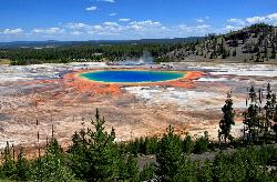
Grand Prismatic Spring Overlook Trail
Old Faithful, Yellowstone National Park
8.0 miles NWThe Grand Prismatic Spring Overlook Trail gives hikers an opportunity to see the famous aerial view of the Grand Prismatic Spring. The vibrant rainbow waters of the Grand Prismatic Spring are...
Hike 0.3-5.0 mi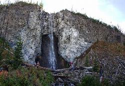
Fairy Falls
Old Faithful, Yellowstone National Park
8.0 miles NWFairy Falls is something out of a fantasy novel. Fairy Falls is a wonderful portion of Yellowstone. It has stolen the hearts of many who have had a little pixie dust sprinkled on them...
Hike 4.8 mi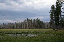
Riddle Lake Hike
Grant Village, Yellowstone National Park
8.5 miles SERiddle Lake hike is a 5 mile roundtrip hike. Riddle Lake is an alluring body of water with a sandy beach. The hiker gets the best of both worlds on this hike. Impressive pine and mountain views,...
Hike 0.7 mi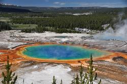
Grand Prismatic Spring
Old Faithful, Yellowstone National Park
8.7 miles NWThe Grand Prismatic Spring in Yellowstone National Park is the largest hot spring in the United States, and the third largest in the world, after Frying Pan Lake in New Zealand and Boiling Lake...
Hike 2.1-11.5 mi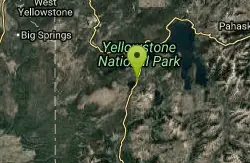
Lewis River Channel / Dogshead Loop
Grant Village, Yellowstone National Park
10.1 miles SEAnyone who doesn't want to backpack through Yellowstone but is looking to experience the real beauty of Yellowstone will truly love this hike. Walking along the Lewis Channel is one of the...
Canoe, Hike, Kayak 6.9 mi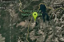
Heart Lake Trail
Grant Village, Yellowstone National Park
10.3 miles SEThe trail is very clear and leads to a moderate eight mile hike to Heart Lake. This hike has many possibilities. Day hikers need to push their time to make sure they are on the trail early to allow...
Backpack, Camp, Hike, Hot Springs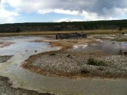
Sentinel Meadows & Queen's Laundry
Madison, Yellowstone National Park
10.6 miles NWThe hike to Sentinel Meadows and Queens Laundry gives you a level trail with wide open meadows, hot springs, ponds, birds, and a little bit of Yellowstone National Park history. The trail can be done...
Hike 14.8 mi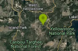
Biscuit Basin to Fairy Falls and Firehole Meadows
Old Faithful, Yellowstone National Park
11.5 miles WFreight Road trail is a almost 15 mile hike that leaves from Biscuit Basin or Fountain Flats Drive. This hike is a beautiful remote hike that passes several unique landmarks, breaking up this hike...
Backpack, Camp, Hike 2.3 mi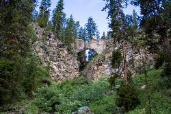
Natural Bridge Trail
Lake Village, Yellowstone National Park
14.3 miles NENatural Bridge Trail is an exciting and easy 2 mile trail to the beautiful rock formation that is Natural Bridge Yellowstone. This Natural Bridge was formed by Bridge Creek as it wore a hole in...
Hike, Mountain Bike 6.1 mi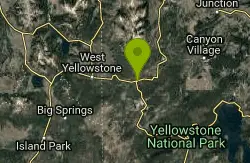
Purple Mountain Trail
Madison, Yellowstone National Park
15.7 miles NWPurple Mountain Trail is a 6 mile out and back trail to the peak of purple mountain. This is a beautifully forested trail with little foot traffic is a quiet respite from the crowds of...
HikeNearby Campsites
Grant Village
Grant Village, Yellowstone National Park
7.8 miles SEGrant Village was built in 1984 and named after Ulysses S. Grant, president when Yellowstone became the world’s first national park in 1872. Located near the West Thumb of Yellowstone Lake,...
Camp, Canoe, Kayak 6.9 mi
Heart Lake Trail
Grant Village, Yellowstone National Park
10.3 miles SEThe trail is very clear and leads to a moderate eight mile hike to Heart Lake. This hike has many possibilities. Day hikers need to push their time to make sure they are on the trail early to allow...
Backpack, Camp, Hike, Hot Springs 14.8 mi
Biscuit Basin to Fairy Falls and Firehole Meadows
Old Faithful, Yellowstone National Park
11.5 miles WFreight Road trail is a almost 15 mile hike that leaves from Biscuit Basin or Fountain Flats Drive. This hike is a beautiful remote hike that passes several unique landmarks, breaking up this hike...
Backpack, Camp, Hike 0.1 mi
Lewis Lake Campground
Grant Village, Yellowstone National Park
11.9 miles SLewis Lake is located in the southern part of Yellowstone National Park. It is 4 miles southeast of Shoshone Lake. Lewis Lake offers a plethora great water activities. This lake offers...
Camp, Canoe, Kayak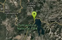
Bridge Bay
Lake Village, Yellowstone National Park
14.3 miles NEBridge Bay Campground was named for its proximity to Bridge Bay Marina on Yellowstone Lake. The area is quite scenic, with wooded areas, open meadows and some limited views of the lake. Because of...
Camp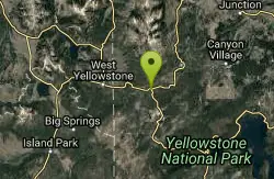
Madison Campground
Madison, Yellowstone National Park
15.9 miles NWMadison Campground is named for its proximity to the Madison River, which runs through the area in a lush mountain setting rich in wildlife. Madison Campground is at an elevation of 6,800’ and...
Camp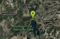
Fishing Bridge RV Campground
Lake Village, Yellowstone National Park
18.2 miles NEThe Fishing Bridge Recreational Vehicle Park is located near the mouth of the Yellowstone River as it leaves Yellowstone Lake. The RV park is named after the Fishing Bridge, a wooden vehicle bridge...
Camp 1.5-3.8 mi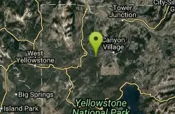
Little Gibbon Falls
Norris, Yellowstone National Park
18.7 miles NIce Lake and Little Gibbon Falls Loop is a 4.5 mile loop trail located near Yellowstone National Park, Wyoming. The trail is good for all skill levels and primarily used for hiking, but there are...
Camp, Canoe, Hike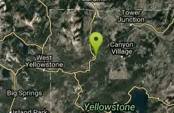
Norris Campground
Norris, Yellowstone National Park
20.1 miles NNorris campground is centrally located in Yellowstone National Park and offers a good spot for those planning to visit many of the most famous features in Yellowstone. Norris is a relatively short...
Camp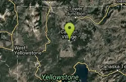
Canyon Campground
Canyon Junction, Yellowstone National Park
22.5 miles NECanyon Campground is a popular choice for visitors to Yellowstone National Park, and it's easy to see why. Located in the heart of the park, the campground offers easy access to some of the...
Camp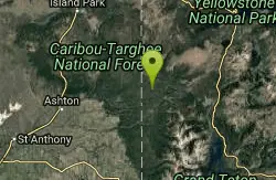
Cave Falls of Yellowstone
Ashton, Idaho
25.7 miles SWThis campgrond is situated on the banks of Fall River in Wyoming along the south border of Yellowstone National Park. Cave Falls Campground has 23 single site units and a terrific area for...
Camp, Hike
Loon Lake
Ashton, Idaho
26.1 miles SWCamp, Kayak, and Swim near Ashton, Idaho
Camp, Kayak, Swim 17.5 mi
Tear Drop Lake
Ashton, Idaho
26.1 miles SWNestled in the Targhee National Forest just off of Ashton's Fish Creek Road, this tear drop shaped lake is a family adventure waiting to happen. The lake isn't very big but it is teeming with...
Camp, Canoe, Hike, Kayak, Mountain Bike, Swim
Big Springs
Island Park, Idaho
27.6 miles WThere's also a great little walking trail along the river with placards that tell about the ecosystem and history of the area. There's about a 1/2 mile that's paved and then a 1/2 mile...
Camp, Hike
Horseshoe Lake
Ashton, Idaho
27.9 miles SWHorseshoe Lake is hidden back in the Targhee National Forest. It's a beautiful lake with plenty of lily pads. The road to get there is well maintained and there are many options for pull-outs...
Camp, Canoe, Dive, Swim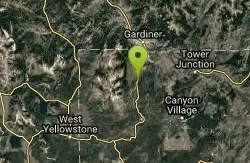
Indian Creek Campground Yellowstone
Mammoth Hot Springs, Yellowstone National Park
30.1 miles NIndian Creek Campground is a quiet and secluded wooded campground within Yellowstone National Park, ideal for tent campers. It’s close to lots of hiking and fishing, and only a few miles to...
Camp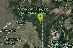
Sheep Falls on Fall River
Ashton, Idaho
31.9 miles SWThe lesser known Sheep Falls on Fall River is a local treasure off of Cave Falls road. There are primitive campsites and beautiful views for a great picnic spot. The water splits and comes down in...
Camp 0.9 mi
Buffalo River Campground
Island Park, Idaho
32.7 miles WThe float here is nice and easy. It's a great early season float. Later in the season the shallow spots will force you to walk a good chunk of the float. The water is super clear and often pretty...
Camp, Canoe, Kayak, Swim
Upper Coffee Pot Campground
Island Park, Idaho
32.9 miles WUpper Coffeepot Campground stretches along a floatable section of Henry's Fork of the Snake River. A mixed growth lodgepole pine forest provides partial shade and summer wildflowers are...
Camp, Canoe
Tower Falls
Tower Junction, Yellowstone National Park
34.4 miles NETower Fall is a waterfall on Tower Creek in the northeastern region of Yellowstone National Park, in the U.S. state of Wyoming. Approximately 1,000 yards (910 m) upstream from the creek's...
Camp, Hike


