Bicentennial Park
Provo, Utah
| Address: | 1600 E 1440 S, Provo, UT 84606 |
| GPS: |
40°12'52.1"N 111°37'54.4"W Maps | Directions |
| State: | Utah |
| Disc Golf Target Type: | Basket |
| Disc Golf Tee Type: | Concrete |
Restrooms Picnic Tables Trails Ponds
Disc Golf, Hike, and Sled
Bicentennial Park is a favorite among disc golfers and families in the Provo area. The park has a 16-hole golf course, a duck pond, a playground, and a nature trail which features natural springs and a wetland area with a convenient boardwalk.
Mature landscape, moderate hole lengths, but many obstacles - OB, mandos, monstrous trees and a big spring-fed pond. Truly challenging experience. *May 2013 - Course constricted by construction issues. Use map to make 9. Public (No Fee)Courtesy of DiscGolfUnited.com
More Information
Add ResourceBe courteous, informed, and prepared. Read trailhead guidelines, stay on the trail, and don't feed the wildlife.
Read MoreDirections
From Provo, Utah
- Head west on Center St toward N University Ave (46 ft)
- Turn right at the 1st cross street onto N University Ave (482 ft)
- Turn right at the 1st cross street onto 100 N (0.4 mi)
- Turn right onto N 400 E (0.4 mi)
- Turn left onto 300 S (0.3 mi)
- Turn right onto S State St (1.2 mi)
- Turn left onto E 1440 S (0.2 mi)
I-15 to exit #266 University Ave., southbound: go straight onto 1860 South; northbound: quick right onto 1860 South. Go 1.5 miles to a left on State St. for a half mile to a right on 1440 South (gas station), 100 yards into parking lot. 1st tee next to restroom.Courtesy of DiscGolfUnited.com

Other Hiking Trails, Sledding Hills, and Folf Courses Nearby
Y-Mountain Summit Trail
Provo, Utah
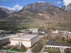
2.5 miles NEY Mountain is located directly east of Brigham Young University (BYU) in Provo, Utah, United States. The Slide Canyon/Y Mountain Trail leads to a large block Y located 1.2 miles (1.9 km) from a...
Camp, Hike
Rock Canyon Park
Provo, Utah
3.6 miles NThis is the biggest park in Provo, Utah, with lots to do. The hills are great for sledding.
Sled
Rock Canyon Disc Golf
Provo, Utah
3.7 miles NIt is located at the mouth of Rock Canyon above BYU. It is very hilly and there are a fair amount of trees. This location is NOT FOR BEGINNERS at disc golf. At this course, there are...
Disc Golf
Cherry Hill Park
Orem, Utah
4.6 miles NWJust south of Cherry Hill Elementary, this is a small hill for small children great and moms who are looking to avoid a well populated hill. The hill is to the south of the playground and most...
Sled
Spring Acres Arts Park
Springville, Utah
4.7 miles SEA short course - good for beginners. First 3 holes cannot be played if another event is taking place. Tee 4 plays from the stump by #3 - it's a very short hole. The rest are easy to follow. 5...
Disc Golf
Riverview Park
Provo, Utah
5.8 miles NAn object course with mostly well-marked tees and poles. There are specific rules for play at this course (see Course Media). Vintage plastic throwers particularly like this course. The 2nd hole is...
Disc Golf
Scera Park Disc Golf Course
Orem, Utah
5.9 miles NWPlays through the park and around the Scera Theater. Tees are well marked with posts. Public (No Fee)
Disc Golf
Utah Valley University
Orem, Utah
6.3 miles NWVery short course (all holes less than 200') on the south end of campus. Water comes into play. Holes near the baseball diamond. Bring the map to help with navigation. Public (No Fee)
Disc Golf
Cascade Park
Orem, Utah
6.3 miles NThis is a small hill great for mom's looking to escape the crowd and let their little ones have a good time. It's pretty short but really wide so there's plenty to share.
Sled
Eagle Rock Disc Golf Course
Mapleton, Utah
7.1 miles SELong open course with some elevation. Public (No Fee)
Disc Golf
Jolley's Ranch Campground
Springville, Utah
7.4 miles SEThe mostly flat and moderately wooded course is nestled in a beautiful Utah Canyon. Most of the holes have a good bit of shade to cut down on the summer heat. Public (No Fee)
Disc Golf
Orem Cemetary
Orem, Utah
7.9 miles NSled near Orem, Utah
Sled
Spanish Fork Disc Golf Course
Spanish Fork, Utah
8.5 miles SIn an old gravel pit, plays long with 9 alternate shorter tees. Relatively flat - no trees and lots of wind. Public (No Fee)
Disc Golf
Spanish Oaks Elementary
Spanish Fork, Utah
9.0 miles SSled near Spanish Fork, Utah
Sled
Oak Canyon Junior High
Lindon, Utah
9.1 miles NWSled near Lindon, Utah
Sled
Dripping Rock
Spanish Fork, Utah
9.2 miles SDripping Rock is along a paved path adjacent to Spanish Oaks Golf Course.
Hike
Provo River Parkway Trail
Provo, Utah
10.2 miles NThis isn't quite as much mountain biking as it is an easy downhill bike ride. The whole trail is paved. One of the best ways to do it is to take two vehicles and park one at Will's Canyon...
Hike, Mountain Bike 1.2 mi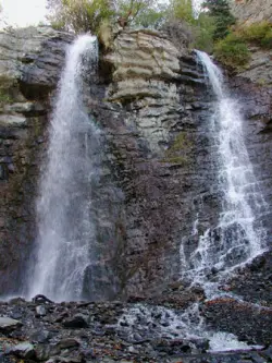
Battle Creek Falls
Pleasant Grove, Utah
10.9 miles NBattle Creek Falls, located near Pleasant Grove, Utah, is a scenic waterfall that also has a rappelling and rock climbing area nearby. Hikers are allowed to see the falls from two view points, below...
Canyoneer, Hike
G Mountain Trail
Pleasant Grove, Utah
10.9 miles NThe trail starts at Kiwanis Park which is south of the 'G' at the end of Battle Creek Road. The trail starts out a little steep for about .25 mile and the very last bit is a...
Hike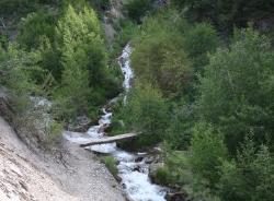
Grove Creek Trail
Pleasant Grove, Utah
11.9 miles NThe Grove Creek Trail falls from the upper shoulder of Mount Timpanogos down Grove Creek Canyon to Pleasant Grove. It's usually ridden as a shuttled downhill -- because the climb up this...
Hike, Mountain BikeNearby Campsites

Y-Mountain Summit Trail
Provo, Utah
2.5 miles NEY Mountain is located directly east of Brigham Young University (BYU) in Provo, Utah, United States. The Slide Canyon/Y Mountain Trail leads to a large block Y located 1.2 miles (1.9 km) from a...
Camp, Hike 1.6-14.1 mi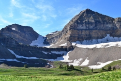
Mount Timpanogas
Provo, Utah
15.0 miles NMt. Timp, as the locals call it, is the 2nd highest mountain in the Wasatch range (only Mt. Nebo is higher). What sets "Timp" apart is its location. It towers over the Provo, Orem, Pleasant...
Camp, Hike, Horseback, Swim 4.7 mi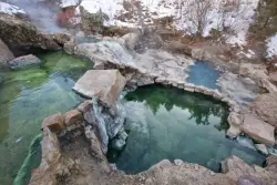
Fifth Water Hot Springs
Provo, Utah
17.2 miles SEAKA Diamond Fork Hot Springs A beautiful drive and a 2.5 mile hike along the river will end you at an amazing set of hot springs that's well worth the trip. There's a variety of...
Backpack, Camp, Hike, Hot Springs, Mountain Bike, Swim
Spruces Campground
Salt Lake City, Utah
29.5 miles NCamping isn't free. See USDA.gov for details. If you know the coordinates of the sledding hill here, please comment.
Camp, Sled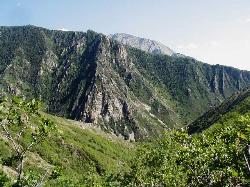
Mill Creek Canyon
Salt Lake City, Utah
33.8 miles NMill Creek is an out and back with over 1000 ft of elevation gain. The lower section of the ski trail gets a lot of foot traffic, but the upper section (above Elbow Fork) is generally very quiet....
Camp, Cross-country Ski, Snowshoe
Maple Canyon
Fountain Green, Utah
45.6 miles SMaple Canyon is a fantastic place for hiking, rock climbing, and camping. This maple tree-filled canyon is one of the nation's most unique rock climbing areas and is well-known for sport...
Camp, Hike, Mountain Bike, Rock Climb
Holbrook Trailhead
Bountiful, Utah
47.4 miles Nairsoft feaild woth bunkers
Airsoft, Backpack, Camp, Paintball, Snowshoe


