Alum Creek State Park
Delaware, Ohio
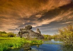
5.9 miles SE of Delaware, OhioAlum Creek Reservoir - A 3,300-acre U.S. Corp of Engineers managed Lake. The northern section is restricted to paddling, the southern section is great for all kinds of boats and water skiing. Fishing is popular from boats and from the shore. Swimming Beach - a 3000 ft beach along the shore of the Lake. There is a changing area, bathrooms, and a concession stand. Campground - there are 286 campsites at the main campground. Each site has electricity, water, and there is Wi-Fi available.

City of Rocks National Reserve
Malta, Idaho
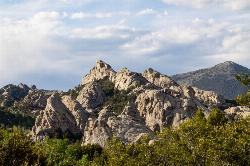
23.3 miles SW of Malta, IdahoThe City of Rocks, or "The City" as locals call it, is one of the best places in the country to go rock climbing. Throughout the valley granite spires dominate the skyline, reaching anywhere from 30-600 ft. Because there are so many rocks that can be climbed, the level of difficulty ranges from 5.6 all the way to 5.13. There are over 700 devloped routes throughout the reserve, with different options for climbing like trad or sport climbing. Unlike most climbing spots, City of Rocks allows a full range of technique in one location, making it the perfect place for both the new climber and the seasoned, technical climber. Permits are not required to climb, though climbing is not allowed on any rocks within the California Trail Corridor.
Some of the more popular areas to climb are the Bread Loaves, Bath Rock, Parking Lot Rock, Elephant Rock, and Treasure Rock. Each of these rocks may have routes as easy as a 5.6 right next to something as difficult as a 5.11. Most of these rocks have parking lots in close proximity to the rocks. The parking lot for Bath Rock includes a water spout and bathrooms. Campgrounds can be found throughout the reserve, though they do require a fee. Many routes will only have two or three permanent bolts on the rock, requiring additional equipment for setting up routes. In order to preserve the natural beauty of the city regulations were put in place for rock climbers. Be aware of different regulations before going to the city.
Bread Loaves offers some of teh most well known and climbed routes in the reserve. Walls such as Decadent Wall include routes that go from a 5.7 to a 5.11a. One of the most popular climbs is known as Carole's Crack, a 5.8 featuring a double crack at the top. Many people will rappel down from the top or practice lead climbing on these routes. The best time to climbthese routes is during the morning because they aren't being hit by the sun. As the day goes on, shade will become scarce around the walls.
Bath Rock has a large parking lot with views of the valley as well as some nice campgrounds. On top of Bath Rock has a wide variety of routes as well, with routes ranging from 5.4 to 5.12c. There are some good climbs to introduce new climbers to crack climbing. At the top, climbers will be greated by a nice view of all the other peaks in the area they can climb. On the west side, there is a clear trail with steps leading to the routes, as well as fences built near the wall to keep people from harming the nature.
There is plenty of history in City of Rocks, both climbing history as well as pioneer history. Many pioneers used to come through this area on the California Trail and signed their names on some of the surrounding rocks with axle grease. The climbing history does not date back as far as the pioneers, but began in the 1960's. Today there is a rock climbing festival held in the park every September. This festival offers introduction to climbing courses, as well as demo's of different climbing projects and a lot of climbing. During the summer the park services offer climbing classes for any interested.

Castle Rocks State Park
Almo, Idaho
3.4 miles NW of Almo, IdahoNeighboring the popular climbing area City of Rocks, Castle Rock is a beautiful state park with plenty to do. This park opened to the public in 2003 and offers many additional climbing and hiking spots. One of the popular activities in this park is rock climbing as well as bouldering. New rock climbing routes are allowed to be put up, but must follow the guidelines established through the Climbing Management Plan. Unlike City of Rocks, many of the climbing routes require a longer approach. The park is also split into different areas, such as Castle Rock, South Hills, and the Sanctuary.
Many people who visit Castle Rock are in awe over the large rock formations and beautiful landscape. Most of the time visitors will go to City of Rocks first, and visit Castle Rock another day, meaning that Castle Rock can be less crowded.
Camping is permitted in the park, however there is a fee to pay in order to enter and camp. Each year the city of Almo hosts a climbing festival in which many famous climbers as well as new comers are welcome and get into the park for free.

Middle Teton
Jackson Hole, Wyoming
17.6 miles N of Jackson Hole, WyomingAt 12,804 ft above sea level, the Middle Teton is a challenging and beautiful hike from the trailhead all the way to the peak. The first part of the trail is dirt trails through the trees. That becomes switchbacks after awhile. After about 4 miles, that emerges into a rocky trail where you begin walking below the towering peaks of the Middle and South Tetons. The trail remains rocky/gravelly until you get up through Garnett Canyon to The Meadows. This is a common place to pitch a tent. Many people use this as a base camp to hike the Middle, South, and Grand Teton.Â
Southwest Couloir
From The Meadows, the easy hike is over. It becomes bouldering up the hill among the glaciers. It's steep and deceiving. The next major checkpoint is the saddle between the Middle and South but there are about 3 false saddles before that. The real one is obvious. From the cliff that is the saddle, you can see Ice Flow Lake, the Alaska Basin trail, Table Mountain, Devil's Stairs, Battleship Mountain, The Wall, and everything in between. For many, this view is enough.
From the saddle, the trail continues up along the ridge and glaciers until you reach the Southwest Couloir. At that point, the trail becomes more of a scramble until you reach the top. From the top, you can clearly see the Grand Teton, as well as the South Teton, and Teewinot.

Grand Targhee XC Park
Moose, Wyoming
15.1 miles NW of Moose, Wyoming
Paramount Wall / Blanche Rock
Ririe, Idaho
6.1 miles E of Ririe, IdahoSitting high above the road, the routes at Paramount offer great exposure and relief from the afternoon summer sun. Chuck Oddette, Steve Reiser and Jed Miller established the routes from 1989 to 1990. While not the hardest climbing around, Paramount is home to great lines in the 5.9 - 5.10 range a perfect place for the budding lead climber. All routes except Fly By Night, Positively Negative, and Spraypaint can be done with a 50-meter rope.
Courtesy of SEIClimbing.com
Shady Side Cliffs at Ross Park
Pocatello, Idaho
2.4 miles SE of Pocatello, IdahoThe routes on the Shady Side can be identified by a number on top of the cliff as well as on the face at the bottom of the climbs. The number is close to where the rope should hang for a given climb. There are tons of variations to every problem which are not presented in this guide. These variations are contrived sequences eliminating holds or setting bounds as to how far left or right one can reach.


