


60 Mountain Bike Trails near Pink Lime
first prev 1 2 3 next lastShowing Mountain Bike Trails within 50 miles Distance miles of 3VFC+53 Eureka, UT, USA City, Zip, or Address
Mountain Ranch Bike Park
Eagle Mountain, Utah
21.1 miles NMountain Ranch Bike Park takes great advantage of that otherwise unusable strip of land underneath large power lines. There is tons of single track thoughout the area but the bike park offers...
Mountain Bike
Sheepherder Loop
Payson, Utah
21.4 miles ESheepherder, along with the Blawkhawk trail are two of the best singletrack rides around! The Sheepherder trail is one of those "impossible, uphill loops"!! With all of the short climbs...
Mountain Bike
4 Bay
Elk Ridge, Utah
23.9 miles ETrails are smooth with some rocky or root spots. Gradual climbs and descents. Crosses 4 wheeler trails. South of the small water reservoir, look for metal signs on wood posts with trail...
Mountain Bike
Yellow Fork Canyon
Herriman, Utah
27.2 miles NYellow Fork is a surprisingly nice trail in the Oquirrh Mountain foothills at Rose Canyon. Among the many options are two main choices: there's a nice 7-mile singletrack loop ride with 1300...
Mountain Bike
Blackhawk Loop
Salem, Utah
27.3 miles EThe Blackhawk loop is one of the premier singletrack rides in Utah! Blackhawk loop is composed of couple of different trails, so the name changes from time to time. I would recommend...
Mountain Bike
Squaw Peak Trail
Springville, Utah
29.1 miles EStart at Rock Canyon trailhead, ride straight up the trail, passing a green gate and subsequently 5 wooden bridges. 1/4 mile after the last bridge, take a left on "Squaw Peak Trail."...
Mountain Bike
Bonneville Shoreline Trail - Cedar Hills to Grove Creek Canyon
Pleasant Grove, Utah
30.3 miles NEThe Cedar Hills to Grove Creek Canyon portion of the Bonneville Shoreline Trail is an intermediate level trail. There are some flat spots that are on old dirt roads, as well as single track...
Mountain Bike
Grove Creek Trail
Pleasant Grove, Utah
30.4 miles NEThe Grove Creek Trail falls from the upper shoulder of Mount Timpanogos down Grove Creek Canyon to Pleasant Grove. It's usually ridden as a shuttled downhill -- because the climb up this...
Hike, Mountain Bike
South Fork of the Provo
Provo, Utah
30.9 miles NESouth Fork of the Provo is a fun, short, scenic singletrack ride. It is an ideal trail to introduce a new mountain biker to the joys of singletrack! The trail has one or two rocky...
Mountain Bike 1.3 mi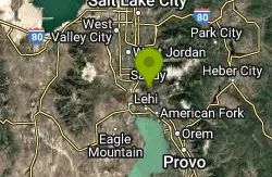
Eagle Crest Trail
Draper, Utah
31.6 miles NEEagle Crest trail is a beginner level trail mountain bike in Draper, Utah along the north side of Traverse Mountain. From the trail, riders can see the Salt Lake Valley, the Northern end of Utah...
Hike, Mountain Bike 0.8 mi
Red Rock Trail
Draper, Utah
32.0 miles NEThe Red Rock trail located in Draper, Utah is a short loop trail just down the road from the Draper LDS Temple. The hike itself may be short, but since it is along the cliffs of the southern end of...
Hike, Mountain Bike, Rock Climb
Little Valley Trail
Draper, Utah
32.2 miles NEOne of the best places in the Salt Lake valley to take kids mountain biking is the Little Valley Instructional Trails. Fortunately, these superbly constructed “flow” trails are just as...
Hike, Mountain Bike 0.6 mi
Potato Hill Trail
Draper, Utah
32.3 miles NELocated in Draper, UT, Potato Hill Trail start at the trailhead on Transverse Mountain Road. and goes down to the (BST) or Bonneville Shoreline Trail west of Coyote Hollow. There are some trails that...
Hike, Mountain Bike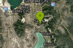
Mercer Hollow Trail
Draper, Utah
32.3 miles NEMercer Hollow Trail is primarily used to bomb down the southern flanks of the ridge the Corner Canyon Trails sit on. It's filled with berms, rock features, rollers, and sweet, sweet...
Hike, Mountain Bike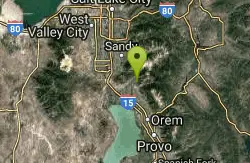
Rodeo Down
Alpine, Utah
33.1 miles NEBlack Dog. Trail winds from the middle of Corkscrew down to Flank and River, just south of the water tank. Some technical aspects, length 0.5 miles with 300 vertical feet elevation...
Mountain Bike 1.6 mi
Corner Canyon Trail
Draper, Utah
33.3 miles NECorner Canyon is the "Go To" riding area in South Salt Lake and for many riders it is worth the drive (or ride) from Utah County. It is a good mix of everything from beginner training...
Backpack, Hike, Mountain Bike 0.6 mi
Bst To Equestrian Center Loop
Draper, Utah
33.4 miles NEAn intermediate trail with a length of 10 miles that's located in Draper, UT. It's a single track look trail that has an elevation of 417 ft. Start at the Equestrian Center and follow the...
Hike, Mountain Bike 0.2-1.8 mi
Lone Peak
Draper, Utah
33.5 miles NEEstablished in 1978 and located southeast of Salt Lake, Lone Peak is one of the taller peaks in the Wasatch range along the Wasatch Front. It has 5 main trailheads: Jacobs Ladder via Corner Canyon...
Hike, Mountain Bike, Rock Climb 1.7 mi
Jacob's Ladder Trail
Sandy, Utah
33.5 miles NEJacobs Ladder trail has an elevation trail of 5,700 ft. and the most popular trailhead out of the five trails in Lone Peak. It's located near a large area on the right side of the road...
Hike, Mountain Bike 1.2 mi
Ghost Falls Trail
Sandy, Utah
33.5 miles NEGhost Falls is located in the corner canyon riding area of Draper, Utah and one of the first mountain bike routes in the canyon. It's a family-friendly hike, named for the...
Hike, Mountain Bike, Snowshoe


