


51 Hiking Trails near Pink Lime
Showing Hiking Trails within 50 miles Distance miles of 3VFC+53 Eureka, UT, USA City, Zip, or Address
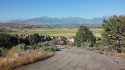
Kiowa Valley Path
Eagle Mountain, Utah
20.7 miles NEAt 0.3 miles, this short little hike is almost more of a quick dog walk but kids seem to enjoy the lizards and rabbits that frequent the path. The lizards seem to enjoy basking in the heat of the...
Hike
P Mountain and Little Mountain
Payson, Utah
21.1 miles EP mountain can be seen from many of the points in Payson. Ask any local and they can guide you there!
Hike
Saratoga Hot Springs
Saratoga Springs, Utah
22.8 miles NEThe Saratoga Hot Springs are a wonderful place to visit in every season. The water is always around 100 degrees Fahrenheit, perfect for soaking away the winter cold. This is a wonderful place to...
Hike, Hot Springs
Grotto Falls
Payson, Utah
25.5 miles EGrotto Falls is a short trail into the Payson Canyon. Visitors will enjoy a quick walk through the woods along the creek, as they cross over several bridges and make their way towards the Grotto....
Hike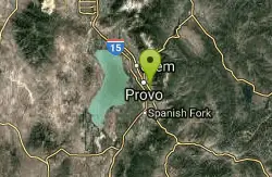
Bicentennial Park
Provo, Utah
28.0 miles EBicentennial Park is a favorite among disc golfers and families in the Provo area. The park has a 16-hole golf course, a duck pond, a playground, and a nature trail which features natural springs...
Disc Golf, Hike, Sled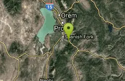
Dripping Rock
Spanish Fork, Utah
28.2 miles EDripping Rock is along a paved path adjacent to Spanish Oaks Golf Course.
Hike
Y-Mountain Summit Trail
Provo, Utah
30.0 miles NEY Mountain is located directly east of Brigham Young University (BYU) in Provo, Utah, United States. The Slide Canyon/Y Mountain Trail leads to a large block Y located 1.2 miles (1.9 km) from a...
Camp, Hike
G Mountain Trail
Pleasant Grove, Utah
30.2 miles NEThe trail starts at Kiwanis Park which is south of the 'G' at the end of Battle Creek Road. The trail starts out a little steep for about .25 mile and the very last bit is a...
Hike 1.2 mi
Battle Creek Falls
Pleasant Grove, Utah
30.2 miles NEBattle Creek Falls, located near Pleasant Grove, Utah, is a scenic waterfall that also has a rappelling and rock climbing area nearby. Hikers are allowed to see the falls from two view points, below...
Canyoneer, Hike
Grove Creek Trail
Pleasant Grove, Utah
30.4 miles NEThe Grove Creek Trail falls from the upper shoulder of Mount Timpanogos down Grove Creek Canyon to Pleasant Grove. It's usually ridden as a shuttled downhill -- because the climb up this...
Hike, Mountain Bike 1.3 mi
Eagle Crest Trail
Draper, Utah
31.6 miles NEEagle Crest trail is a beginner level trail mountain bike in Draper, Utah along the north side of Traverse Mountain. From the trail, riders can see the Salt Lake Valley, the Northern end of Utah...
Hike, Mountain Bike 0.8 mi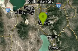
Red Rock Trail
Draper, Utah
32.0 miles NEThe Red Rock trail located in Draper, Utah is a short loop trail just down the road from the Draper LDS Temple. The hike itself may be short, but since it is along the cliffs of the southern end of...
Hike, Mountain Bike, Rock Climb
Little Valley Trail
Draper, Utah
32.2 miles NEOne of the best places in the Salt Lake valley to take kids mountain biking is the Little Valley Instructional Trails. Fortunately, these superbly constructed “flow” trails are just as...
Hike, Mountain Bike 0.6 mi
Potato Hill Trail
Draper, Utah
32.3 miles NELocated in Draper, UT, Potato Hill Trail start at the trailhead on Transverse Mountain Road. and goes down to the (BST) or Bonneville Shoreline Trail west of Coyote Hollow. There are some trails that...
Hike, Mountain Bike
Mercer Hollow Trail
Draper, Utah
32.3 miles NEMercer Hollow Trail is primarily used to bomb down the southern flanks of the ridge the Corner Canyon Trails sit on. It's filled with berms, rock features, rollers, and sweet, sweet...
Hike, Mountain Bike 1.6 mi
Corner Canyon Trail
Draper, Utah
33.3 miles NECorner Canyon is the "Go To" riding area in South Salt Lake and for many riders it is worth the drive (or ride) from Utah County. It is a good mix of everything from beginner training...
Backpack, Hike, Mountain Bike 0.6 mi
Bst To Equestrian Center Loop
Draper, Utah
33.4 miles NEAn intermediate trail with a length of 10 miles that's located in Draper, UT. It's a single track look trail that has an elevation of 417 ft. Start at the Equestrian Center and follow the...
Hike, Mountain Bike 0.2-1.8 mi
Lone Peak
Draper, Utah
33.5 miles NEEstablished in 1978 and located southeast of Salt Lake, Lone Peak is one of the taller peaks in the Wasatch range along the Wasatch Front. It has 5 main trailheads: Jacobs Ladder via Corner Canyon...
Hike, Mountain Bike, Rock Climb 1.7 mi
Jacob's Ladder Trail
Sandy, Utah
33.5 miles NEJacobs Ladder trail has an elevation trail of 5,700 ft. and the most popular trailhead out of the five trails in Lone Peak. It's located near a large area on the right side of the road...
Hike, Mountain Bike 1.2 mi
Ghost Falls Trail
Sandy, Utah
33.5 miles NEGhost Falls is located in the corner canyon riding area of Draper, Utah and one of the first mountain bike routes in the canyon. It's a family-friendly hike, named for the...
Hike, Mountain Bike, Snowshoe


