


100 Mountain Bike Trails near Falls River, Lower Run
first prev 1 2 3 4 5 next lastShowing Mountain Bike Trails within 50 miles Distance miles of 1293 4525 E, Ashton, ID 83420, USA City, Zip, or Address

Yellowstone Branch Line Trail
Ashton, Idaho
4.9 miles NWYellowstone branch line trail runs from Warm River to the Montana border totaling 39 miles. There are a few places to jump on and off the trail as well as a few smaller trails that branch off of this...
Backpack, Cross-country Ski, Hike, Horseback, Mountain Bike 29.6 mi
Ashton to Tetonia Trail
Ashton, Idaho
9.4 miles WThe Idaho Department of Parks and Recreation undertook the project to transform the old Teton Valley Branch of the Union Pacific Railroad from Ashton to Tetonia into a trail for bikes, ATVs, and...
Mountain Bike 17.5 mi
Tear Drop Lake
Ashton, Idaho
12.3 miles NENestled in the Targhee National Forest just off of Ashton's Fish Creek Road, this tear drop shaped lake is a family adventure waiting to happen. The lake isn't very big but it is teeming with...
Camp, Canoe, Hike, Kayak, Mountain Bike, Swim
Flat Canyon Trail
Island Park, Idaho
12.9 miles NNon-motorized use. souce: fs.usda.gov
Mountain Bike
Badger Creek
Tetonia, Idaho
15.0 miles SBadger Creek is a stream located just 13.6 miles from Ashton, in Teton County, in the state of Idaho, United States, near France, ID. Whether you’re spinning, baitcasting or fly fishing your...
Camp, Cross-country Ski, Hike, Mountain Bike, Rock Climb

Big Bend Ridge Trail
Ashton, Idaho
17.5 miles NWTrail is open to OHVs. source: fs.usda.gov
Mountain Bike 0.6-4.7 mi
Harriman State Park
Island Park, Idaho
20.5 miles NWHarriman State Park is found 38 miles from Yellowstone along Henry's Fork. This 11,000-acre wildlife refuge is open year round for most activities. In addition to having beautiful scenery and...
Cross-country Ski, Hike, Horseback, Mountain Bike, Snowshoe
Wright Creek Trail
Tetonia, Idaho
20.6 miles SOpen to MTB, horseback riding, snowshoeing, and hiking. source: fs.usda.gov
Mountain Bike 0.6 mi
Packsaddle Lake
Tetonia, Idaho
20.8 miles SPacksaddle is one of the less well known lakes/trails in the area. If you've got a good offroad vehicle, you can probably make it all the way to the end of the road, otherwise, it's just an...
Dive, Hike, Mountain Bike, Snowshoe, Swim
Probation And Burg Bumper
Tetonia, Idaho
22.7 miles SThe Probation part of the trail is the steepest downhill in the area. Has multiple bridges and log jumps in the short mile down. The Burg portion of the trail is uphill with some...
Mountain Bike
Sharks Belly
Driggs, Idaho
23.6 miles STrail system can start from Channel lock or Bovine. Channel Lock is an easier climb than Bovine. This description and mileage starts at the Channel Lock trail, forest service boundary marker. Take...
Mountain Bike
Southbound
Driggs, Idaho
23.6 miles STrail starts by going up the Channel lock trail. At the top of Channel Lock go right onto the Southbound trail. Trail will loop back to Channel lock which you take back to your car. Trail is...
Mountain Bike
Channel Lock
Driggs, Idaho
23.7 miles STrail is a little over 1 mile uphill. Recommended route up to access the larger Horseshoe canyon trail system. Makes a nice downhill with twists. Gets its name from the deep ruts made from cows....
Mountain Bike 1.7 mi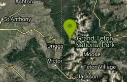
Rick's Basin
Driggs, Idaho
23.7 miles SEMountain Bike near Driggs, Idaho
Mountain Bike
Horseshoe Canyon
Tetonia, Idaho
23.9 miles SHorseshoe Canyon is one of the closest trail systems to the town of Driggs, Idaho. This network doesn't have a ton of climbing or descending, but the smooth, swooping singletrack with a...
Mountain Bike
Horseshoe Trails
Driggs, Idaho
24.0 miles SMountain Bike near Driggs, Idaho
Mountain Bike
Bovine
Driggs, Idaho
24.0 miles SBovine trail is part of a larger system. You can use it to access more trails or make it your end destination from other trailheads. It is a steep climb but returns the favor with a fast downhill....
Mountain Bike 0.6-4.0 mi
Grand Targhee XC Park
Moose, Wyoming
24.1 miles SEMountain Bike 1.1 mi

More Cowbell
Moose, Wyoming
24.1 miles SEThis singletrack trail winds through aspens, high alpine meadows and old growth conifers.
Mountain Bike 1.9 mi
Perm-a-grin
Moose, Wyoming
24.1 miles SEPerma Grin is guaranteed to fix a smile on your face indefinitely! This swooping, flowing, smooth singletrack descends the hillside above Rick's Basin.
Mountain Bike


