


68 Hiking Trails near Wright Creek Trail
first prev 1 2 3 4 next lastShowing Hiking Trails within 50 miles Distance miles of Forest Rd 922, Tetonia, ID 83452, USA City, Zip, or Address

Packsaddle Lake
Tetonia, Idaho
2.4 miles EPacksaddle is one of the less well known lakes/trails in the area. If you've got a good offroad vehicle, you can probably make it all the way to the end of the road, otherwise, it's just an...
Dive, Hike, Mountain Bike, Snowshoe, Swim 0.5-3.5 mi
Webster's Dam
Ririe, Idaho
12.3 miles SWAlso known as Manmade Falls or the Woodmansee Dam, Webster Dam is an abandoned dam located deep in Moody Creek canyon, the dam was abandoned when sediment built up behind the dam which then...
Camp, Hike, Mountain Bike 0.6-2.2 mi
Fish Creek Area
Ririe, Idaho
12.5 miles SWCLOSED. This land is owned and managed by the US Forest Service and is not designated for use. As of July 2024, being caught mountain biking on this trail could recieve up to a $5000 fine and a...
Hike, Mountain Bike
Badger Creek
Tetonia, Idaho
12.8 miles NEBadger Creek is a stream located just 13.6 miles from Ashton, in Teton County, in the state of Idaho, United States, near France, ID. Whether you’re spinning, baitcasting or fly fishing your...
Camp, Cross-country Ski, Hike, Mountain Bike, Rock Climb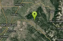
Burns Canyon
Ririe, Idaho
13.3 miles SHike and Mountain Bike near Ririe, Idaho
Hike, Mountain Bike 1.1 mi
Hidden Vista / Pine Loop
Ririe, Idaho
14.4 miles SWCLOSED. This land is owned and managed by the US Forest Service and is not designated for use. As of July 2024, being caught mountain biking on this trail could recieve up to a $5000 fine and a...
Hike, Mountain Bike 1.7 mi
Buckskin Morgan Ridge
Ririe, Idaho
14.4 miles SWCLOSED. This land is owned and managed by the US Forest Service and is not designated for use. As of July 2024, being caught mountain biking on this trail could recieve up to a $5000 fine and a...
Hike, Mountain Bike
Herbert Idaho Ghost Town
Ririe, Idaho
14.7 miles WCLOSED. Private property marked NO TRESPASSING. Herbert is a small ghost town that was operated until the 40s, but with the invention of the automobile, it was much more convenient to live in Rexburg...
Hike
Poison Flats
Ririe, Idaho
14.9 miles SWHike near Ririe, Idaho
Hike 3.8 mi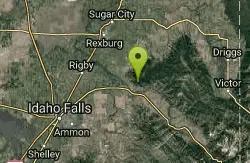
Kelly Mountain Trail
Ririe, Idaho
15.2 miles SWKelly Canyon Trail is a moderate, uphill trail that can be used by hikers, mountain bikers, and ATV riders. The trail features views of hills, mountains, trees, wildflowers, and some wildlife. Dogs...
Cross-country Ski, Hike, Mountain Bike, Snowshoe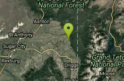
Bitch Creek Trestle
Tetonia, Idaho
16.3 miles NEAs part of the Rails to Trails project, this old railroad bridge has been transformed into a very safe little viewing experience for the whole family. You can drive right up to the bridge where...
Hike 0.8 mi
Conant Creek Pegram Truss Railroad Bridge
Ashton, Idaho
16.6 miles NAs part of the Rails to Trails project, this old railroad bridge has been transformed into a very safe little viewing experience for the whole family. You can drive right up to the bridge where there...
Hike 3.8 mi

Stinking Springs
Ririe, Idaho
18.0 miles SWStinking Springs is a great early to late season trail. Being at the edge of the Big Hole range, it gets spring earlier and winter later than other trails in the range. It's closed from December...
Hike, Mountain Bike 4.5 mi
Aspen Trail
Alta, Wyoming
18.0 miles EAspen Trail (tr 034) is single track trail for 4.35 miles along 6,800 ft contour to Darby Canyon (tr 012). Spring Creek Trail (tr 032) is double track trail for 3.68 miles to end. The trail starts...
Hike, Mountain Bike 0.3-0.6 mi
Cress Creek Nature Trail
Rexburg, Idaho
18.9 miles SWMeandering along the scenic South Fork of the Snake River, the beautiful 1¼ mile Cress Creek Nature Trail will lead you on a journey through sagebrush-grass communities, over juniper covered...
Hike 0.1-2.3 mi
Hidden Valley Trails
Rexburg, Idaho
19.2 miles WRight on the edges of town outside of the Hidden Valley subdivision, you'll find this fun little set of trails that's pretty good for mountain bikes. It is mostly a dirt bike...
Hike, Mountain BikeHenry's Fork Green Way (St. Anthony Green Belt)
Saint Anthony, Idaho
19.5 miles NWThis is a great walk along the river. While it is nestled right next to the highway, the closeness and beauty of the river flowing on the other side of the trail more than make up for it. Halfway...
Hike 4.5 mi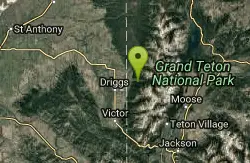
Sheep Bridge Trail
Driggs, Idaho
19.9 miles EThis is a great easy trail for beginner hikers or mountain bikers. In the early summer, you'll find many beautiful wildflowers and large kaleidoscopes of butterflies to go with them. You...
Hike, Mountain Bike 0.1-0.5 mi
Eagle Park
Rexburg, Idaho
20.8 miles WEagle Park is a little urban oasis. Once you drive in to this cottonwood forest along the river, you may forget that you're still inside Rexburg city limits. You can camp, picnic, throw rocks in...
Camp, Hike, Mountain Bike, Sled 0.1-6.2 mi
Darby Wind Cave
Driggs, Idaho
21.9 miles EDarby Wind Cave is a beautiful hike full of waterfalls, wildflowers, streams, and mountainous views. The sites you see will depend on the time of year you visit but it will always be beautiful and...
Backpack, Cave, Hike, Rock Climb


