


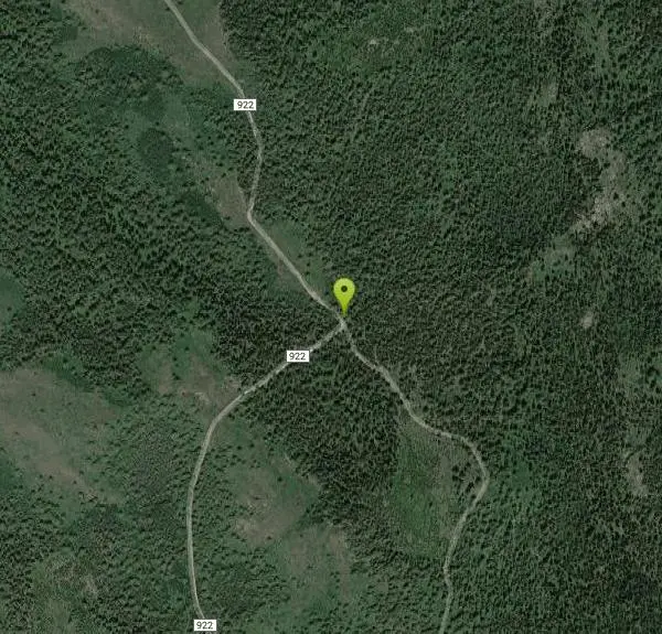
Wright Creek Trail
Tetonia, Idaho

| Address: | ~Forest Rd 922, Tetonia, ID 83452, USA |
| GPS: |
43°47'11.7"N 111°23'4.9"W Maps | Directions |
| State: | Idaho |
| Trail Length: | 2.00 miles |
| Trail Type: | Out & Back |
| MTB Trail Type: | Singletrack |
Mountain Bike
Open to MTB, horseback riding, snowshoeing, and hiking. source: fs.usda.gov Courtesy of Singletracks.com
More Information
Add ResourceNever modify trail features. Ride trails when they're dry enough that you won't leave ruts. Speak up when you see others on the trail and always yield to hikers, horses, and others coming uphill. Always ride on the established trail.
Read More- Plan Ahead and Prepare
- Travel & camp on durable surfaces
- Dispose of waste properly
- Leave what you find
- Minimize campfire impacts
- Respect wildlife
- Be considerate of other visitors
Directions
From Tetonia, Idaho
- Head north on ID-33 W/S Main St toward Central AveContinue to follow ID-33 W(16.7 mi)
- Turn left onto Canyon Creek Rd (0.8 mi)
- Merge onto N Canyon Creek Rd (1.0 mi)
- Turn left onto Pony Creek Rd (0.2 mi)
- Turn right (1.8 mi)
- Turn right (0.4 mi)
- Turn left (0.8 mi)
- Slight right onto Forest Rd 922Destination will be on the left(0.9 mi)
Other Mountain Bike Trails Nearby

Packsaddle Lake
Tetonia, Idaho
2.4 miles EPacksaddle is one of the less well known lakes/trails in the area. If you've got a good offroad vehicle, you can probably make it all the way to the end of the road, otherwise, it's just an...
Dive, Hike, Mountain Bike, Snowshoe, Swim
Probation And Burg Bumper
Tetonia, Idaho
4.8 miles SEThe Probation part of the trail is the steepest downhill in the area. Has multiple bridges and log jumps in the short mile down. The Burg portion of the trail is uphill with some...
Mountain Bike
North Mahogany Trail #220
Tetonia, Idaho
6.2 miles SEhe N. Mahogany Trail is open to Motorbikes, Mountain bikes, Horses, and Hikers. Motorbikes and Horseback riders are the most common visitors, but the trail is becoming increasingly...
Mountain Bike
Horseshoe Canyon
Tetonia, Idaho
6.4 miles SEHorseshoe Canyon is one of the closest trail systems to the town of Driggs, Idaho. This network doesn't have a ton of climbing or descending, but the smooth, swooping singletrack with a...
Mountain Bike
Horseshoe Trails
Driggs, Idaho
6.5 miles SEMountain Bike near Driggs, Idaho
Mountain Bike
Bovine
Driggs, Idaho
6.5 miles SEBovine trail is part of a larger system. You can use it to access more trails or make it your end destination from other trailheads. It is a steep climb but returns the favor with a fast downhill....
Mountain Bike
Channel Lock
Driggs, Idaho
6.7 miles SETrail is a little over 1 mile uphill. Recommended route up to access the larger Horseshoe canyon trail system. Makes a nice downhill with twists. Gets its name from the deep ruts made from cows....
Mountain Bike
Sharks Belly
Driggs, Idaho
6.7 miles SETrail system can start from Channel lock or Bovine. Channel Lock is an easier climb than Bovine. This description and mileage starts at the Channel Lock trail, forest service boundary marker. Take...
Mountain Bike
Southbound
Driggs, Idaho
6.7 miles SETrail starts by going up the Channel lock trail. At the top of Channel Lock go right onto the Southbound trail. Trail will loop back to Channel lock which you take back to your car. Trail is...
Mountain Bike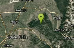
Thousand Springs Trail
Driggs, Idaho
8.2 miles SThe Thousand Springs trail begins at Moody Swamp trailhead and ends at Jct Prospect Peak Trail. source: fs.usda.gov Courtesy of Singletracks.com
Mountain Bike
Twin Creek Trail
Driggs, Idaho
9.5 miles SEThe Twin Creek trail is 2.3 miles long. It begins at Trail 6195 and ends at Trail 6219. source: fs.usda.gov
Mountain Bike
Big Hole Crest Trail
Driggs, Idaho
11.8 miles SEThis is a tough ride. Definately for advanced riders. Lots of climbing and descending. The trail at either end is well used and really fun. Not too much technical riding, just fun...
Mountain Bike 0.5-3.5 mi
Webster's Dam
Ririe, Idaho
12.3 miles SWAlso known as Manmade Falls or the Woodmansee Dam, Webster Dam is an abandoned dam located deep in Moody Creek canyon, the dam was abandoned when sediment built up behind the dam which then...
Camp, Hike, Mountain Bike 0.6-2.2 mi
Fish Creek Area
Ririe, Idaho
12.5 miles SWCLOSED. This land is owned and managed by the US Forest Service and is not designated for use. As of July 2024, being caught mountain biking on this trail could recieve up to a $5000 fine and a...
Hike, Mountain Bike
Badger Creek
Tetonia, Idaho
12.8 miles NEBadger Creek is a stream located just 13.6 miles from Ashton, in Teton County, in the state of Idaho, United States, near France, ID. Whether you’re spinning, baitcasting or fly fishing your...
Camp, Cross-country Ski, Hike, Mountain Bike, Rock Climb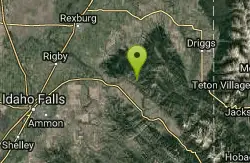
Burns Canyon
Ririe, Idaho
13.3 miles SHike and Mountain Bike near Ririe, Idaho
Hike, Mountain Bike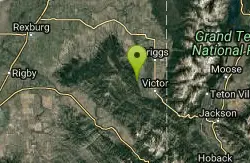
Henderson Canyon
Victor, Idaho
13.3 miles SETrail begins as dirt road/double track with numerous "cow" trails breaking off of road. Some of these trails see more tire tracks than others.
Mountain Bike 0.6-5.5 mi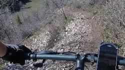
Old Ranger
Ririe, Idaho
13.4 miles SOn the South end of the Big Hole mountains just above the Snake River is a grueling yet diverse section of single-track on Forest Service Trail 287 called Old Ranger. Because of the...
Mountain Bike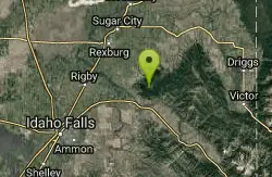
Kelly Canyon Loops
Ririe, Idaho
13.5 miles SWThis mountain bike trail near Kelly Canyon Ski Area has several options available. Highlights are the views in all directions from the top of the mountain. Trails: Waterfall...
Mountain Bike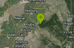
Cranky Cowboy
Herbert, Idaho
13.8 miles SWMountain Bike near Herbert, Idaho
Mountain BikeNearby Campsites

Moody Meadows
Driggs, Idaho
8.3 miles SWGood place for kids, they can ride bikes in the meadow, play in the stream, and camping is off of the road. Hiking, motorbiking, and horseback riding trails are abundant in the area.
Camp 0.5-3.5 mi
Webster's Dam
Ririe, Idaho
12.3 miles SWAlso known as Manmade Falls or the Woodmansee Dam, Webster Dam is an abandoned dam located deep in Moody Creek canyon, the dam was abandoned when sediment built up behind the dam which then...
Camp, Hike, Mountain Bike
Badger Creek
Tetonia, Idaho
12.8 miles NEBadger Creek is a stream located just 13.6 miles from Ashton, in Teton County, in the state of Idaho, United States, near France, ID. Whether you’re spinning, baitcasting or fly fishing your...
Camp, Cross-country Ski, Hike, Mountain Bike, Rock Climb
Big Hole Dispersed Campsites
Ririe, Idaho
13.6 miles SWA dispersed campsite is simply an unestablished and unmaintained area where people camp. Often, this means that there is a campfire or other basic campsite feature to identify the site and that's...
Camp
Table Rock Campground
Ririe, Idaho
14.9 miles SWTable Rock / Poison Flat Campground is located at the Caribou-Targhee National Forest which occupies over 3 million acres and stretches across southeastern Idaho, from the Montana, Utah, and Wyoming...
Camp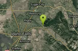
Paramount Wall / Blanche Rock
Ririe, Idaho
16.9 miles SWSitting high above the road, the routes at Paramount offer great exposure and relief from the afternoon summer sun. Chuck Oddette, Steve Reiser and Jed Miller established the routes from 1989...
Camp, Horseback, Rock Climb
Wolf Flats Recreation Area
Ririe, Idaho
17.2 miles SWWolf Flats is a completely free, dispersed, undeveloped camping area with 25 locations to camp. Some areas are large enough to accommodate groups of 50 people.
Camp
Pine Creek Campground
Victor, Idaho
17.3 miles SEThe Pine Creek Campground has 10 single units and has restrooms.
Camp
Kelly Island Campground
Ririe, Idaho
17.9 miles SWThis is a BLM campground with 14 campsites for RVs or tents and 1 group campsite. Daily Rates $5-20 Showers No Bathrooms Vault...
Camp
Darby Canyon Camping
Alta, Wyoming
19.8 miles SEThere's no official campgrounds up the canyon but there are several dispersed campsites with existing fire lays. Please adhere to principles of Leave No Trace. Use existing fire lays and leave...
Camp
Twin Bridges Park
Rexburg, Idaho
20.6 miles WTwin Bridges is a campground 12 miles South East of Rexburg on S. 600 E. It is maintained by Madison County Parks Department. It is a 27 acre park of pristine land rich with wildlife on the Snake...
Camp, Canoe 0.1-0.5 mi
Eagle Park
Rexburg, Idaho
20.8 miles WEagle Park is a little urban oasis. Once you drive in to this cottonwood forest along the river, you may forget that you're still inside Rexburg city limits. You can camp, picnic, throw rocks in...
Camp, Hike, Mountain Bike, Sled
Reunion Flat Campground
Alta, Wyoming
21.7 miles ECamp near Alta, Wyoming
Camp
Porcupine Creek
Ashton, Idaho
22.4 miles NPorcupine Creek is a hunting, fishing, camping, and swimming spot near Ashton, Idaho in Fremont County within Targhee National Forest. It's surrounded by forests, meadows, and a creek...
Camp, Swim
Mike Harris Campground
Victor, Idaho
22.4 miles SEMike Harris Campground is located along scenic Teton Pass, just 5 miles from Victor, Idaho at an elevation of 6,200 feet. Visitors enjoy fishing, exploring local trails and sightseeing in this...
Camp
Teton Canyon Campground
Alta, Wyoming
23.3 miles ETeton Canyon is the start of several great adventures, including the Alaska Basin Trail, Table Rock, Devil's Stairs, and the Teton Crest. The campground offers a perfect basecamp to get an...
Camp
Warm River Campground
Ashton, Idaho
23.4 miles NWarm River Campground is located nine miles northeast of Ashton, Idaho, along the slow-moving Warm River at an elevation of 5,200 feet. Willows line the riverbanks and pine trees offer partial...
Camp 3.8-6.4 mi
Table Rock / Table Mountain
Driggs, Idaho
23.4 miles EAt 11,300 feet, Table Mountain is possibly the most beautiful climb this side of the Tetons and offers what may well be the very best view of the Grand Tetons. It's just far enough away...
Camp, Hike
Fall Creek Falls
Swan Valley, Idaho
23.9 miles SFalls Campground is located next to the Snake River near beautiful Swan Valley, only 45 miles east of Idaho Falls, Idaho. Mixed growth cottonwood trees provide partial shade, and grassy meadows with...
Camp, Cave, Hike, Kayak, Swim
Falls Campground
Victor, Idaho
24.5 miles SFalls Campground is located next to the Snake River near beautiful Swan Valley, only 45 miles east of Idaho Falls, Idaho. Mixed growth cottonwood trees provide partial shade, and grassy meadows...
Camp


