


66 Hiking Trails near Rockport State Park
first prev 1 2 3 4 next lastShowing Hiking Trails within 50 miles Distance miles of Juniper Campground Rd, Peoa, UT 84061, USA City, Zip, or Address
Wasatch Crest
Salt Lake City, Utah
14.8 miles SWThe Wasatch Crest Trail (GWT) is probably one of the best, if not the very best, singletrack trail in Utah! I prefer to do this ride as an out and back, starting at Millcreek Canyon's Big Water...
Hike, Mountain Bike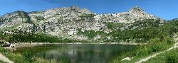
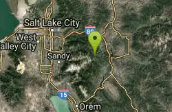
Silver Lake (Big Cottonwood)
Brighton, Utah
15.9 miles SWThis hike has everything. The trail passes by three bodies of water and winds through beautiful woodland areas. Wildlife is in abundance. Everything from chipmunks to moose can be observed along...
Hike, Mountain Bike
Donut Falls
Salt Lake City, Utah
16.2 miles SWVery popular beginning hike in the Salt Lake City area. Many take this as a good intro hike into the outdoors, while others go for a trip out with friends to escape the rush of daily life. The...
Hike, Swim
Cecret (Secret) Lake
Alta, Utah
18.9 miles SWCecret (pronounced "Secret") Lake is a beautiful lake located among alpine meadows in Little Cottonwood Canyons Albion Basin. Some folks spell Secret Lake as Cecret Lake, but the USGS...
Hike
Sugarloaf Peak
Alta, Utah
19.3 miles SWSugarloaf Peak is an easily reached 11,000 ft. summit which overlooks Albion Basin, Secret Lake, and much of Utah's Alta ski resort. The easy terrain and relatively high trailhead elevation...
Hike

Lake Blanche
Salt Lake City, Utah
19.9 miles SWLake Blanche is a fun and popular hike. Lake Blanche, Lake Florence and Lake Lillian are all located next to each other in the upper reaches of the South Fork of Mill B. The trail to Lake Blanche...
Hike
Grandeur Peak
Salt Lake City, Utah
19.9 miles WGrandeur Peak is the most easily accessible of the major peaks that form the Salt Lake City skyline. For many valley residents Grandeur Peak was there first major summit. The peak offers great...
Hike 2.6 mi
Salt Lake Valley Scenic Overlook
Salt Lake City, Utah
19.9 miles WThe Salt Lake Valley Scenic overlook starts on the Desolation trail in Millcreek Canyon near Salt Lake City, Utah and offers hikers a wide variety of destinations to stop at along the trail,...
Hike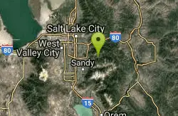
Hidden Falls
Salt Lake City, Utah
20.1 miles SWHidden Falls is a popular road side attraction for anyone cruising Big Cottonwood Canyon on a sunny afternoon. The falls are within strolling distance of the parking lot and only require about 15...
Hike
Pfeiferhorn Peak
Provo, Utah
20.8 miles SWThe Pfeifferhorn is a majestic peak, which is located east of Salt Lake City, Utah in the Wasatch mountain range. It's easy access, proximity to alpine lakes and short trail make it a popular...
Backpack, Hike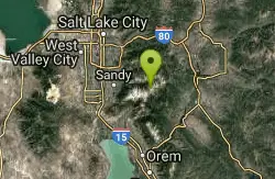
American Fork Twin Peaks
Provo, Utah
21.1 miles SWAmerican Fork Twin Peaks is the highest mountain on the Little Cottonwood Canyon ridge. The summit is the prominent peak overlooking the Snowbird ski resort. A short approach hike...
Hike
Storm Mountain
Salt Lake City, Utah
21.4 miles SWStorm Mountain is on of the smaller peaks included in the Wasatch Range. Storm Mountain is located in Cottonwood Canyon. Storm Mountain Day Use Area is just 3 miles up Big Cottonwood Canyon,...
Hike, Mountain Bike, Rock Climb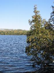
White Pine Lake
Sandy, Utah
22.4 miles SWWhite Pine Canyon has long been the subject of intense controversy between advocates of wilderness and ski resort owners. The original boundaries of Lone Peak Wilderness Area, created in 1977, were...
Hike, Mountain Bike
Lisa Falls
Sandy, Utah
22.7 miles SWLisa Falls is a great place to climb Spring through Fall, any time of day. The base is well shaded by trees and offers many flat places to belay, or just hang out and relax. The roaring waterfall...
Hike, Rock Climb 0.7 mi
Great White Icicle
Sandy, Utah
23.5 miles SWThe Great White Icicle is located in Little Cottonwood Canyon just outside of Salt Lake City, Utah. It is a climbing area that is a frozen waterfall in the winter and a cascading waterfall...
Hike, Rock Climb
Pete's Rock
Salt Lake City, Utah
23.5 miles WA large rock next to the Mount Olympus trailhead known locally as Pete's Rock and is a popular place for casual rock climbing. Mount Olympus is a prominent 9,026 feet peak on the east side of the...
Hike, Rock Climb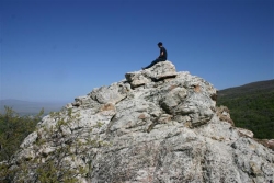
Mueller Park Trail
Bountiful, Utah
23.9 miles WThe Mueller Park Trail is a great year-round trail that's almost right off the road. It's considered moderate difficulty. It's a gradual grade with beautiful views. It's a popular...
Cross-country Ski, Hike, Mountain Bike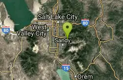
Ferguson Canyon
Cottonwood Heights, Utah
23.9 miles SWFerguson canyon is small canyon between Big and Little Cottonwood Canyons. This canyon has gained popularity over the last few year and is a popular destination for rock climbers. This is one hike...
Hike, Mountain Bike, Rock Climb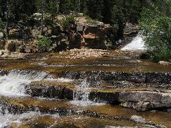
Provo River Falls
Kamas, Utah
24.9 miles EFrom the highway on the way to Mirror Lake, drivers will see the Provo River flow and cascade over several waterfalls on its way to the valley. Both the upper and lower falls are visible and...
Hike 4.7 mi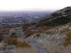
Bonneville Shoreline Trail
Salt Lake City, Utah
25.5 miles WBonneville Shoreline Trail is a great place for hiking, biking, and trail running. It stretches from North Salt Lake to Parley's Canyon. The trail follows the shoreline of ancient Lake...
Hike, Mountain Bike


