Rockport State Park
Peoa, Utah
| Address: | ~Juniper Campground Rd, Peoa, UT 84061, USA |
| GPS: |
40°46'55.9"N 111°23'33.3"W Maps | Directions |
| State: | Utah |
| Trail Length: | 0.00 miles |
| MTB Difficulty: | Beginner |
| Trail Type: | Network |
| MTB Trail Type: | Singletrack |
Mountain Bike
Rockport State Park has several trails for a variety of experience levels. The park is located right next to Rockport Reservoir, near Peoa Utah.
One of the easiest and longest trails in the park is called the Rail Trail. This trail is over 27 miles long on a paved path. It connects the town of Echo with Park City. Overall the trail gains 1,468' ft when approaching Park City, and does not have to be done in one long ride. Many bikers will break it up in order to enjoy the area.
Princess Di is a trail rated expert, though can be done by intermediate riders if they dismount at certain, more technical parts of the trail. It is about 7.5 miles long, but can be turned into a loop if taking the Three Mile Canyon and Rail Trails. This trail is not paved and there is a lot of loose volcanic rock. Visitors will start the trail at Promotory Trailhead and stick to that trail for about 3 miles, taking a left turn where the pavement ends. Along the trail bikers will be gaining and loosing altitude and huging the mountain with switchbacks throughout.
Three Mile Canyon Trail is a paved trail that connects to the Princess Di trail from the Rail Trail. It is about 3.1 miles long and not too difficult of a ride. There is about 400' of elevation gain over the 3 mile ride, with views of Park City and the nearby lake in the distance.
More Information
Never modify trail features. Ride trails when they're dry enough that you won't leave ruts. Speak up when you see others on the trail and always yield to hikers, horses, and others coming uphill. Always ride on the established trail.
Read MoreDirections
From Peoa, Utah
- Head northwest on US-189 toward Browns Canyon Rd (2.8 mi)
- Turn right onto UT-302 N (0.3 mi)
- Turn left to stay on UT-302 N (3.0 mi)
- Turn left onto Juniper Campground RdDestination will be on the right(167 ft)

Other Mountain Bike Trails Nearby

Historic Union Pacific Rail Trail
Park City, Utah
6.8 miles SWThe Historic Union Pacific Rail Trail is a 28-mile non-motorized trail. One end of the trail begins in Park City and follows Interstate 80 through Wanship and Coalville to Echo...
Mountain Bike
Trailside Loop And Skills Park
Park City, Utah
7.5 miles SWFind the skills park up off the trail you can't miss it and have some fun. Good for beginner to intermediates to practice their skills in an easy environment to gain confidence for some...
Mountain Bike
Round Valley
Park City, Utah
8.1 miles SWNice network of intermediate singletrack in a open space preserve. Good veiws, some nice curvy sections of trail. Well maintained good training ride. Like most of the trails in Park City,...
Mountain Bike
Flying Dog Trail
Park City, Utah
8.4 miles SWThis hot, dusty, and sun-exposed route is a great test for riders looking to gain some fitness and get used to the loose dirt Park City has on offer. If you're feeling bold and want to expand...
Mountain Bike
Silver Springs
Park City, Utah
8.8 miles SWPartially paved, double track. Very easy. Excellent for beginners or casual riders.
Mountain Bike
Stealth
Park City, Utah
9.2 miles WThe best rout is to go clockwise. Take the Stealth trail and follow it to the top of the ridge. Cross the road at the top of the ridge and look for a single track near the cell towers....
Mountain Bike
SOS
Park City, Utah
9.2 miles SWSOS is an advanced .3 mile descent off of the Prospector Trail down to Prospector Park. It's a steep drop, so hang on tight!
Mountain Bike
Boot Hill
Park City, Utah
10.0 miles SWBoot Hill is an intermediate singletrack trail in Park City located near Monitor Drive, Snow Creek Drive, and Kearns Blvd.
Mountain Bike
Lost Prospector
Park City, Utah
10.0 miles SWLost Prospector is a well-constructed machine-built trail that makes up one big side of the Gambel Oaks trail system. Rocky in places and loamy in others, this trail provides some fantastic views...
Mountain Bike
Glenwild
Park City, Utah
10.1 miles WThis easy to follow 8.4 mile loop is located just across from I-80 in Park City. Starting at 6350 feet, the loop has 800 feet of elevation change, with a total of 1200 feet of climbing....
Mountain Bike
Solamere
Park City, Utah
10.2 miles SWSolamere is a great downhill! Fast and relatively smooth downhill with sweeping switchbacks and a fun rock garden two or three straightaways into the ride. Drops you off on Solamere...
Mountain Bike
The Canyons Bike Park
Park City, Utah
10.5 miles SWThe Canyons has a dedicated lift-served downhill mountain bike park complete with big hits and gnarly terrain. Unlike the lift-served riding currently available at PCMR, the trails at...
Mountain Bike
Masonic
Park City, Utah
10.6 miles SWMasonic is a twisty, techy oldschool-style descent off the top of the knob down to Lost Prospector. The trees and undergrowth grow in close to the narrow tread, and the challenging...
Mountain Bike
Prospector Area
Park City, Utah
10.6 miles SWTrailhead/entrance is off of Mellow Mountain Road. .75 miles of uphill to get to the top of the mountain. Once there, you have a couple of choices for your downhill... either Solamere...
Mountain Bike
Spin Cycle
Park City, Utah
10.6 miles SFamous Park City trail. Natural half pipe (the actual Spin Cycle portion) that is tons of fun (and makes it pretty much a one-way, downhill only trail). Don't forget to take a picture...
Mountain Bike
PC Dirt Jumps
Park City, Utah
10.7 miles SWThe Park City dirt jumps are a complex of, well, sculpted dirt jumps set up progression-style from little bumps for kids on strider bikes, all the way up to some of the biggest jumps...
Mountain Bike
Armstrong
Park City, Utah
10.7 miles SWArmstrong is a 4-mile climb that begins near the Crescent Lift and climbs all the way up to Ham and the Mid-Mountain trail. While most of the trails at PCMR are two-way trails,...
Mountain Bike
Mid-mountain
Park City, Utah
10.7 miles SWMid Mountain Loop can be summed up in one word, "extraordinary"!! Mid Mountain is an epic ride that begins in Park City and climbs the Spiro Trail, touches very briefly on the Powerline...
Mountain Bike
Colin's Trail
Park City, Utah
10.8 miles SWLocated near The Canyons Ski Resort, Colin's trail connects to Rob's and Rosebud Heaven.
Mountain Bike
Jenni's
Park City, Utah
10.8 miles SWJenni's is a 5-mile singletrack trail that traverses the ski slopes of PCMR and descends down to the town of Park City. Much of the trail is bright and sunny and traverses across the...
Mountain BikeNearby Campsites

Spruces Campground
Salt Lake City, Utah
16.2 miles SWCamping isn't free. See USDA.gov for details. If you know the coordinates of the sledding hill here, please comment.
Camp, Sled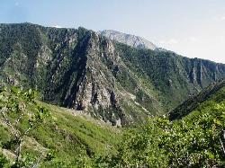
Mill Creek Canyon
Salt Lake City, Utah
17.8 miles WMill Creek is an out and back with over 1000 ft of elevation gain. The lower section of the ski trail gets a lot of foot traffic, but the upper section (above Elbow Fork) is generally very quiet....
Camp, Cross-country Ski, Snowshoe
Holbrook Trailhead
Bountiful, Utah
24.6 miles Wairsoft feaild woth bunkers
Airsoft, Backpack, Camp, Paintball, Snowshoe 1.6-14.1 mi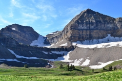
Mount Timpanogas
Provo, Utah
27.5 miles SWMt. Timp, as the locals call it, is the 2nd highest mountain in the Wasatch range (only Mt. Nebo is higher). What sets "Timp" apart is its location. It towers over the Provo, Orem, Pleasant...
Camp, Hike, Horseback, Swim
Hell Hole Lake
Evanston, Utah
28.8 miles EThe first 250 feet of this trail are on private property with access provided by Kayenta. The trail is actually the northern portion of Dry Wash. Sand and boulders litter the wash making hiking...
Camp, Hike, Horseback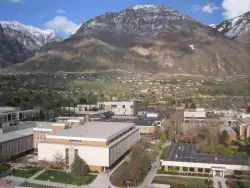
Y-Mountain Summit Trail
Provo, Utah
38.8 miles SY Mountain is located directly east of Brigham Young University (BYU) in Provo, Utah, United States. The Slide Canyon/Y Mountain Trail leads to a large block Y located 1.2 miles (1.9 km) from a...
Camp, Hike 2.9 mi
Pineview Reservoir
Eden, Utah
42.1 miles NWLocated on the backside of the Wasatch Front, Pineview Reservoir in the Ogden River Canyon is home to stunning views of the water, sandy beaches, the Southern Skyline trail, paved ramps, and...
Camp, Canoe, Hike, Kayak, Mountain Bike, Swim 5.6 mi
Antelope Island Lakeside Trail
Syracuse, Utah
46.9 miles WThe Lakeside Trail is a kid-friendly trail with great views and many bugs. This is a gorgeous scenic hike winding around part of the Great Salt Lake. The trail on Antelope Island that runs about...
Camp, Hike, Horseback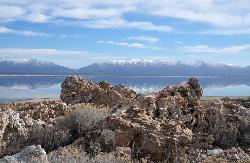
Antelope Island State Park
Syracuse, Utah
47.3 miles WLocated just 41 miles north of Salt Lake City, Antelope Island State Park encompasses a vast selection of outdoor activities and spectacular scenery providing a peaceful nature experience. Experience...
Backpack, Camp, Hike, Horseback, Mountain Bike 4.7 mi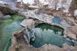
Fifth Water Hot Springs
Provo, Utah
48.3 miles SAKA Diamond Fork Hot Springs A beautiful drive and a 2.5 mile hike along the river will end you at an amazing set of hot springs that's well worth the trip. There's a variety of...
Backpack, Camp, Hike, Hot Springs, Mountain Bike, Swim


