


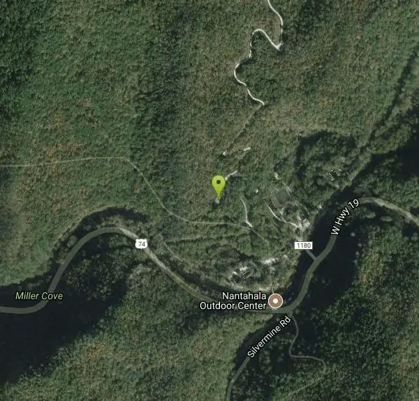
Flint Ridge
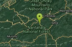
Bryson City, North Carolina
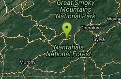
| Address: | ~315 Noc Way, Bryson City, NC 28713, USA |
| GPS: |
35°20'2.0"N 83°35'37.8"W Maps | Directions |
| State: | North Carolina |
| Trail Length: | 5.00 miles |
| MTB Difficulty: | Advanced |
| Trail Type: | Lariat |
| MTB Trail Type: | Singletrack |
Mountain Bike
The first mile or so of this trail is a series of nine switchbacks that take you up a pretty steep face of the ridge. The top of the ridge has some great views of the Nantahala river with some pretty fast single track. You're rewarded for your hard work in the first mile with some pretty steep downhill on the way back home. Although this trail will never compare to Tsali, which is 5 miles down the road, it's a nice change of pace and worth a stop if you're in the area to ride Tsali. Courtesy of Singletracks.com
More Information
Add ResourceNever modify trail features. Ride trails when they're dry enough that you won't leave ruts. Speak up when you see others on the trail and always yield to hikers, horses, and others coming uphill. Always ride on the established trail.
Read More- Plan Ahead and Prepare
- Travel & camp on durable surfaces
- Dispose of waste properly
- Leave what you find
- Minimize campfire impacts
- Respect wildlife
- Be considerate of other visitors
Directions
From Bryson City, North Carolina
- Head southwest on Bryson Walk toward Slope St (0.2 mi)
- Turn left at the 1st cross street onto Slope St (0.2 mi)
- Continue onto US-19 N (0.1 mi)
- Continue straight onto Spring St/Veterans BlvdContinue to follow Veterans Blvd(0.6 mi)
- Sharp right to merge onto US-74 W toward Murphy (12.5 mi)
- Turn right onto State Rd 1180 (0.1 mi)
Other Mountain Bike Trails Nearby
Swinging Bridge
Bryson City, North Carolina
4.6 miles EThis is a relatively flat ride with one huge hill near the end. From Brush Creek Church, ride Lower Needmore to the swinging bridge on the right (about one mile from the church)....
Mountain Bike
Tsali Mouse Branch Loop
Almond, North Carolina
5.0 miles NFrom the main parking area, Mouse starts with doubletrack. Head out the main road and continue in a clockwise direction. Many riders consider Mouse the most technical of the Tsali trails, but...
Mountain Bike
Tsali Thompson Loop
Almond, North Carolina
5.0 miles NThompson Loop, like Mouse Branch Loop, is more technical than the Right and Left loops at Tsali. Thompson has a lot of tight twisting singletrack and like all the trails at Tsali is...
Mountain Bike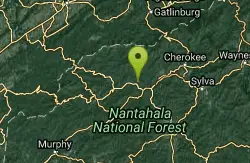
Tsali Right Loop
Almond, North Carolina
5.1 miles NThe Right Loop is by far my favorite Tsali trail. Start at the trailhed parking lot and follow the signs for the LEFT LOOP (that's right). After about 0.3 miles, turn right onto the...
Mountain Bike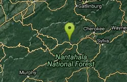
Tsali Recreation Area
Almond, North Carolina
5.1 miles NTsali features four singletrack loops that hug the banks of Fontana Lake. The trails are super fast and flowy singletrack with mostly moderate climbs and amazing scenery.Daily usage...
Mountain Bike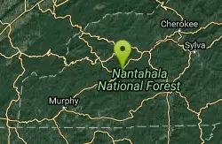
Winding Stairs
Topton, North Carolina
6.3 miles SWStart the trail by riding back down Wayah Rd. towards the power station. Turn right into the rafting put-in and find the bridge across the river (a cement bridge with steel framing)....
Mountain Bike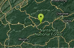
Stecoah Gap
Robbinsville, North Carolina
7.2 miles WThis is a great trail to ride after a long day at Tsali, or even a great trail for a quick ride after work. The elevation starts at 3165 ft and gradually winds up the mountain to...
Mountain Bike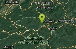
Deep Creek Trail
Bryson City, North Carolina
12.7 miles NEThe trail appears to be an old forest service road or an old logging road. There are two out and back trails. Deep Creek and Indian Creek Falls. Deep Creek is about 2 miles one way....
Mountain Bike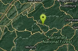
Fontana Village
Fontana Dam, North Carolina
14.7 miles NWThere are a ton of trails in the village, each of them labeled and fairly well blazed. We rode Brooks Cove trail and it was a blast. To find the trail, take the road down toward the...
Mountain Bike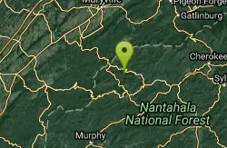
Turkey Chute
Robbinsville, North Carolina
15.1 miles NWA fast, screaming downhill! This trail is used several times per year for downhill races, but is totally rideable on a regular mountain bike. Enjoy this sweet downhill!...
Mountain Bike
Santeetlah Lake Trail
Robbinsville, North Carolina
15.2 miles WIt is old forest road, but is intermediate/difficult due to the variation of terrain. It needs to be ridden in to create a trail tread. Take the mountain bike. The mile markers on the...
Mountain Bike
WCU Trails
Cullowhee, North Carolina
22.1 miles ETrail is intermediate in difficulty with steep mountainside terrain. Although the elevation change from the trail's highest to lowest point is only a few hundred feet, there are lots of...
Mountain Bike
Burnt Tree Peninsula
Hayesville, North Carolina
24.6 miles SWOne of the easiest trails in the entire Jack Rabbit system, this is still an absolute blast to ride!
Mountain Bike
Jack Rabbit Trails
Hayesville, North Carolina
24.9 miles SWJackrabbit is a very beginner-friendly trail network and features gentle ups and downs, and is very twisty and very fast! There are very few obstacles, and essentially no technical...
Mountain Bike
High Point
Hayesville, North Carolina
24.9 miles SWThis trail is named high point for a reason: it accesses the highest point in the trail system. The views of the top of the lake and the mountains in the background are phenomenal!...
Mountain Bike
Yotee's Run
Hayesville, North Carolina
24.9 miles SWA part of the Jack Rabbit trail system, Yotee's run (named after their trail dog) is a wonderful fast, flowy trail that exemplifies what the singletrack here is all about....
Mountain Bike
Sneaking Creek
Hayesville, North Carolina
24.9 miles SWWhile all of the trails at Jack Rabbit are flowy, Sneaking Creek is the king of flow! You'll find yourself pedaling as fast as possible and just reveling in the momentum you're able to...
Mountain Bike
Cades Cove
Townsend, Tennessee
25.5 miles NWTake some of the gravel roads on the right for adventures but turn around or you'll end up sssomewhere else besids the parking lot. If you wimp out take either of the two gravel roads...
Mountain Bike
Snaggy Creek Trail
Cullowhee, North Carolina
26.5 miles E5 mile climb starting at about 2300 feet and limbs steadily to 5500. Return halfway down previous route then break right and end up going down the atv trails and finally back to...
Mountain Bike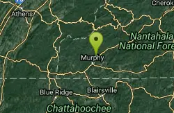
Grape Smuggler
Murphy, North Carolina
27.4 miles SWThis trail system is being actively developed and the inner loop is open for business. Without a doubt the best designed trail system we have near town. Full of fun flow, this trail...
Mountain BikeNearby Campsites

Mt. LeConte Lodge
Sylva, North Carolina
19.2 miles EHigh atop Mt. LeConte in the Great Smoky Mountains National Park, LeConte Lodge® is the highest guest lodge in the eastern United States. It is situated on an open glade just below the summit of...
Camp, Hike, Horseback, Rock Climb
Cades Cove Campground
Townsend, Tennessee
21.2 miles NWOver 2 million visitors annually come to enjoy the scenic beauty of Cades Cove and its many historic structures. Popular activities here include hiking, biking, touring the 11-mile Cades Cove loop...
Camp
Davis Branch
Tellico Plains, Tennessee
28.6 miles WDavis Branch is a beautiful campground located in Tennesse by the beautiful Tellico River. Here you can camp, hike, and explore the river. The campground has six different campsites all offering...
Camp, Hike, Swim
War Woman Dell Wildlife Management Area
Clayton, Georgia
34.1 miles SEWarwoman Dell Nature Trail and Becky Branch Falls Trail is a 0.8 mile out and back trail located near Clayton, Georgia that features a waterfall and is good for all skill levels. The trail is...
Camp, Hike, Horseback
Cosby Campground
Cosby, Tennessee
36.4 miles NECamp and Swim near Cosby, Tennessee
Camp, Swim
Vogle State Park
Blairsville, Georgia
43.3 miles SWVogel State Park is a 233-acre or 94 hectares state park located at the base of Blood Mountain in the Chattahoochee National Forest. It became one of the first two parks in Georgia when it founded a...
Camp, Canoe, Swim
Davidson River Campground
Pisgah Forest, North Carolina
49.3 miles EDavidson River Recreation Area offers camping and outdoor activities for the whole family. The campground boasts several loops of shaded campsites, as well as access to hiking trails, fishing spots,...
Camp, Hike, Swim


