


68 Mountain Bike Trails near Flint Ridge
first prev 1 2 3 4 next lastShowing Mountain Bike Trails within 50 miles Distance miles of 315 Noc Way, Bryson City, NC 28713, USA City, Zip, or Address
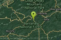
Swinging Bridge
Bryson City, North Carolina
4.6 miles EThis is a relatively flat ride with one huge hill near the end. From Brush Creek Church, ride Lower Needmore to the swinging bridge on the right (about one mile from the church)....
Mountain Bike
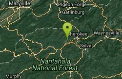
Tsali Mouse Branch Loop
Almond, North Carolina
5.0 miles NFrom the main parking area, Mouse starts with doubletrack. Head out the main road and continue in a clockwise direction. Many riders consider Mouse the most technical of the Tsali trails, but...
Mountain Bike
Tsali Thompson Loop
Almond, North Carolina
5.0 miles NThompson Loop, like Mouse Branch Loop, is more technical than the Right and Left loops at Tsali. Thompson has a lot of tight twisting singletrack and like all the trails at Tsali is...
Mountain Bike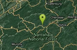
Tsali Right Loop
Almond, North Carolina
5.1 miles NThe Right Loop is by far my favorite Tsali trail. Start at the trailhed parking lot and follow the signs for the LEFT LOOP (that's right). After about 0.3 miles, turn right onto the...
Mountain Bike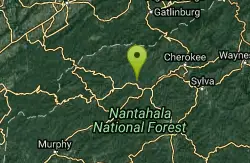
Tsali Recreation Area
Almond, North Carolina
5.1 miles NTsali features four singletrack loops that hug the banks of Fontana Lake. The trails are super fast and flowy singletrack with mostly moderate climbs and amazing scenery.Daily usage...
Mountain Bike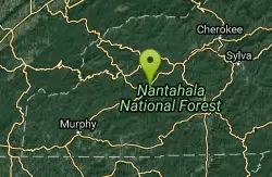
Winding Stairs
Topton, North Carolina
6.3 miles SWStart the trail by riding back down Wayah Rd. towards the power station. Turn right into the rafting put-in and find the bridge across the river (a cement bridge with steel framing)....
Mountain Bike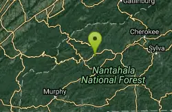
Stecoah Gap
Robbinsville, North Carolina
7.2 miles WThis is a great trail to ride after a long day at Tsali, or even a great trail for a quick ride after work. The elevation starts at 3165 ft and gradually winds up the mountain to...
Mountain Bike
Deep Creek Trail
Bryson City, North Carolina
12.7 miles NEThe trail appears to be an old forest service road or an old logging road. There are two out and back trails. Deep Creek and Indian Creek Falls. Deep Creek is about 2 miles one way....
Mountain Bike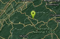
Fontana Village
Fontana Dam, North Carolina
14.7 miles NWThere are a ton of trails in the village, each of them labeled and fairly well blazed. We rode Brooks Cove trail and it was a blast. To find the trail, take the road down toward the...
Mountain Bike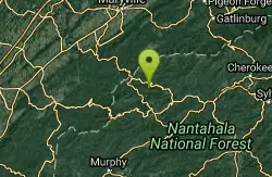
Turkey Chute
Robbinsville, North Carolina
15.1 miles NWA fast, screaming downhill! This trail is used several times per year for downhill races, but is totally rideable on a regular mountain bike. Enjoy this sweet downhill!...
Mountain Bike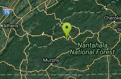
Santeetlah Lake Trail
Robbinsville, North Carolina
15.2 miles WIt is old forest road, but is intermediate/difficult due to the variation of terrain. It needs to be ridden in to create a trail tread. Take the mountain bike. The mile markers on the...
Mountain Bike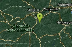
WCU Trails
Cullowhee, North Carolina
22.1 miles ETrail is intermediate in difficulty with steep mountainside terrain. Although the elevation change from the trail's highest to lowest point is only a few hundred feet, there are lots of...
Mountain Bike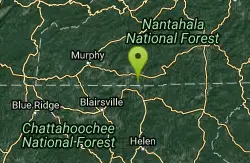
Burnt Tree Peninsula
Hayesville, North Carolina
24.6 miles SWOne of the easiest trails in the entire Jack Rabbit system, this is still an absolute blast to ride!
Mountain Bike
Jack Rabbit Trails
Hayesville, North Carolina
24.9 miles SWJackrabbit is a very beginner-friendly trail network and features gentle ups and downs, and is very twisty and very fast! There are very few obstacles, and essentially no technical...
Mountain Bike
High Point
Hayesville, North Carolina
24.9 miles SWThis trail is named high point for a reason: it accesses the highest point in the trail system. The views of the top of the lake and the mountains in the background are phenomenal!...
Mountain Bike
Yotee's Run
Hayesville, North Carolina
24.9 miles SWA part of the Jack Rabbit trail system, Yotee's run (named after their trail dog) is a wonderful fast, flowy trail that exemplifies what the singletrack here is all about....
Mountain Bike
Sneaking Creek
Hayesville, North Carolina
24.9 miles SWWhile all of the trails at Jack Rabbit are flowy, Sneaking Creek is the king of flow! You'll find yourself pedaling as fast as possible and just reveling in the momentum you're able to...
Mountain Bike
Cades Cove
Townsend, Tennessee
25.5 miles NWTake some of the gravel roads on the right for adventures but turn around or you'll end up sssomewhere else besids the parking lot. If you wimp out take either of the two gravel roads...
Mountain Bike
Snaggy Creek Trail
Cullowhee, North Carolina
26.5 miles E5 mile climb starting at about 2300 feet and limbs steadily to 5500. Return halfway down previous route then break right and end up going down the atv trails and finally back to...
Mountain Bike
Grape Smuggler
Murphy, North Carolina
27.4 miles SWThis trail system is being actively developed and the inner loop is open for business. Without a doubt the best designed trail system we have near town. Full of fun flow, this trail...
Mountain Bike


