


129 Things to do near Flint Ridge
first prev 1 2 3 4 5 6 7 next lastShowing results within 50 miles Distance miles of 315 Noc Way, Bryson City, NC 28713, USA City, Zip, or Address
Fingerlake
Almond, North Carolina
3.1 miles NEFingerlake overlooks Fontana Lake near Almond, NC. Fingerlake is the perfect place to cool off on a hot day. Fingerlake has a day use area that is open to the public from dawn to dusk from April to...
Canoe, Kayak, Swim
Swinging Bridge
Bryson City, North Carolina
4.6 miles EThis is a relatively flat ride with one huge hill near the end. From Brush Creek Church, ride Lower Needmore to the swinging bridge on the right (about one mile from the church)....
Mountain Bike
Tsali Mouse Branch Loop
Almond, North Carolina
5.0 miles NFrom the main parking area, Mouse starts with doubletrack. Head out the main road and continue in a clockwise direction. Many riders consider Mouse the most technical of the Tsali trails, but...
Mountain Bike
Tsali Thompson Loop
Almond, North Carolina
5.0 miles NThompson Loop, like Mouse Branch Loop, is more technical than the Right and Left loops at Tsali. Thompson has a lot of tight twisting singletrack and like all the trails at Tsali is...
Mountain Bike
Tsali Right Loop
Almond, North Carolina
5.1 miles NThe Right Loop is by far my favorite Tsali trail. Start at the trailhed parking lot and follow the signs for the LEFT LOOP (that's right). After about 0.3 miles, turn right onto the...
Mountain Bike
Queens Creek Lake
Nantahala, North Carolina
5.1 miles SWQueens Creek Lake is a beautiful secluded reservoir in Natahala George. This picturesque winding lake is surrounded by mountains covered with trees. The mountains and sky often mirror themselves into...
Swim
Tsali Recreation Area
Almond, North Carolina
5.1 miles NTsali features four singletrack loops that hug the banks of Fontana Lake. The trails are super fast and flowy singletrack with mostly moderate climbs and amazing scenery.Daily usage...
Mountain Bike
Winding Stairs
Topton, North Carolina
6.3 miles SWStart the trail by riding back down Wayah Rd. towards the power station. Turn right into the rafting put-in and find the bridge across the river (a cement bridge with steel framing)....
Mountain Bike
Stecoah Gap
Robbinsville, North Carolina
7.2 miles WThis is a great trail to ride after a long day at Tsali, or even a great trail for a quick ride after work. The elevation starts at 3165 ft and gradually winds up the mountain to...
Mountain Bike
Deep Creek Trail
Bryson City, North Carolina
12.7 miles NEThe trail appears to be an old forest service road or an old logging road. There are two out and back trails. Deep Creek and Indian Creek Falls. Deep Creek is about 2 miles one way....
Mountain Bike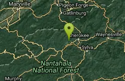
Deep Creek Area
Wallace, North Carolina
13.1 miles NESwim near Wallace, North Carolina
Swim
Fontana Village
Fontana Dam, North Carolina
14.7 miles NWThere are a ton of trails in the village, each of them labeled and fairly well blazed. We rode Brooks Cove trail and it was a blast. To find the trail, take the road down toward the...
Mountain Bike
Turkey Chute
Robbinsville, North Carolina
15.1 miles NWA fast, screaming downhill! This trail is used several times per year for downhill races, but is totally rideable on a regular mountain bike. Enjoy this sweet downhill!...
Mountain Bike
Santeetlah Lake Trail
Robbinsville, North Carolina
15.2 miles WIt is old forest road, but is intermediate/difficult due to the variation of terrain. It needs to be ridden in to create a trail tread. Take the mountain bike. The mile markers on the...
Mountain Bike
Heritage Park
Andrews, North Carolina
16.3 miles SWPublic (No Fee)
Disc Golf
Macon Early College Disc Golf Course
Franklin, North Carolina
17.0 miles SESmall 9 hole course with dual tees on 7 holes. Good for beginners - a variety of uphill, downhill, short, and long holes. Bring the map to aid navigation. Public (No Fee)
Disc Golf
Mt. LeConte Lodge
Sylva, North Carolina
19.2 miles EHigh atop Mt. LeConte in the Great Smoky Mountains National Park, LeConte Lodge® is the highest guest lodge in the eastern United States. It is situated on an open glade just below the summit of...
Camp, Hike, Horseback, Rock Climb
Cades Cove Campground
Townsend, Tennessee
21.2 miles NWOver 2 million visitors annually come to enjoy the scenic beauty of Cades Cove and its many historic structures. Popular activities here include hiking, biking, touring the 11-mile Cades Cove loop...
Camp
Boone Area
Otto, North Carolina
22.0 miles SSwim near Otto, North Carolina
Swim
Big Laurel Falls
Otto, North Carolina
22.0 miles SSwim near Otto, North Carolina
Swim


