Map of 36 Campsites near Supai, Arizona
first prev 1 2 next lastShowing Campsites within 50 miles Distance miles of Supai, AZ 86435, USA City, Zip, or Address

Havasu Falls and Mooney Falls Trail
Supai, Arizona
5.4 miles SThe Havasupai Indian Reservation is not part of the Grand Canyon National Park, but you cannot tell that from the scenery. From your very first step at the trailhead parking lot until...
Backpack, Camp, Hike
Havasupai Falls
Supai, Arizona
5.4 miles SThe Havasupai Reservation is located in one of the most beautiful and remote areas of the western Grand Canyon. The Village of Supai, is located in Havasu Canyon, a southwestern branch...
Backpack, Camp, Hike
Tapeats Creek to Deer Creek
North Rim, Arizona
15.3 miles NENOTE: The beginning of this hike is in a remote location. The nearest trailhead is Bill Hall trailhead. This is an excellent route ranging from the trackless beaches of the Colorado...
Backpack, Camp, Hike
South Bass Trail
Supai, Arizona
17.8 miles EThis is a strenuous, 15.6-mile (round-trip), remote, non-corridor hike in Grand Canyon National Park. Camping here is at large, as there are no established sites below the rim. There is...
Backpack, Camp, Hike
Deer Creek to Colorado River
North Rim, Arizona
19.9 miles NEBackpack, Camp, Hike

Thunder River and Tapeats Creek Trail
North Rim, Arizona
19.9 miles NEThunder River Trail - Grand Canyon National Park (North Rim) is a 25 mile out and back trail located near North Rim, Arizona that features a river. The trail is only recommended for...
Backpack, Camp, Hike
North Bass Trail
North Rim, Arizona
20.1 miles EDirections from North Rim Entrance Station: Drive northward to Forest Service Road (FSR) 422 and turn left. Follow 422 to FSR 270 and turn left. Drive approximately 3 miles to FSR 223...
Backpack, Camp, Hike
Powell Plateau Trail
North Rim, Arizona
20.1 miles EA rewarding plateau-top day hike or backpack to a remote North Rim plateau. Hikers who pack enough water can easily wander around the plateau for days, visiting various rim overlooks...
Backpack, Camp, Hike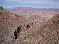
Boucher Trail to Hermit Trail Loop
Grand Canyon Village, Arizona
29.3 miles SEA demanding loop trip of three to four days, tracing one of the most difficult South Rim trails. Even seasoned Grand Canyon backpackers consider the Boucher Trail to be the most difficult, hazardous,...
Backpack, Camp, Hike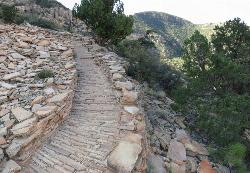
Hermit's Rest Viewpoint to Tonto Trail to Bright Angel Trail
Grand Canyon Village, Arizona
29.3 miles SEHermit’s Rest Viewpoint to Tonto Trail to Bright Angel Trailhead is perfect for hiking, backpacking, walking, and trail running. The Trail takes you across a well-established portion of the...
Backpack, Camp, Hike
Hermit Trail
Grand Canyon Village, Arizona
29.3 miles SEThe Grand Canyon's Hermit Trail is a scenic beauty which begins at the end of Hermit Road. The rocky trail is well-marked and less busy than the Bright Angel and North Kaibab trails. While...
Backpack, Camp, Hike 4.9 mi
Bright Angel Trail to Tonto Trail
Grand Canyon Village, Arizona
32.9 miles E"[T]he Tonto Trail offers a degree of civility not found elsewhere along the trail, and it is here that most hikers get their first exposure to the unique nature of this singular transcanyon...
Backpack, Camp, Hike
Bright Angel Trail to Three-Mile Rest house
Grand Canyon Village, Arizona
32.9 miles EThe popular out-and-back Bright Angel Trail to Three-Mile Resthouse is 5.4 miles out in distance. The trail includes many steep switchbacks and 360 degrees of absolutely stunning views of the inside...
Backpack, Camp, Hike 4.5 mi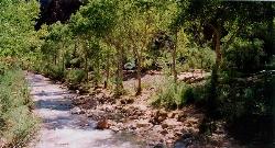
Bright Angel Trail to Bright Angel Campground and River Trail
Grand Canyon Village, Arizona
32.9 miles EBright Angel Trail to Bright Angel Campground and River dirt trail is one of the most famous trails near Grand Canyon, Arizona. The well-maintained trail encompasses incredible views and has an...
Backpack, Camp, Hike, Rock Climb 1.4-9.8 mi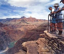
The Bright Angel Trails
Grand Canyon Village, Arizona
32.9 miles EPrepare yourself for switchbacks as part of a tough elevation gain on the Bright Angel trail to Plateau Point trail. This trail features spectacular views as you hike along the edge of...
Backpack, Camp, Hike, Horseback 0.6 mi
Mather Campground Trail
Grand Canyon Village, Arizona
34.5 miles ELocated on the South Rim of the Grand Canyon, Mather Campground Trail is a brief one mile out and back connector trail which is great for hiking, mountain biking, walking, and trail running. The...
Camp, Hike, Mountain Bike 6.3 mi
Tiyo Point Trail
North Rim, Arizona
35.0 miles EThis former road is becoming increasingly overgrown by the encroaching forest. This being said, it is generally easy to follow with some blown down trees to climb over or around. There are some old...
Backpack, Camp, Hike
North Kaibab Trail to Colorado River
North Rim, Arizona
35.3 miles EThe North Kaibab Trail to Colorado River Trail is perfect for experienced hikers. The trail contains many elevation changes and is very steep. The trail is well maintained and well marked so you can...
Backpack, Camp, Hike
Phantom Ranch to Ribbon Falls on North Kaibab Trail
North Rim, Arizona
35.3 miles ECamp, Hike

Rim-to-Rim: North to South Kaibab Trail
North Rim, Arizona
35.3 miles EArizona Office of Tourism, 2702 N. 3rd St., Suite 4015 , Phoenix, AZ, 85004, Phone: 888-520-3434, Fax: 602-240-5432, [email protected]
Camp, Hike, Horseback


