Refine Search
- hike 6
- swim 2
- disc golf 2
- camp 2
- sled 2
- skateboard 2
- backpack 2
- canoe 1
- cave 1
- mountain bike 1
- kayak 1
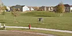
Smith Park
Rexburg, Idaho
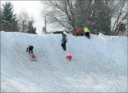
1.0 miles E of Rexburg, IdahoWhen the snow piles up in the streets, the wonderful city of Rexburg moves the snow to the park. It gets piled on the side of the road on top of what is a small sledding hill to start with. The hill is probably about a 30-40 foot drop. It's great for kids and there's a utility box often used to build a jump. Because it's such a great hill with such a convenient location, it can get a bit crowded at peak sledding times.
I don't believe the added height from the city snow removal doesn't usually occur until the winter celebration in January. There's still a smaller hill there before that though.
Hidden Valley Park
Rexburg, Idaho
1.3 miles E of Rexburg, Idaho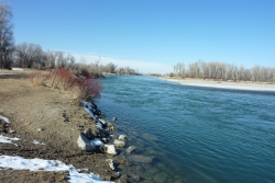
Lorenzo Boat Ramp
Rigby, Idaho
4.7 miles N of Rigby, Idaho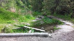
Cress Creek Nature Trail
Rexburg, Idaho
11.9 miles S of Rexburg, IdahoMeandering along the scenic South Fork of the Snake River, the beautiful 1¼ mile Cress Creek Nature Trail will lead you on a journey through sagebrush-grass communities, over juniper covered slopes, and along a lush perennial creek. Cress Creek derives its name from the watercress plant, a favorite food of the moose that live in this area. With clear skies, prepare for an expansive view of the Snake River, volcanoes and farmland. The site offers ample parking, restrooms and trail accessibility, which attract a wide spectrum of trail users to the area. You will become familiar with life in the Cress Creek area as it is now and as it was long ago. If you hike quietly you may see deer, rabbits, small lizards, or possibly an eagle or a moose. The nature trail is self-guided with many beautiful interpretive signs posted along the way to assist you. The first half-mile of the trail is accessible by wheelchair.
On the northeastern corner of the trail, there's an overlook trail. Parts of it are pretty nice like the rest of the loop but some is barely recognizable as a trail. Parts of the trail are steep and parts of it go over some pretty loose rock. It goes for about a ½ mile all the way to the top of the hill. Just below the rim, there are several really cool caves. From the top, you can see from Rexburg to Idaho Falls.
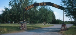
Beaver Dick Park
Rexburg, Idaho
5.7 miles W of Rexburg, IdahoBeaver Dick is a park 4.5 miles west of Rexburg, Idaho on Hwy 33. It's a 9.5 acre park that passes next to the west bank of the Henry Fork of the Snake River; it's a popular place for swimming, fishing and other water activities such as boating and canoeing.
Within the campgrounds, there are fire pits, pavilions for social events and gatherings, bathrooms and a playground for the kids. It almost makes for good rounds of walks around the outskirts of the Snake River while enjoying the scenery.
History:
The park was named after an English-American named Richard Leigh. He was reportedly given the moniker "Beaver Dick" by LDS president Brigham Young for his beaver trapping abilities. As a young boy, he left England and moved to the United States to make a living as a fur trapper and eventually, fought in the Mexican war at 17 years old. He traveled throughout the Teton laying traps for beavers for fur, hunting and mapping out the Fire-Hole [Yellowstone Park], Jackson Hole and west of the Tetons in his journal. He became a fluent speaker of the Bannock and Shoshone language, met and married a native American woman named Jenny and had 6 children. The family adopted a child that contracted smallpox; the family of the child died. The family, including the adopted child, died of smallpox and Beaver Dick survived. He later remarried to a Bannock Indian named Susan Tadpole in 1979 and had 3 children. He lived the rest of his life as a mountain man but in 1899, he passed away of a serious illness and was buried beside his family overlooking his ranch in Rexburg, Idaho. He will be remembered as a skilled hunter, trapper and an expert in exploration and settlement of the Tetons, guiding travelers and explorers throughout the mountain west.
Tips:
-Bring water; there are no water fountains
-Bring life jackets in case of strong water currents during swimming
-Beaver Dick is open 7 days a week
-Make camping reservations in advance; first come, first serve
Camping Fees:
- $5 a night or $15 for all 5 day/night stays
For reservations, information, questions or concerns:
-Phone number: (208)-356-3139
-Website: https://www.co.madison.id.us/departments/parks-recreation/30-beaver-dick-park
The use of this field for playing paintball is now prohibited. Please take better care of the fields we are permitted to use.

North Menan Butte ('R' Mountain)
Menan, Idaho
4.5 miles N of Menan, IdahoThe North Menan Butte is more commonly known to the locals and college students as R Mountain. Many kids know it better as Ou'R' Mountain. The butte is a rare and unique geological area and provides a great volcanic hike.
There's a paved parking lot and a vault toilet at the West trailhead. The first few hundred yards are well-maintained gravel and sand paths and the further you get, the less defined the trail gets, though it is relatively easy to find and follow. The switchback trails (South and West) are marked by sections of log fences. Towards the top of the West switchbacks, there's a chain handrail. It gets a little steep so you'll want some shoes with some grip. The sand on the rock makes it pretty slippery in the steeper parts. You'll get better grip after a good rain. Once you get up to the top, there's an informational placard. From there, it's easy to hike the rim and get an awesome view of the valley including Rexburg, Henry's Fork, and the Snake River.
It's a great hike for a small family or just a quick hike for a date. Even going up the West switchbacks and around rim, including the 'R', and back down the same way is only 3.5 miles (longest route) so you can do it pretty quick if you want. There's so much to look at that you could also spend hours climbing rocks, exploring caves, and playing around "The Ampitheater". If you just want to get to the 'R' as quickly as possible, you can do the hike in as little as 2 miles roundtrip.
Distances:
- West trailhead up the face to the rim: 0.5 miles
- West trailhead up the switchbacks to the rim: 0.75 miles
- West trailhead, from reaching the rim to 'R': 1 mile
- South trailhead to the rim: 0.3 miles
- South trailhead, from reaching the rim to 'R': 0.75 mile
- Through the caldera: 0.6 miles
- Around the rim: 2 miles
- Rim to 'R': 500 feet
There are no fees. Camping is allowed up to 5 nights but fires must be in an elevated fire pan and all the ash must be packed out.
Posted regulations:
- No motorized vehicle use
- Discharging of weapons or fireworks is prohibited
- Open fires are permitted only with an approved elevated fire pan and ash removal
- Burning pallets, tires, wire, plastic, glass, metal, magnesium, or hazardous material is prohibited
- Cutting or damaging vegitation is prohibited
- 5-day camping limit
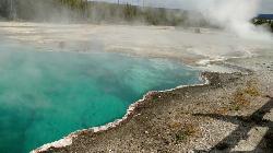
West Thumb Geyser Basin
Grant Visitor's Center, Yellowstone National Park
1.8 miles NW of Grant Visitor's Center, Yellowstone National ParkWest Thumb Geyser Basin is one of the smaller geyser basins in Yellowstone, yet its location along the shore of Yellowstone Lake and is ranked as the most scenic. This area was formed by volcanic explosion that took place more than 150,000 years ago. After the volcano exploded, the area collapsed and filled with water over time. It gets its thermal abilities from the enclosed magma trapped in the ring fractures that developed over time.In the 1990's several underwater geysers were discovered. These geysers can be seen as bulges underground, especially during the summer months. The basin is also special because of its location in Yellowstone. The West Thumb Geyser Basin is located on the edge of Yellowstone Lake.
This area features many other springs in the area. As surprising as it is, this area is also one of the least visited areas within Yellowstone. There are boardwalks all along the basin, making it an easy walk to see the beautiful hydrothermal springs in the area. West Thumb's name is derived from the thumb-like projection of Yellowstone Lake and the name was given by the 1870 Washburn Expedition. It was also known as Hot Spring Camp. West Thumb has less geyser activity than other basins. However, amazingly for its size it has all — hot springs, pools, mud pots, fumaroles and lake shore geysers.

Owens Field Skatepark
Columbia, South Carolina
2.7 miles SE of Columbia, South CarolinaFOR BEGINNERS TO THOSE WHO ARE GREAT! Located next to Owens Field Airport in downtown Columbia, this 15,000 sq-ft park has: Flat grounds for kick-flips, 360s, heel flips, pop shove-its, power slides, etc. etc. etc. Stairs for ollies, nollies, etc. Metal plated rails for cool grinds. Bowls (ranging from 4-12 ft.) It's also meant for in-line skaters and bikers as well. Remember, to always wear knee, helmet and elbow pads when doing anything! There are restrooms and a canteen area for drinks and snacks if you get a little parched. Come out and skate!
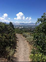
Corner Canyon Trail
Draper, Utah
1.6 miles SE of Draper, UtahCorner Canyon is the "Go To" riding area in South Salt Lake and for many riders it is worth the drive (or ride) from Utah County. It is a good mix of everything from beginner training trails in Little Valley to big table tops and wall rides in Maple Hollow.Courtesy of trailforks.com
For trail maps and trails specific information, visit trailforks.com.
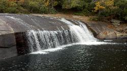
Turtleback Falls
Lake Toxaway, North Carolina
3.3 miles SW of Lake Toxaway, North CarolinaTurtleback Falls was named for its domed shape, similar to the back of a turtle. It's also called "umbrella falls" for the same reason. Visitors slide down Turtleback as the river flows over the slab of rock and drop into an open pool basin, also known as the Chug Hole. This great swimming hole is a quarter mile upstream from the 150' Rainbow Falls.
Located near Brevard on the Horsepasture River in the Pisgah National Forest, Turtleback Falls is an open slip-in-slide waterfall for the summer months. Visitors go down Turtleback falls and drop roughly 10 feet into an open pool basin.
Although Turtleback is a great swimming spot, it can also be dangerous. The water currents can be very strong and visitors have either drowned or have been swept downriver and over 125' rainbow river. If you want to slide, it's best to wait until the water currents aren't strong so it's safer to swim. If you want to find a calmer swimming hole, then go 1/3 of a mile down the river at Hidden Falls.
Turtleback falls is mostly a calm place to slip and swim and a great summer activity!
Rexburg Nature Park
Rexburg, Idaho
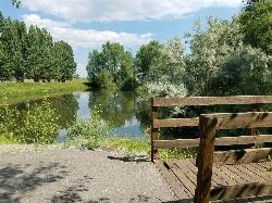
0.8 miles NW of Rexburg, IdahoRexburg Nature Park:
Life can be stressful, annoying, or just not good. Sometimes, it takes a moment to simply get away from the non-sense of this world; to gather yourself and seek peace and tranquility. That option is around the corner; you drive and see a trail, so you park and walk on the trail. As you walk, there's trees and sunlight shining on the leaves. You walk further and see a pond with ducks (both green and brown) and families sitting on the green grass with their kids; they watch, feed the ducks and take pictures with a smile on their face.
You go back to your vehicle and reminisce what you saw. Close to the south fork of the Teton River, is a nature park that isn't crowded with college students or infested with incoming traffic but a 15 acre park that was made so you can take your family or acquaintances for a picnic or a social gathering and enjoy; you also have the option to ride your bike or to jog on the trails.
The park is next to the Claire Boyle skate park, a beautiful golf course next to the fairgrounds and a 9 hole Frisbee golf course.
Features:
-Playground for the kids
-Fishing ponds ( A valid fishing license is required); fishing ponds for children as well.
-Wildlife and wildflowers
For more information and questions:
| Phone | 208-359-3020 Ext. 0 |
|
customerservices@rexburg.org |
Claire Boyle Skatepark
Rexburg, Idaho
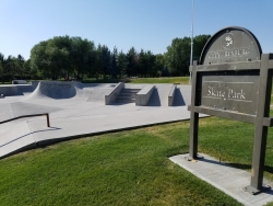
0.5 miles NW of Rexburg, IdahoThere are 2 bowls right next to each other plus several boxes quarter pipes and rails. It's not huge but it's also rarely crowded. It's all concrete with metal edge, specially for grinding.


