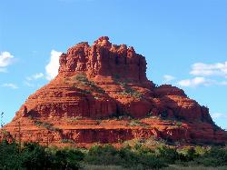
Schnebly Hill Vista Overlook
Sedona, Arizona
3.6 miles NE of Sedona, ArizonaThe Schnebly Hill Formation is a beautiful red rock gem in Sedona, Arizona. This rock formation is considerably big, which is why it is divided into four different sections that are called "members". A 'formation' generally refers to a section of rock that was deposited under a certain set of environmental conditions. Because each section of this formation details slightly different environmental conditions, the members within this formation were divided and recorded with minor environmental fluctuations during the deposition of the formation. From youngest to oldest, here are the members: Sycamore Pass Member, Ft. Apache Member, Bell Rock Member, and the Rancho Rojo Member. Each one of these members tell an interesting story of its past to create one beautiful formation. The Sycamore Pass Member tells the story of red to orange sandstone containing high-angle cross-beds, while the Ft. Apache Member details a past of limestone, dolomite, and siltstone units. The Bell Rock Member is comprised of over 500 feet of flat-bedded, ripple-marked sandstone and siltstone, which varies slightly to the Rancho Rojo Member which is 20 to 40 feet of orange sandstones containing low-angle cross-beds.
This rock formation doesn't only detail its humble beginnings, but it also has recorded signs of early life. In the form of fossils, you can see the feet of reptiles and animals that called the formation home over 280 million years ago. Schnebly Hill also reminds its viewers of the windy Sahara desert-like past it has had in its earlier days in the form of wind ripples along the rock. The Schnebly Hill Formation offers amazing history and views to be enjoyed on a hike to see the different members. Take a look at its history, you might find something new!
Willow Creek Environmental Campground
Duncans Mills, California
2.1 miles W of Duncans Mills, CaliforniaWillow Creek campground is located along the sandy banks of the Russian River. It offers a beautiful sandy beach like terrain along the edges of the river, and unmatched river views. The weather around Willow Creek is refuge for those who are seeking to escape California's summer heat. It is often cool and breezy along the this river bank because it is near California's coast line. Around the campground there are tiny streams that add life and beauty to everything that grows around it.
Willow Creek Campground is equipped with picnic tables, garbage, and restroom services. Although there is water available, it is not potable. The water will need to be boiled before it can be consumed. There are a few fees that should be noted before going to the campsite. It cost $12 per campsite, and it is on a first come first serve basis. Willow Creek Campground has a shallow and sandy spot to launch kayaks, canoes, and tubes. It is a great location for children and adults as there are shallow and deep spots within the river. The Russian River itself empties into the Pacific. Because it is connected so closely to the ocean, at certain times during the year the area can be closed off due to high tides. These tides have a sneaky way of reaching into the creek and can cause some trouble.
The campground is a wonderful option to enjoy Willow Creek Beach a little longer. There are a few fees that include a $10 vehicle fee, and a park pass. These are very little fees however for the amazing amenities the camp offers. You can find beach access, beachcombing, creek access, day use area, parking area, self-pay station, surfing, trash collection, vault toilets, and wildlife viewing.

Bush Creek Campground
Kernville, California
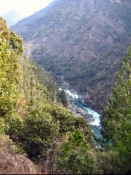
14.9 miles N of Kernville, CaliforniaBush Creek Campground is conveniently situated between several swimming holes in the canyon. The swimming holes stem from the upper portion of Kern River. The campground offers 6 campsites with toilets and picnic tables available. Near the campsite, there are multiple activities visitors can take advantage of such as biking, fishing, horseback riding, paddling, swimming, and white water rafting.
The campground offers amazing amenities that make camping super comfortable. Bush Creek campground has modern restrooms and showers, a clubhouse with ping pong and foosball tables, shaded trails, picnic areas, and an RV dump station. Bush Creek is open year round, making it very possible to enjoy every season in this area.
The highlight of Bush Creek is the swimming holes in the river nearby and the many hiking trails that can be taken advantage of. The water near the campgrounds can be steady flowing or flow quite quick, depending on the time of year. Be cautious in the faster flowing river on rocks that can become slippery. Trails along the creek are very well maintained, and have natural shade provided along the hike. The area isn't known to get very crowded, so if you are planning to go somewhere to just disconnect, Bush Creek might just be the spot for you!
Limestone Campground
Kernville, California
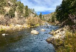
14.7 miles N of Kernville, CaliforniaLimestone Campground is a great rustic campground beautifully situated near the Kern River and by a swimming hole. The campground is decorated with both oak and gray pine which serve as shade from the sun, and beauty for the campground. Limestone Campground has 19 paved sites that come equipped with picnic areas, vault toilets, a grill, and a fire ring. It is open from April to October, and cost $24 per night. On weekend and holidays the fees jump up to $26 on holiday weekends. Reservations can be made by simply going to Recreation.gov or calling 877-444-6777. Because the river and swimming hole are nearby, kayaking and white water rafting are popular activities. The area also offers fishing, hiking, an equestrian trail, and mountain biking.
This campsite does not have cell service, which means you can escape the cares of the world and fully immerse yourself in nature. This campground doesn't have any electrical plugs, or running water. Make sure to pack a sufficient water supply for your stay.
Willow Creek Picnic Area
Big Sur, California
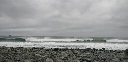
32.4 miles SE of Big Sur, CaliforniaWillow Creek Picnic Area is a beautiful, coastal, pebble beach located in Sonoma County. This location features black jagged cliffs and aqua blue oceanic views. The Big Sur coast is one of California's most sought out locations. The operation hours for this location are 10:00 a.m. to 6:00 p.m. and it is open year round.There isn't a place directly on the beach designated for camping, but if you go up further on the hill to some of the wide dirt patches, you can easily fit a tent. Although there isn't a place on the rocky beach to overnight camp, there is plenty one can do in an eight hour day time stay. If you come to Willow Creek Beach to enjoy the views, there is a cliff off of the freeway that has parking spots looking over and onto the beach. To park in the suggested parking on the cliff, there is a $10 fee, however it is well worth it. Many are captivated by the black and blue unique hues of this beautiful coastal beach. This location is described by many as "one of California's treasures", while it only cost $10 to see, I would want a piece of the treasure too!
Willow Creek Picnic Area is equipped with toilets, but does not offer drinking water. Be sure to bring sufficient water supply for a day on the sea side, as the salt in the air combined with physical activity could lead to dehydration.

Sunset Beach River Park
Forestville, California
3.1 miles NW of Forestville, CaliforniaSunset Beach is a great swimming hole in the Russian River. This swimming hole is one of California's summer destination spots.The river offers so many fun activities such as paddle boarding, fishing, picnicking, and swimming! From the parking lot, it is a short stroll to the picnic area and the to the rocky beach. This beach can be very quiet and serene; it is an excellent spot for kids and teenagers to unplug and get in tune with nature. Sunset beach can get crowded on the weekends, but during the weekdays it is uncongested. As you walk from the picnic area, you will be exposed to a brilliant pebble beach area that welcomes you into the shallow water. Although some of the areas in the water are shallow, there are some deep areas as well. Many guests to the park set up day tents that they can use to lounge around the swimming hole all day long. While swimming you can enjoy the beautiful views of the Redwood Forest from sunrise to sunset.
There are some restrictions at this beach that should be made known. The park restricts fires, barbecues, alcohol, and biking. While these things my be prohibited, endless summer fun isn't!
Hidden Falls Campground
Springville, California
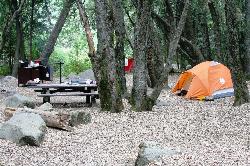
12.4 miles NE of Springville, CaliforniaHidden Falls Campground is a small walk-in campground that is situated along the side of the Tule River. The drive to the campground is quite scenic. After you pass through the town of Springville and come up the mountain, you will be graced with beautiful views of the Sequoia Forest. From the parking lot it is a short walk to the campsites.
This location is notorious for the many waterfalls that stem from the Tule River. The highest waterfall near Hidden Falls is 30 ft. When the water levels are safe, the Tule River creates swimming holes. The water falls and swimming holes are wonderful places to explore from the campground. Several of the waterfalls and swimming holes are available short easy distances from the campground.
In the surrounding area, you can also find Indian Bathtubs. These are deep basins in the granite that appear to have been made by early Native American civilizations. These could have been the Yokut, Paiute and Mono tribes that often stayed in the area.
The campground has several amenities. Each of its 8 walk-in tent sites has access to picnic tables, fire rings, piped water, and pit toilets. Reservations are not necessary because the campsites are available on a first come first serve basis. Hidden Falls is usually open around mid May through October, and has a limit of 6 people per campsite. Pets are allowed on the campsite, but you must always have them on a leash or attended.

Red Rock State Park
Sedona, Arizona
4.1 miles SW of Sedona, ArizonaRed Rock in Sedona, Arizona details the beauty in the layers of sedimentary rock that has been constructed over millions of years. It is at Red Rock that you can see "Schnebly Hill Formation", which tells the story of an ancient beachfront in the area over 275 million years ago. This beachfront deposited iron, which is what gives Red Rock its notorious crimson color. The sandstone layers tell the story of the sand dunes that were believed to cover much of the western hemisphere of the US thousands of years ago. If you look closely, you will also see limestone layers, these layers are from the shallow seas that covered the area millions of years ago.
Red Rock is a mystery to the eye, and food for the mind. These structures are more than boulders, the structure is natures way of recording its very own history. Much of Red Rock has contributed to the study of archeology. We can see signs of early civilizations on these rocks. Native Americans used these rocks to communicate, create petroglyphs, and to share their sacred beliefs. Where natural art can be found, so can artist. Because of the beauty in this area, it led to an art migration in the early 1950's. Max Ernst was the first artist to settle in the area, and soon led others to draw on the beauty of Red Rock as inspiration for their artwork. This is why this area is filled with many museums and galleries.
There are many ways to take advantage of this wonderful location. You can hike, bike, or horseback ride through the parks many winding trails. Red Rock can be enjoyed year round, and there are five miles of trails all networked together through the park. In the visitors center, you can request a guided tour https://azstateparks.com/red-rock/explore/facility-information. These guided tours leave from the visitors center every morning. Knowledgeable volunteers tour guides explain the geology, wildlife, history, archeology and plant life. The hikes begin at 10 a.m. from September through May and 9 a.m. from June through August.
Red Rock has much to offer for the curious mind. Take advantage of this remarkable location, you might be surprised with the story it has to tell.
Chavez Crossing
Sedona, Arizona
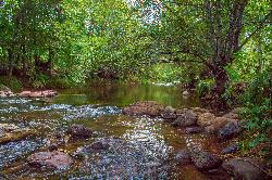
2.1 miles SW of Sedona, ArizonaChavez Crossing is a campground in Sedona, Arizona. It sits perfectly nestled in Arizona's most beautiful red rock attractions along with the grand summer sunsets. If that didn't sound convincing enough, Chavez Crossing is also conveniently close to Sedona's Oak Creek. Turn a hot summer day into a relaxing water day full of wading, fishing, or swimming! The campsites are located in the thickets of Arizona's sycamore grove and cypress trees. The campsite offers many amenities such as campfire rings, grills, pit toilets, picnic tables, fire pits, a water spigot, and easy creek access. The campground also has onsite host that can assist guest with questions and needs. Nearby there are restaurants, a golf course, an art gallery, and local shops if you are in need of an item.
If you're itching for adventure, there are other great attractions near the campground. There are swimming holes, panoramic views of the Munds Mountain Wilderness, Secret Mountain Wilderness, and the infamous Red Rock, where you can find rock art from early inhabitants of the area. If you decide to come to Chavez Crossing, stay long enough to see the sunset. There is something magical about the sunsets in this area. Suddenly the water becomes still, and there doesn't seem to be movement. It is almost as if nature is just as attentive and captivated by the sunsets as we are.
Cave Springs
Sedona, Arizona
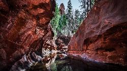
8.8 miles N of Sedona, ArizonaCave Springs Campground is a scenic campground that sits in Oak Creek Canyon. Cave Springs is nestled perfectly in the town of Sedona, giving the campground the notorious Sedona red views. Uniquely, Cave Springs Campground is lush and green. The campsite is located right on the bank of the Oak Creek making it a perfect location for cool water play during the scorching summer sun. The campsite itself is comprised of 84 campsites, and they operate on a one tent per campsite rule. Each campsite comes equipped with picnic tables with natural shade from the trees, campfire rings, a grill, and restrooms. The campground is also close to many of the popular attractions in Sedona such as the swimming holes, Slide Rock, and the 1.8-million acre Coconino National Forest. The area is also known for fish. The fish that Oak Creek has to offer are trout and native trout.
You can make a reservation for the campsite at https://www.recreation.gov/camping/campgrounds/232194 which needs to be made at least three days in advance. Campsites are $22 per night and operate from May to September.
Slide Rock
Sedona, Arizona
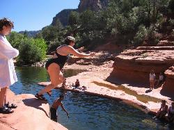
5.1 miles N of Sedona, ArizonaSlide Rock is one of the most popular locations in the Sedona area. Slide Rock is natures most thrilling water slides. Slide Rock is a gargantuan 80 feet long, and 2-4 feet wide. This slippery slope is lined with algae that gives Slide Rock its gripless feel. Slide Rock has been named one of " America's Top Ten Swimming Holes". Between the incredible natural waterslide, and the famous red rock canyons, this location is unbeatable. If Sliding down an 80 foot long slip and slide isn't your thing, Oak creek is the river the slide funnels into and offers hours of endless water play. Slide Rock can be enjoyed by people of all ages.The area also offers amenities such as picnic tables and restrooms.
While Slide Rock is a well known attraction, it also has a rich history. The park itself is a 43-acre historic apple farm, which is nestled in Oak Creek Canyon. In 1907 a man named Frank L. Pendley acquired the land through the Homestead Act in 1910. Frank didn't just acquire the land, he transformed the area with his unique irrigation system that is still being used today. This irrigation system is what aided him in his endeavor to plant and sustain the first apple orchard in the area in 1912. In addition to the orchard, Frank also grew garden produce and owned livestock. The Slide Rock area is one of the only few homesteads that is still intact in the canyon. Today we can see through its beauty the hard work and dedication of the agriculture industry of the past.
There are a few tips that can be taken into consideration when going to this fantastic spot. Although Sedona, Arizona is known for its scorching heat in the summer, the temperatures are known to drop down to near freezing depending on the season. It is good to check weather reports as well as reviews before you go! The sandy stone under the water is what gives Slide Rock its amazing waterslide abilities, however because it is so slippery it can be quite hazardous on foot. Be sure to bring water shoes that have great grip for walking along the slippery areas. Playing in the sun and in the river is the greatest part of this location, however even though you cannot see it, you work up quite a sweat! The location does not offer drinking water, which means it is vital for you to pack a sufficient water supply to combat the risk of dehydration and heat stroke. Finally, be vigilant and careful. There is no lifeguard on duty. Make sure you're having fun, while staying safe!
Grasshopper Point
Sedona, Arizona
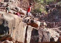
2.0 miles NE of Sedona, ArizonaGrasshopper Point is a beautiful swimming hole located in Sedona, Arizona. Grasshopper Point is the perfect place to cool off in the summer after a nice hike, or a hot summer day. This swimming hole is nestled perfectly in Oak Creek Canyon. The swimming hole is managed by National Forest Service. Grasshopper Point offers alluring views of crimson red rock and teal colored water. For those who are jumpers, there are many cliffs that can offer amazing cliff jumping experiences. Grasshopper Point is the perfect place to cool off in the summer after a nice hike, or a hot summer day.
This swimming hole can be reached from Allen's bend, and it is connected to the Huckaby Trail. In an ideal day, you could hike these trails and be led straight to the swimming hole for a fun day of water activity. Grasshopper Point is open year round from 9am to 6pm Mondays through Thursdays, and from 8am to 6pm on Fridays through Sundays. Nearby the swimming hole there are amenities like picnic tables and restrooms. Drinking water is not available at this location. Be sure to bring a sufficient water supply. During the summer this location becomes quite popular. If the swimming hole gets too full on a certain day, management will put up a sign that says "full" by the entry.
Dixie National Forest
Cedar City, Utah
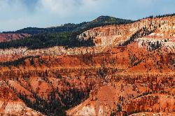
21.2 miles E of Cedar City, UtahDixie National Forest is an often forgotten/hidden gem in Cedar City. It is over 2 million acres of beautiful red rock canyons and trees. Dixie Forest isn't only limited to rocks and trees however, this location has Duck Creek, Boulder Mountain, and a Ski Resort. Dixie forest bestrides the Great Basin and the Colorado River. Depending where you are in the forest, elevation can vary between 2,800 to 11,322 ft. The temperatures in the forest can vary drastically, ranging from 100 to -30 degrees Fahrenheit. To say the least, Dixie National Forest can be enjoyed through all the seasons.
This area holds a very impressive and rich history. There are signs scattered through out the rock formations of life dating back to Native American days. The archeological record exhibits pictographs, petroglyph, dwellings, and artifacts presence of these native populations.Dixie Forest is also the nature watchers playground. The forest supports a variety wildlife species, and can provide endless hours of viewing enjoyment for the nature observer.
There are campgrounds, restrooms, and drinking water available in and around the forest. There are also opportunities for winter activities, these include (but are not limited to): skiing, snowmobiling, snowshoeing,sledding, and many others! There are hikes available throughout the forest that can vary between simple to difficult. The forest offers many opportunities for hikers and those who seek more engagement with the outdoors.
Trailside Park
Park City, Utah
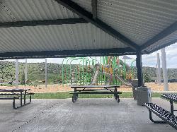
4.6 miles N of Park City, UtahTrailside park is located in Park City, Utah. You can do almost anything at this park. You can play tennis, basketball, soccer, pickleball or play on the jungle gym. Each of the courts are strategically spaced to create an open feel. You can play your game with the assurance you won't bump into anyone or disturb their game. There are open fields for kite flying, or even just laying around to catch some sun's rays. There is a pavilion that has picnic areas, and shade. This park even includes a skate park and a mountain bike trail system.This park has something for everyone. It is spacious, and there is a variety of sports that can be played at this park.
This park is also extremely child friendly. The jungle gym is massive, and can have many kids play at one time. Teenagers can find solace in the skate park and make new friends, or join a game of soccer. The open field is big enough for a few people who would like to practice their football skills, or toss a ball around. The possibilities are endless at this park, and it is beautiful to view as well.
There are meadows in the back of the park with little streams that run though them, there are rolling hills that capture the sun's rays perfectly in the morning, and around sunset. There is a pond on the west side of the park, and a little board walk. Children, teens, adults, and the elderly all can find something they enjoy at Trailside park.

Idaho Centennial Trail
Warren, Idaho
22.9 miles NE of Warren, IdahoThe Idaho Centennial Trail (ICT) display much of Idaho's Wild Wild West nature. You can find intricately carved red rock, and windy jewel toned rivers. There are a couple of different rivers this hike follows. It follows the Salmon River, Maple Creek, and ultimately leads to Idaho's famous Snake River. The main tail branches off into many different hikes along its way, which makes taking breaks, or bookmarking your progress simple. The Centennial Trail begins near Murphy Hot Springs, goes through the Snake River near Glenn's Ferry, and then goes up through the mountains. It is a 900 mile hike, and is riddled with some of Idaho's most beautiful nature spots.
There are many ways to complete the trail. Some like to complete the trail by foot, mountain bike, or use a small motorize vehicle. There have been only a few people who have completed the trail in its entirety by foot, which could make it truly a daunting hike. However, dedication and an even pace can help one with the task. Because this trail is 900 miles long, the hiker can pick where he/she would like to start or stop. It is important to remember that the trail may change due to weathering conditions. Earthquakes, excessive rainfall, mudslides, etc could cause the trail to change, and because many parts of the trail are not maintained, it could be dangerous.
The Centennial Trail is primarily public land, but various campsites along the way are private. These private campsites require permission to stay. It would be wise to ask for permission before you begin your hike. Having the security of a place to sleep before night fall is helpful, because the hike cannot be completed in one day. It is also vital to plan out your water supply while on this hike.
In all, the Idaho Centennial Trail does not need to be completed in its entirety to be enjoyed. It is a beautiful hike along a cooling river for all to enjoy. It can be an easy hike, difficult hike, or a moderate hike. It is up you!
Independence Lakes
Elba, Idaho
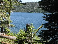
7.2 miles W of Elba, IdahoThe Independence Lakes hike is a 7.7 mile hike that gets progressively better the farther you go. At the summit of Mt. Independence, you will get a birds eye view of four beautiful jewel tone glacial lakes that make up the Independence Lakes.The Independence Lakes have an emerald green color tone and crispy, clear water. These lakes are home to six different species of fish, who have called these lakes home since the glaciers disappeared over 10,000 years ago.
There is a little something for everybody on this hike. For those who like to animal watch, you're in luck! The trail is home to many animals that can be seen any time of the year. There is fishing available along the shoreline, and for those who enjoy endless water fun, watercraft is available to the public on a first come first serve basis.They are completely free, although donations are appreciated! The watercrafts include: kayaks, motorized boats, and floats. These watercrafts are available from Memorial Day weekend through October 1st.
This hike is also beautiful during the Fall. Although the trail is long and narrow, there is a steady path in the form of an intense arch all the way to the summit of the mountain. The colors of the fall leaves dance off the reflection of the lakes making for a beautiful 360 view along the hike. If you enjoy your time on the trail and wish it wouldn't end, Independence Lakes Campground is a non-fee campground equipped with picnic tables and does not require a reservation. The campground has 5 single sites, which means it is on a first come first serve basis. It is noted that a majority of the campers camp at the trailhead,and day hike to the lake for convenience.
This location is wonderful. Independence Lakes is the perfect non-fee place to go to with friends, family, or on your own. It does not need to be completed in its entirety for one to enjoy the beauty, but it is possible!
Skillern Hot Springs
Fairfield, Idaho
20.9 miles N of Fairfield, IdahoSkillern hot spring is located in Fairfield, Idaho. It is a stunning six mile hike. The trail to Skillern hot spring follows the beautiful Big Smoky Creek, which gives life to the forest. Big Smoky Creek has crystal clear waters that expose smooth stones that have been eroded over time. The river is home to various species of fish, that weave themselves through the boulders in the creek. If you continue to follow the creek, you may find spots that have sitting water, waterfalls, or slow running water. Either way, the creek is a refreshing sight to see.
Many have stated that the best time to hike the trail, or go to the hot spring is during the fall. Not only do the colors of the forest change to riveting red, pumpkin tone orange, and zesty yellow, the cool breeze helps to cool down hikers on the way to the hot springs. The trail is known to split into two separate trails that lead to the same thing. One trail is more intense and uphill, while the other is low and continues to follow the creek closely. Both trails have seen hikers, and both trails lead to the hot springs if you are looking for them. The trail however does not end at the hot spring, but can guide you there. On the trail, there is a sign that says "Skillern Hot Spring", from this sign, the hot spring is three miles away.
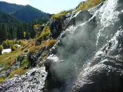
The hot spring itself has the capacity to reach 140 degrees Fahrenheit when you continue up the trail to other portions of the hot spring. However if you want to soak, the hot springs closest to the trail only get up to 90-100 degrees. Skillern hot springs are filled with mineral water often said to relax the body as well as exfoliate dead skin. There are camping grounds located up or down the trail for those who are looking to camp. The hot spring does not look like a typical hot spring, so remember to look for a boulder that appears to be dripping hot water. When approaching the boulder, be careful while navigating to the hot springs. Just on the other side there are other rocks that are slippery and could cause quite a fall. When you see steam coming from multiple boulders, the steam will be your guide to an oval shaped hot spring waiting to welcome you for hours of relaxation.
While the hike requires a little bit of perseverance, it is worth it! You will leave feeling relaxed, lighter, and better than you did before you started the hike.

Perrine Bridge
Jerome, Idaho
9.1 miles S of Jerome, IdahoPerrine Bridge is located just above the Snake River. It spans 1,500ft, and is 486ft above the Snake River. You can drive over this bridge on the way back from Boise, or get out, park, and take it all in. There is a parking lot located in the Twin Falls Visitor Center. From there, you can access the canyon trails leading to the Bridge. This bridge is also home to many base jumpers who come prepared with parachutes year round.


