


Map of 19 Things to do near Redding, California
first prev 1 next lastShowing results within 50 miles Distance miles of Redding, CA, USA City, Zip, or Address
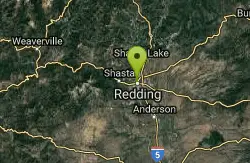
Redding Skatepark
Redding, California
0.6 miles NSkateboard near Redding, California
Skateboard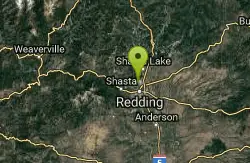
Buckeye Park
Redding, California
3.1 miles NTones and baskets in a parched section of this Manzanita studded park. Public (No Fee)
Disc Golf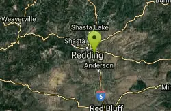
Enterprise Community Park
Redding, California
4.1 miles SENice recreational course on rolling ground, through small oaks. Picnic, BBQ, basketball and child play areas. Dual tees. Public (No Fee)
Disc Golf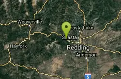
Whiskeytown lake
Redding, California
7.0 miles WWhiskeytown Lake’s beautiful sapphire-blue waters, surrounded by mountain peaks, are perhaps the most prominent feature of the park. However, water-based recreation is only a small part of...
Hike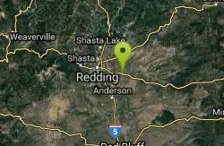
Palo Cedro Community Park
Palo Cedro, California
8.4 miles ERecreational course around a small park. Public (No Fee)
Disc Golf
Volonte Skate Park
Anderson, California
11.1 miles SEplace looks fun worth checking out its right off the 5
Skateboard
Whiskeytown Falls
French Gulch, California
15.3 miles WWhiskeytown Falls trail is located within Whiskeytown State Park just about 15 miles outside of Redding. The state park has a lot of activities to do, but it is also home to one of the "best...
Hike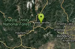
Deer Meadow Disc Golf Course
Lewiston, California
22.9 miles WA rolling deer meadow with long par fours and threes. Concrete tees mowed fairways and various OBs. Behind the Plug And Jug - you can get a great cup of coffee & then enjoy a nice nine hole round!....
Disc Golf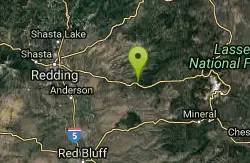
Black Butte Disc Golf Course
Shingletown, California
24.5 miles EChallenging - through tall pines and cedars. Public (No Fee)
Disc Golf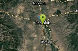
Dog Island Disc Golf
Red Bluff, California
29.0 miles SVery wooded with some decent bending fairways. Public (No Fee)
Disc Golf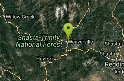
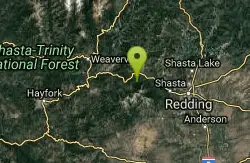
Miner's Point Disc Golf Course
Weaverville, California
29.9 miles WRugged course - especially the final 6 hilly holes. Bringing the map will help with navigation. Public (No Fee)
Disc Golf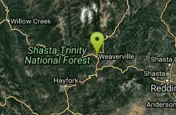
Lee Fong Park Disc Golf Course
Weaverville, California
30.3 miles WViews of the Trinity Alps. Some oaks, firs, pines, and old fruit trees, but fairly open. First 3 holes along a creek. Public (No Fee)
Disc Golf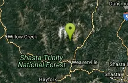
Stuarts Fork Swimming Hole
Trinity Center, California
36.1 miles NWStuart Fork is next to Stuart Fork Trailhead Parking and is located in Trinity County, California, United States. Stuart Fork has a length of 0.52 kilometres. But it is splittet in seperate ways.
Swim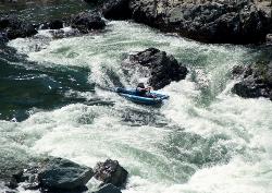
Trinity River below Pidgeon Point
Junction City, California
40.8 miles WThis is probably the third best intermediate run in California, after the Stanislaus Camp 9 run (under New Melones Reservoir most of the time) and the South Fork of the American near Coloma. The...
Whitewater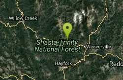
Willow Creek Area
Olympic Valley, California
41.3 miles WSwim near Olympic Valley, California
Swim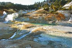
Bumpass Hell
46.9 miles E
Bumpass Hell is the largest collection of hydrothermal features in Lassen Volcanic National Park. The overall 3 mile round trip hike takes visitors around some of the hottest and largest features in...
Hike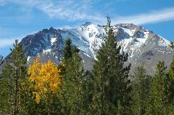
Lassen Peak
Mineral, California
47.3 miles ELassen Peak is the largest plug dome volcano in the world and the second tallest volcano in Northern California. It is situated in Lassen Volcanic National Park, one of the few places in the world...
Backpack, Hike 0.3 mi
Burney Falls
Burney, California
48.7 miles NEBurney Falls has been considered one of the most spectacular waterfalls in the state. It stands at 129 feet tall and is coated by curtains of green fern. The best part about this waterfall, for many...
Hike
Kings Creek Falls
Shasta County, California
49.8 miles EWhile Lassen Volcanic National Park is known for its wide variety of hydrothermal features, there are a few other sights in the park worth seeing, including Kings Creek Falls. The trail is accessible...
Hike, Horseback


