Map of 229 Things to do near Pleasant Grove, Utah
first prev 1 2 3 4 5 6 7 8 9 10 next lastShowing results within 50 miles Distance miles of Pleasant Grove, UT, USA City, Zip, or Address

Bonneville Shoreline Trail - Cedar Hills to Grove Creek Canyon
Pleasant Grove, Utah
1.6 miles NEThe Cedar Hills to Grove Creek Canyon portion of the Bonneville Shoreline Trail is an intermediate level trail. There are some flat spots that are on old dirt roads, as well as single track...
Mountain Bike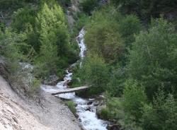
Grove Creek Trail
Pleasant Grove, Utah
1.7 miles NEThe Grove Creek Trail falls from the upper shoulder of Mount Timpanogos down Grove Creek Canyon to Pleasant Grove. It's usually ridden as a shuttled downhill -- because the climb up this...
Hike, Mountain Bike
G Mountain Trail
Pleasant Grove, Utah
2.0 miles EThe trail starts at Kiwanis Park which is south of the 'G' at the end of Battle Creek Road. The trail starts out a little steep for about .25 mile and the very last bit is a...
Hike 1.2 mi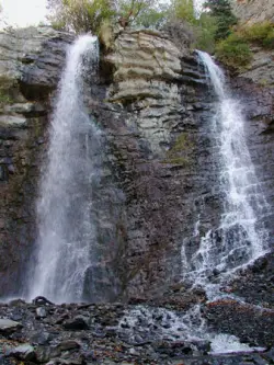
Battle Creek Falls
Pleasant Grove, Utah
2.0 miles EBattle Creek Falls, located near Pleasant Grove, Utah, is a scenic waterfall that also has a rappelling and rock climbing area nearby. Hikers are allowed to see the falls from two view points, below...
Canyoneer, Hike
Evergreen Park
American Fork, Utah
2.4 miles NWSled near American Fork, Utah
Sled
Oak Canyon Junior High
Lindon, Utah
2.9 miles SESled near Lindon, Utah
Sled
Art Dye Disc Golf Park
American Fork, Utah
3.1 miles NWTechnical with a variety of lengths. Plays mostly in trees with tight fairways and minor elevation. Tees are brick tiles, except #13 (rubber), and #12 and #15 (dirt). Course Map at 1st tee. Public...
Disc Golf
Shelley Elementary
American Fork, Utah
3.8 miles NWSled near American Fork, Utah
Sled
Orem Cemetary
Orem, Utah
4.4 miles SESled near Orem, Utah
Sled
Cascade Park
Orem, Utah
5.6 miles SEThis is a small hill great for mom's looking to escape the crowd and let their little ones have a good time. It's pretty short but really wide so there's plenty to share.
Sled
South Fork of the Provo
Provo, Utah
5.7 miles SESouth Fork of the Provo is a fun, short, scenic singletrack ride. It is an ideal trail to introduce a new mountain biker to the joys of singletrack! The trail has one or two rocky...
Mountain Bike 1.5 mi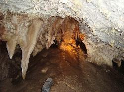
Timpanogas Cave
Provo, Utah
5.8 miles NKnown for it's colorful cave decorations, the Timpanogas cave attracts numerous visitors per year, is steep but it's paved so that visitors can access the cave. To access the cave, visitors...
Backpack, Cave, Hike
Scera Park Disc Golf Course
Orem, Utah
5.9 miles SEPlays through the park and around the Scera Theater. Tees are well marked with posts. Public (No Fee)
Disc Golf
Utah Valley University
Orem, Utah
6.0 miles SVery short course (all holes less than 200') on the south end of campus. Water comes into play. Holes near the baseball diamond. Bring the map to help with navigation. Public (No Fee)
Disc Golf
Riverview Park
Provo, Utah
6.2 miles SEAn object course with mostly well-marked tees and poles. There are specific rules for play at this course (see Course Media). Vintage plastic throwers particularly like this course. The 2nd hole is...
Disc Golf
300 East Lehi Lot
Lehi, Utah
6.5 miles NWThis is a huge lot with a lot of terrain. There's a couple of easily accessible hills and plenty more that could be played on.
Sled
Rodeo Down
Alpine, Utah
6.5 miles NBlack Dog. Trail winds from the middle of Corkscrew down to Flank and River, just south of the water tank. Some technical aspects, length 0.5 miles with 300 vertical feet elevation...
Mountain Bike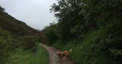
Dry Creek Trail Park
Lehi, Utah
6.6 miles NWSpread out along creek. Trees and water come into play - some long walks between holes but well marked for navigation. Public (No Fee)
Disc Golf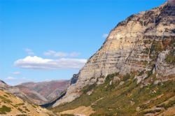
Provo Canyon
Provo, Utah
7.0 miles EProvo Canyon is a canyon located in unincorporated Utah County, Utah, USA and Wasatch County, Utah. Provo Canyon splits between Mount Timpanogos on the north and Mount Cascade on the south. The...
Rock Climb
Timpanooke
Provo, Utah
7.0 miles NEThis is a great trail. Intermediate tech and moderate aerobic. It winds through pine forests and grass meadows. Start by heading down the Timpanooke section of the Great Western Trail...
Mountain Bike


