


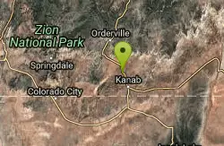
Map of 52 Things to do near Orderville, Utah
first prev 1 2 3 next lastShowing results within 50 miles Distance miles of Orderville, UT, USA City, Zip, or Address
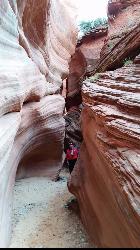
Red Slot Canyon AKA Peek-a-boo
Kanab, Utah
9.1 miles SThis great little slot canyon is officially Red Slot Canyon but is also referred to as Peekaboo Canyon. It is not to be confused with Peek-a-boo Canyon near Spooky Gulch. It's not really very...
Hike 0.8 mi
Moqui Caverns
Kanab, Utah
11.8 miles SLocated near the small town of Kanab, Utah, The Moqui Caverns are a rare sight to behold. With bright flourescent rocks, Moqui Caverns is one of the more unique hikes not only in the state of Utah,...
Cave, Hike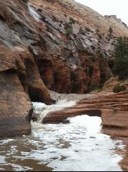
Keyhole Canyon
Springdale, Utah
14.9 miles WMany of Zion's canyons are deep, long and have a permanent stream flowing through, but the national park also contains plenty of short, narrow slots, and the easiest reached is undoubtedly...
Canyoneer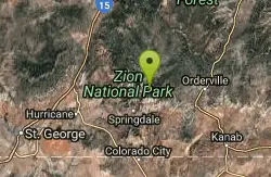
Echo Canyon
Springdale, Utah
15.6 miles WEcho Canyon is a technical canyoneering adventure that will require complete technical gear. The route normally requires 4 to 5 hours to complete. Echo Canyon is rated 3B II using the Canyon Rating...
Canyoneer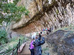
Weeping Rock
Springdale, Utah
16.5 miles WExpect to get wet on this short hike! Weeping Rock gets its name from the continuous "weeping" of water that seeps through sandstone and drips from the cliffs above. Seasonal flowers...
Hike
Montezuma Mines
Kanab, Utah
16.6 miles EA bunch of sand caves/mines. There are some pits with old ladders, and at least one pit in particular that you can descend with a rope.
Cave, Hike 1.1 mi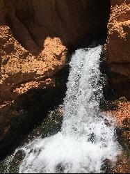
Cascade Falls
Cedar City, Utah
16.9 miles NWCascade Falls, located outside of Cedar City, Utah, is a beautiful waterfall that is just a 1.2 mile hike round trip, ending at Cascade Falls. It is somewhat of a hidden local hotspot that not...
Hike
Riverside Walk
Springdale, Utah
17.1 miles WThe Virgin River has many moods, from quiet and slow to a raging torrent. This beautiful, shaded walk meanders through forested glens, following the path of the stream ever deeper into the...
Hike
Pine Creek Canyon
Hurricane, Utah
17.2 miles WPine Creek is a technical canyoneering adventure that will require approximately 4 hours to complete. Pine Creek Canyon has become very popular over the years and is heavily traveled. Please allow...
Canyoneer 2.6 mi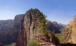
Angels Landing
Springdale, Utah
17.3 miles WAngels Landing is one of the park's most strenuous day hikes, but it offers spectacular vistas. It follows the West Rim Trail through the famous switchbacks of Walters Wiggles, past dramatic...
Hike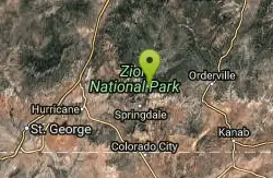
The Grotto Trail
Springdale, Utah
17.3 miles WThe Grotto Trail is a short easy trail that connects The Grotto shuttle stop and Zion Lodge. It follows near the road for about 1.5 miles and has an elevation gain of about 130 feet.
Hike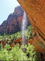
Emerald Pools Trail
Hurricane, Utah
17.7 miles WThe Emerald Pools were named for their unusual color. At some times of the year, algae gives the water in these pools a distinctive hue. A series of basins have been carved into a rock ledge in the...
Hike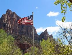
Zion National Park
Hurricane, Utah
19.6 miles WThis is a unique place in the world. Sandstone,carved from wind, water and ice have created icons to visitors. The buttes, landings, bends, mounts and mountains have all been given names over the...
Camp, Hike, Mountain Bike, Swim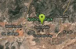
Springdale Town Loop
Hurricane, Utah
20.8 miles WThis trail has tight twisty turns and is fun at all times of the year.
Mountain Bike 7.5 mi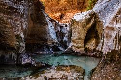
The Subway
Apple Valley, Utah
22.9 miles WThe Subway is one of the best kept secrets of Zion National Park. A little off the beaten path, but a hike that is a must see for any adventure seeking person out there. Hikers begin at the Wildcat...
Canyoneer, Hike, Swim 8.4 mi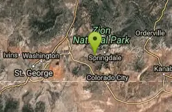
Grafton Mesa
Springdale, Utah
25.6 miles WGrafton Mesa located just outside of Springdale, Utah and Zion National Park is one of the more difficult and jarring trails in southern Utah. This trail is recommended for experienced mountain...
Mountain Bike 8.1 mi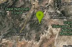
Riggs Spring Loop Trail
Kanab, Utah
25.8 miles NERiggs Spring Loop Trail is the perfect trail for hikers wishing to escape to the wilderness. This is one of the least trafficked trails in Bryce Canyon and one of the most forested. The ponderosa...
Hike 1.0 mi
Bristlecone Loop
Kanab, Utah
25.8 miles NEBristlecone Loop is a one-mile trail from Rainbow Point. Rainbow Point is located at the southern end of Bryce Canyon National Park and is the highest point in the park. The spectacular views...
Hike 7.2 mi
Wire Mesa
Hurricane, Utah
25.8 miles WWire Mesa, located outside of Hurricane, Utah, is a beautiful single track trail near trails like Gooseberry Mesa and Little Creek Mesa. Known for being an introductory trail to the more difficult...
Mountain Bike 3.3 mi
Guacamole Mesa
Virgin, Utah
26.5 miles WGuacamole Mesa, also known by locals as the Whole Guacamole, is an advanced level biking trail in Virgin, Utah (just outside of Hurricane). The trail starts in a climb up the mesa that features tight...
Hike, Mountain Bike


