Map of 10 Things to do near Chiloquin, Oregon
first prev 1 next lastShowing results within 50 miles Distance miles of Chiloquin, OR 97624, USA City, Zip, or Address

Pinnacles Valley Trail
Chiloquin, Oregon
20.1 miles NHike near Chiloquin, Oregon
Hike
The Attraction at Moore Park
Klamath Falls, Oregon
24.0 miles SThis technical course with thick rough off the fairways demands accuracy. Can play from the paver tees to alternate tones to make 18. Public (No Fee)
Disc Golf
Plaikni Falls
Chiloquin, Oregon
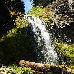
24.5 miles NWThere's more to Crater Lake National Park than the lake itself. If you want to get away from the more popular hiking trails and scenic routes, Plaikni Falls trail is a great...
Hike
Crest Street Park
Klamath Falls, Oregon
26.9 miles SSmall course in public park. Some small trees. Picnic area with BBQs. Play area for kids and basketball, tennis, and horseshoes. Public (No Fee)
Disc Golf 2.4 mi
Wizard Island Summit Trail
Crater Lake National Park
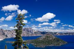
28.5 miles NWWizard Island is one of the most interesting features of Crater Lake itself! It's considered one of the most magnificent volcanic cinder cones in the world. Take a boat tour to the island and...
Hike
Cleetwood Cove Trail
Crater Lake National Park, Oregon
29.9 miles NCleetwood Cove trail leads to the Wizard Island boat tour dock as well as a popular cliff jumping spot in Crater Lake National Park. This is the only legal and safe place for visitors to...
Dive, Hike, Swim
Olene Gap Hot Springs
Klamath Falls, Oregon
30.7 miles SEHot Springs near Klamath Falls, Oregon
Hot Springs
Frog Creek Disc Golf Course at Shale City
Ashland, Oregon
40.4 miles SWOn BLM land at 4000'. Can be snow covered in winter. Mature forest with some ground cover, a creek and pond, and elevation. Public (No Fee)
Disc Golf
Upper Table Rock
Eagle Point, Oregon
46.5 miles WUpper Table Rock and Lower Table Rock are two prominent volcanic plateaus located just north of the Rogue River in Jackson County, Oregon.
Hike
Lower Table Rock
Medford, Oregon
50.0 miles WThe Lower Table Rock trail is a moderate hike/climb and gains about 800 feet of elevation in just over 2.7 miles. This area was originally part of an area signed into a treaty by the Rogue River...
Hike


