


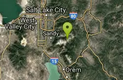
256 Things to do near Pfeiferhorn Peak
first prev 1 2 3 4 5 6 7 8 9 10 next lastShowing results within 50 miles Distance miles of S Parking, Sandy, UT 84092, USA City, Zip, or Address
American Fork Twin Peaks
Provo, Utah
2.1 miles SEAmerican Fork Twin Peaks is the highest mountain on the Little Cottonwood Canyon ridge. The summit is the prominent peak overlooking the Snowbird ski resort. A short approach hike...
Hike
Lake Blanche
Salt Lake City, Utah
2.2 miles NLake Blanche is a fun and popular hike. Lake Blanche, Lake Florence and Lake Lillian are all located next to each other in the upper reaches of the South Fork of Mill B. The trail to Lake Blanche...
Hike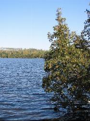
White Pine Lake
Sandy, Utah
2.4 miles SWhite Pine Canyon has long been the subject of intense controversy between advocates of wilderness and ski resort owners. The original boundaries of Lone Peak Wilderness Area, created in 1977, were...
Hike, Mountain Bike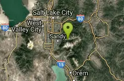
Lisa Falls
Sandy, Utah
2.4 miles WLisa Falls is a great place to climb Spring through Fall, any time of day. The base is well shaded by trees and offers many flat places to belay, or just hang out and relax. The roaring waterfall...
Hike, Rock Climb
Sugarloaf Peak
Alta, Utah
3.0 miles ESugarloaf Peak is an easily reached 11,000 ft. summit which overlooks Albion Basin, Secret Lake, and much of Utah's Alta ski resort. The easy terrain and relatively high trailhead elevation...
Hike
Cecret (Secret) Lake
Alta, Utah
3.1 miles ECecret (pronounced "Secret") Lake is a beautiful lake located among alpine meadows in Little Cottonwood Canyons Albion Basin. Some folks spell Secret Lake as Cecret Lake, but the USGS...
Hike 0.7 mi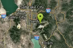
Great White Icicle
Sandy, Utah
3.2 miles WThe Great White Icicle is located in Little Cottonwood Canyon just outside of Salt Lake City, Utah. It is a climbing area that is a frozen waterfall in the winter and a cascading waterfall...
Hike, Rock Climb
Storm Mountain
Salt Lake City, Utah
4.7 miles NWStorm Mountain is on of the smaller peaks included in the Wasatch Range. Storm Mountain is located in Cottonwood Canyon. Storm Mountain Day Use Area is just 3 miles up Big Cottonwood Canyon,...
Hike, Mountain Bike, Rock Climb
Hidden Falls
Salt Lake City, Utah
4.7 miles NWHidden Falls is a popular road side attraction for anyone cruising Big Cottonwood Canyon on a sunny afternoon. The falls are within strolling distance of the parking lot and only require about 15...
Hike 3.2 mi
Little Cottonwood Pipeline Trail
Sandy, Utah
4.9 miles WLocated in Sandy, UT, Little Cottonwood Pipeline trail starts at the mouth of Little Cottonwood Canyon and is a single-track trail with some rocky situations on the trail. The first portion of the...
Mountain Bike
Scruffy Band Little Cottonwood Canyon
Sandy, Utah
4.9 miles WRock Climb near Sandy, Utah
Rock Climb
Spruces Campground
Salt Lake City, Utah
5.1 miles NECamping isn't free. See USDA.gov for details. If you know the coordinates of the sledding hill here, please comment.
Camp, Sled
Brighton Lakes Loop
Salt Lake City, Utah
5.3 miles EThe Brighton Lakes loop is a never ending challenge, from the time you start to climb, to the wild and hair raising descent down the Lake Mary trail! The ride takes you past 4...
Mountain Bike
Donut Falls
Salt Lake City, Utah
5.4 miles NVery popular beginning hike in the Salt Lake City area. Many take this as a good intro hike into the outdoors, while others go for a trip out with friends to escape the rush of daily life. The...
Hike, Swim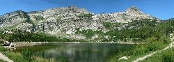
Silver Lake (Big Cottonwood)
Brighton, Utah
5.4 miles EThis hike has everything. The trail passes by three bodies of water and winds through beautiful woodland areas. Wildlife is in abundance. Everything from chipmunks to moose can be observed along...
Hike, Mountain Bike
Ferguson Canyon
Cottonwood Heights, Utah
6.1 miles NWFerguson canyon is small canyon between Big and Little Cottonwood Canyons. This canyon has gained popularity over the last few year and is a popular destination for rock climbers. This is one hike...
Hike, Mountain Bike, Rock Climb 1.1-4.7 mi
Bells Canyon
Sandy, Utah
6.5 miles WBells Canyon is a moderate, 4.5 mile hike that begins in a residential area and ends at a waterfall in the enter of the canyon's forest. The first 1/2 mile of the hike is relatively...
Backpack, Hike, Mountain Bike, Snowshoe
Tibble Fork Reservoir
Provo, Utah
6.7 miles SThere isn't one specific sledding run at this location. There's a great parking lot and hills above and below. It all depends on what kind of speed and excitement you're looking for....
Sled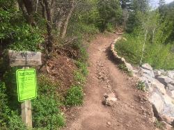
Tibble Fork
Provo, Utah
6.8 miles SThis trail is advanced tech and strenuous aerobic. This trail involves a few miles of riding on the pavement. Start by heading back down to the intersection with the South Fork of American Canyon and...
Mountain Bike 0.2 mi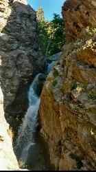
Rocky Mouth Trail/Waterfalls
Sandy, Utah
6.8 miles WThis adventure begins with a very scenic hike to a beautiful waterfall and ends with a magnificent rappel through a short slot canyon and down the waterfall. The hike to the waterfall is a great trip...
Canyoneer, Hike, Rock Climb


