23 Free Swimming Holes near Tuolumne Meadows
first prev 1 2 next lastShowing Swimming Holes within 50 miles Distance miles of Tuolumne Meadows Lodge Rd, California 95389, USA City, Zip, or Address
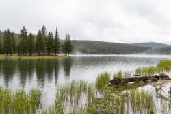
Dog Lake and Lembert Dome
Yosemite Valley, CA
1.0 miles NThe hike to Dog Lake is often paired with the hike to Lembert Dome, because the two are so close in proximity. Each hike by itself is 2.8 miles round trip, but Lembert Dome has an elevation gain of...
Hike, Swim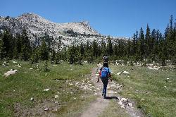
Elizabeth Lake
Wawona, California
2.6 miles SWElizabeth Lake is a gorgeous lake tucked underneath the High Sierras in Yosemite. It's about a 4.8 mile hike to reach it, with an elevation gain of 1000 feet. Even though it's not super long,...
Hike, Swim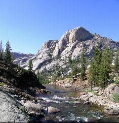
Glen Aulin
Glen Aulin, California
4.6 miles NWThis trail is a popular route to take in the Yosemite High Country because it is a good introductory hike into the backcountry. At the end of the hike there are several waterfalls as well as a...
Backpack, Camp, Hike, Swim 4.0 mi
Mono Pass
Yosemite Valley, CA
4.6 miles EAt an elevation of 10,600 feet, the hike through Mono Pass is an 8 mile journey that takes you across the High Sierras, through several meadows, and stops at a few different lakes along the...
Hike, Swim 0.9-3.2 mi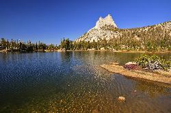
Cathedral Lakes
Wawona, California
4.8 miles SWOne of the busiest trails in the Tuloumne Meadows area, the hike to Cathedral Lakes is a gorgeous 7 mile walk to the perfect place to rest and recuperate. While there are several High Sierra...
Hike, Swim 1.8 mi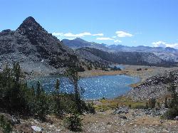
Gaylor Lakes
Yosemite Valley, CA
4.9 miles NEGaylor Lakes is one of Yosemite's most underrated hikes. It's a 2 mile trail with views the entire way. At various points along the trail, you can see Dana Meadows and the mountains...
Hike, Swim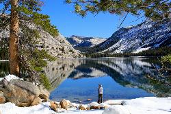
Tenaya Lake
Yosemite Valley, Yosemite National Park
7.1 miles SWTenaya Lake is one of the most visited destinations in Yosemite National Park. The lake is easily accessed by Highway 120/Tioga Pass road which runs along the north shore of the lake. On the east...
Canoe, Hike, Kayak, Swim 1.2-1.6 mi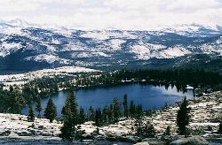
May Lake
Yosemite Valley, Yosemite National Park
8.3 miles WMay lake is a relatively small lake that rests at the base of Mt. Hoffman in Yosemite National Park. One of the park's most scenic lakes, May lake not only gets up close and personal with...
Hike, Swim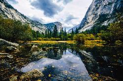
Mirror Lake
Yosemite Valley, Yosemite National Park
14.3 miles SWMirror Lake is a seasonal lake situated in a secluded corner of the beautiful Yosemite Valley. The lake sits at the base of Half Dome and allows a different perspective of the famous monolith....
Backpack, Hike, Swim 0.7 mi
Lukens Lake
Tuolumne Meadows, Yosemite National Park
14.8 miles WLukens Lake is a small lake in the White Wolf area of Yosemite National Park. The hike is a short, 1.6 mile walk through a forest to the secluded lake surrounded by trees and a small...
Hike, Swim
Devil's Bathtub
Yosemite Valley, California
15.2 miles SWDevil's Bathtub is one of those destinations that's a little more off the beaten path of Yosemite tourists. It's just above the Majestic Yosemite (AKA Ahwanhee Hotel). Earlier in the...
Swim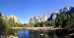
Merced River
Yosemite Valley, Yosemite National Park
16.0 miles SWThe main fork of Merced River at Yosemite National Park is a perfect place to fish, swim, raft, and even pan for gold. The river circles around the center of Yosemite Valley, and almost every...
Camp, Swim, Whitewater 5.5 mi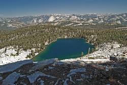
Ostrander Lake
Wawona, California
20.7 miles SWOstrander Lake is a long, 11.4 mile hike just behind Sentinel Dome. Unlike most of Yosemite's summer hikes, the trail to Ostrander Lake is open during the winter for people to ski through....
Hike, Swim
Hot Creek
Mammoth Lakes, California
30.5 miles SECLOSED. Entering the water is now prohibited at this location. This note came in 2008:"I noticed your report of swimming in Hot Creek near Bishop, Calif. I was there in 2006 and it was closed to...
Swim
Hite Cove Trail
El Portal, California
33.4 miles SWThis hike is popular among wildflower enthusiasts. Located in Yosemite National Park, Hite Cove trail is one of the areas that blooms earliest for wildflowers. While areas in the high country...
Hike, Swim
Crowley Lake
Mammoth Lakes, California
37.8 miles SENestled in the picturesque landscape near Benton, California, Crowley Lake stands as a hidden gem, known not only for its breathtaking natural beauty but also for the intriguing geological formations...
Hike, Swim
Gods Bath
Phoenix Lake-Cedar Ridge, CA, California
39.2 miles WGod's Bath swimming hole in the Clavey River is a beautiful and popular location to take a dive in. However, the hike to get there is about one mile of rock climbing. The trailhead begins on...
Hike, Swim
Briceburg Recreation Area
Midpines, California
39.9 miles SWCamp, Kayak, and Swim near Midpines, California
Camp, Kayak, Swim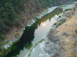
Standish Hickey Area
Lakeshore, California
42.1 miles SEStandish-Hickey is an inland river canyon that runs along Highway 101 just 180 miles from San Fransisco. It's home to a two-mile stretch of the south fork on Eel River, where many...
Backpack, Camp, Hike, Kayak, Swim
Smith River Area
Lakeshore, California
42.1 miles SESwim near Lakeshore, California
Swim


