


23 Free Swimming Holes near Fun Farm Bridge
first prev 1 2 next lastShowing Swimming Holes within 50 miles Distance miles of Ext, St Anthony, ID 83445, USA City, Zip, or Address
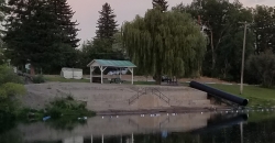
St. Anthony Sandbar
Saint Anthony, Idaho
3.0 miles SWCLOSED. //// Sand Bar Update //// ***As of 27 June 2019 *** The Sand Bar is still closed to ALL swimming, please do not cross the boundary line. We are closely monitoring the river flows...
Dive, Swim
Monkey Rock
Saint Anthony, Idaho
3.4 miles SCLOSED. PSA: Monkey Rock is no longer open to the public. The owner has posted "No Trespassing" signs and is asking the Fremont County Sheriff's Office to assist with keeping people out of their...
Swim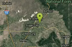
Hog Hollow Bridge
Saint Anthony, Idaho
3.5 miles SLess than 1/2 a mile down the road from the Monkey Rock waterfall, Hog Hollow Bridge is a favorite spot for adrenaline junkies to cool off. The place to jump is off the East side of the bridge where...
Dive, Swim
Twin Bridges
St. Anthony, Idaho
3.6 miles NEThere's an old abandoned bridge next to the one currently in use. The water is pretty deep underneath and offers two distinct levels to jump from. There's a little rope swing under the bridge...
Dive, Swim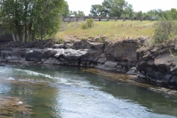
Fall River Bridge
Ashton, Idaho
4.3 miles NERight off Highway 20, there's a great spot to swim, swing, and dive. There's pullouts for parking right next to the bridge. There's a rope swing under the railroad bridge and a little...
Dive, Swim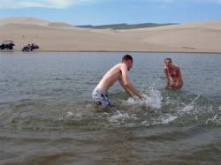
Egin Lakes
Saint Anthony, Idaho
11.8 miles WEgin Lakes is one of the favorite gateways to the St. Anthony Sand Dunes. The lakes themselves are unusually shallow and where you'll actually find a lake depends greatly on what time of the...
Sled, Swim
Beaver Dick Park
Rexburg, Idaho
17.8 miles SWBeaver Dick is a park 4.5 miles west of Rexburg, Idaho on Hwy 33. It's a 9.5 acre park that passes next to the west bank of the Henry Fork of the Snake River; it's a popular...
Camp, Canoe, Disc Golf, Swim 0.6 mi
Packsaddle Lake
Tetonia, Idaho
20.3 miles SEPacksaddle is one of the less well known lakes/trails in the area. If you've got a good offroad vehicle, you can probably make it all the way to the end of the road, otherwise, it's just an...
Dive, Hike, Mountain Bike, Snowshoe, Swim
Porcupine Creek
Ashton, Idaho
21.4 miles EPorcupine Creek is a hunting, fishing, camping, and swimming spot near Ashton, Idaho in Fremont County within Targhee National Forest. It's surrounded by forests, meadows, and a creek...
Camp, Swim
Jefferson County Lake (AKA Rigby Lake)
Rigby, Idaho
24.0 miles SWRigby Lake has long been a favorite swimming hole for those in the area. The county has taken it well under its wing and made it a buzzing spot on any warm summer day. Along with the long standing...
Camp, Canoe, Dive, Kayak, Sled, Swim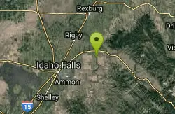
Blacktail Day Use Area
Ririe, Idaho
28.4 miles SOn the North end of Ririe Reservoir there is a great little park with cliff jumping and even rock climbing. There is a trail from the south end of the parking lot down along the cliffs. There are...
Dive, Rock Climb, Swim
Horseshoe Lake
Ashton, Idaho
28.7 miles NEHorseshoe Lake is hidden back in the Targhee National Forest. It's a beautiful lake with plenty of lily pads. The road to get there is well maintained and there are many options for pull-outs...
Camp, Canoe, Dive, Swim 17.5 mi
Tear Drop Lake
Ashton, Idaho
29.7 miles NENestled in the Targhee National Forest just off of Ashton's Fish Creek Road, this tear drop shaped lake is a family adventure waiting to happen. The lake isn't very big but it is teeming with...
Camp, Canoe, Hike, Kayak, Mountain Bike, Swim 0.9 mi
Buffalo River Campground
Island Park, Idaho
33.3 miles NEThe float here is nice and easy. It's a great early season float. Later in the season the shallow spots will force you to walk a good chunk of the float. The water is super clear and often pretty...
Camp, Canoe, Kayak, Swim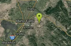
Blacktail Lake / Ririe Reservoir
Idaho Falls, Idaho
33.8 miles SCanoe and Swim near Idaho Falls, Idaho
Canoe, Swim
Loon Lake
Ashton, Idaho
34.7 miles ECamp, Kayak, and Swim near Ashton, Idaho
Camp, Kayak, Swim 15.9-16.6 mi
Union Falls & Ouzel Pool
Grant Village, Yellowstone National Park
35.1 miles EBackpack, Hike, Hot Springs, and Swim near Grant Village, Yellowstone National Park
Backpack, Hike, Hot Springs, Swim 4.8 mi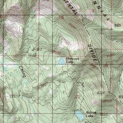
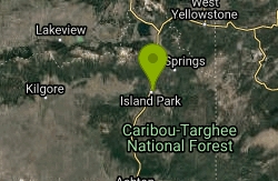
Aldous Lake and Hancock Lake
Kilgore, Idaho
37.8 miles NA pair of alpine lakes near Kilgore, Idaho. Good road all the way to the trailhead. Easy to moderate 1.5mi hike to the first lake (Aldous) and another mile of moderate hiking to Hancock. Beautiful...
Backpack, Camp, Hike, Horseback, Swim
Fall Creek Falls
Swan Valley, Idaho
39.5 miles SFalls Campground is located next to the Snake River near beautiful Swan Valley, only 45 miles east of Idaho Falls, Idaho. Mixed growth cottonwood trees provide partial shade, and grassy meadows with...
Camp, Cave, Hike, Kayak, Swim 3.6 mi
String Lake
Alta, Wyoming
46.6 miles EString Lake is a shallow lake that connects Leigh Lake and Jenny Lake at the base of Mount St. John and Rockchuck Peak. From the lakeshore, you can also take in beautiful views of Teewinot and Mt....
Canoe, Hike, Kayak, Swim


