Map of 11 Mountain Bike Trails near Melrose, Butte, Montana
first prev 1 next lastShowing Mountain Bike Trails within 50 miles Distance miles of Melrose, Butte, MT 59743, USA City, Zip, or Address

Lake Agnes
Glen, Montana
10.9 miles SWAgnes Lake Trail (122) is located in the Pioneer Mountains. The trail begins on the east side of Brownes Lake at the State campground and ends 0.5 mile east of Long Branch Lake on Willow Creek Road....
Camp, Hike, Mountain Bike
CDT: Highland
Butte, Montana
16.2 miles NEThis is a new addition to the Continental Divide Trail. Go through the gate to the west with the CDT sign. There are a couple pieces of doubletrack--take the one with another CDT...
Mountain Bike
Toll Canyon
Butte, Montana
19.5 miles NEStart with an extended climb at a moderate grade for a few miles. Be sure to take the short spurs to lookouts, first on the right, then on the left. Once back on the main trail,...
Mountain Bike
Beaver Ponds
Butte, Montana
19.9 miles NEStart by climbing just over a mile on the highway to a trailhead on the left. This is a seriously sweet piece of singletrack. The initial climb is brutal, but once on top, it turns...
Mountain Bike
Homestake To Pipestone Pass
Butte, Montana
23.7 miles NEButtery smooth singletrack with really fun rock features throughout, in a cool bouldery landscape. The trail is ~75% climbing for about 5 miles to the top, where there's a nice view of...
Mountain Bike
Maud S. Canyon
Butte, Montana
25.2 miles NEa fun easy fast ride. One of the most popular trails in Butte gives bikers and hikers excellent loop possibilities just minutes from town. The Maud S Canyon trail, located northeast of...
Mountain Bike
Spire Rock
Whitehall, Montana
28.4 miles NEFrom the p-lot ride north on the main Delmoe Lake road for about 3.6 miles. This is a great warm-up. Turn right onto a wide four-wheelrer trail and ride up this until you come to a...
Mountain Bike
Dry Creek Loop
Wise River, Montana
28.7 miles NWThe loop follows MT274 to the north for about .5 mi, then joins a segment of the Continental Divide Trail through the Mt. Haggin WMA to the Dry Creek Rd. The loop then follows the Dry...
Mountain Bike 1.0 mi
Lewis & Clark Caverns
Whitehall, Montana
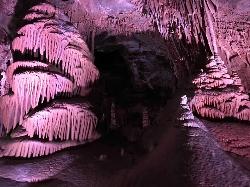
41.4 miles EThe Lewis & Clark Caverns State Park encompasses 3,015 acres that you can explore by foot, on a bike, in a canoe or in a tent. The most famous feature of the park is the Lewis & Clark...
Camp, Canoe, Cave, Hike, Mountain Bike 0.4-3.9 mi
Lewis & Clark Caverns Trails
Whitehall, Montana
42.0 miles ELewis & Clark Caverns State Park is a 3,000-acre park with over 10 miles of trails open to hikers and mountain bikers. It is easy to be one with nature as you explore these adventurous trails....
Hike, Mountain Bike
Spring Hill Campground and Picnic Area
Anaconda, Montana
43.8 miles NWSpringhill Campground is located in Beaverhead-Deerlodge National Forest in southwestern Montana. Warm Springs Creek runs right next to the campground is popular among anglers who commonly catch...
Camp, Hike, Horseback, Mountain Bike, Swim


