


25 Mountain Bike Trails near Tualatin Community Disc Golf Course
first prev 1 2 next lastShowing Mountain Bike Trails within 50 miles Distance miles of 20500 SW Boones Ferry Rd, Tualatin, OR 97062, USA City, Zip, or Address
Cooks Butte
Lake Oswego, Oregon
3.8 miles NEjust a few trails that go through some nice forest right in the middle of Lake Oswego. hikers that go through there are fairly tolerant and don't ever say anything. Fun downhill to the...
Mountain Bike
Iron Mountain Trail
Lake Oswego, Oregon
4.5 miles NEFrom the trailhead you can either ride straightish to fairway road. This is 1.5 track gravel & dirt. Or you can ride down and about halfway there will be a switchback. Take this and...
Mountain Bike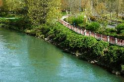
Willamette River Trail
Canby, Oregon
7.7 miles SEThe Willamette River trail is a mix of both paved and natural surface trails. It is a relatively flat trail that would be perfect if you want to take a leisurely bike ride and you're not up...
Hike, Mountain Bike
Upper Sidewinder
Portland, Oregon
7.9 miles NEAdvanced downhill trail with roots, rocks, and lots of corners. Courtesy of Singletracks.com
Mountain Bike
Oaks Bottom Wildlife Refuge
Portland, Oregon
9.2 miles NEThere is a popular paved commuting bikepath called the Springwater Corridor that goes along the edge of Oaks Bottom and there is also a paved connector to the Springwater Corridor that...
Mountain Bike
Terwilliger Parkway
Portland, Oregon
9.3 miles NETerwilliger Parkway is a 99-acre, city-owned park in Portland, Oregon. This park is a great get-away from city life as there is more space than other city-parks, and activities here...
Mountain Bike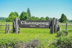
Champoeg State Park
Saint Paul, Oregon
10.3 miles SWChampoeg State Park (commonly pronounced SHAM-poo-EE) is a historic pioneer site as well as a beautiful outdoor recreational area. The Native Americans originally pronounced it CHAM-po-EGG, but it...
Camp, Disc Golf, Hike, Mountain Bike
Leif Erikson Drive Trail
Portland, Oregon
11.9 miles NForget how close you are to the hustle and bustle of the city of Portland by taking a bike ride on this gorgeous nature trail. It's one of the more popular and well-known trails in Forest Park....
Mountain Bike
Forest Park
Portland, Oregon
14.0 miles NAn abundance of wildlife (more than 112 bird and 62 mammal species) can be found in Forest Park. With its massive tree canopy and substantial undergrowth, the park serves as a natural...
Mountain Bike
Forest Park - Leif Erikson Drive
Portland, Oregon
14.5 miles NA good ride for a beginer on a Mt. or cross bike. There is some good single track on side trails but most are closed to bikes. The people of Portland make a stink when they find you...
Mountain Bike
Lumberyard Indoor Bike Park
Portland, Oregon
15.0 miles NEThe Lumberyard, Portland's unique indoor bike park, includes jump lines, pump tracks, skill sections and technical trail riding for beginners to experts.They also offer offer...
Mountain Bike
Powell Butte Nature Park
Portland, Oregon
15.1 miles NEThis place is best ridden early mornings or weekdays due to lots of hikers and horse riders. Be aware of them at all times. Powell Butte has a few decent singletrack trails that are,...
Mountain Bike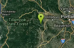
Hagg Lake
Gaston, Oregon
22.3 miles WGreat singletrack, some short steep climbs, can be slippery, rutty and messy in early spring. Gets overgrown with blackberry during peak summer. Also open to hikers, so watch for peeps!...
Mountain Bike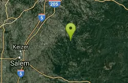
Molalla River Recreation Corridor
Molalla, Oregon
25.1 miles SEThere are several rides at the Hardy Creek trail head. Deerskull is steep and singletrack. Rim trail is sweet. The huckleberry trail is the main trail and all side trails branch from...
Mountain Bike
WSU Vancouver Trails
Vancouver, Washington
26.1 miles NThe Mill Creek Riparian Interpretive Trail, part of the WSU Vancouver Trails System, is designed to expand our knowledge and understanding of the ecological functions of plant and soil systems...
Mountain Bike
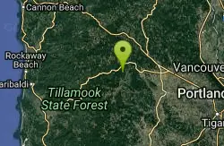
Tillamook State Forest
Gales Creek, Oregon
32.5 miles NWSingletrack loop plus a few out-and-backs overlaid on a huge network of ATV trails. The trails and trailheads are well marked and there are miles of forest roads that can be connected...
Mountain Bike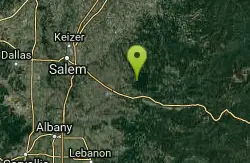
Catamount Trail
Sublimity, Oregon
36.2 miles SStraight forward uphill road on lookout mountain/ house road. Actual trail is newer single track. Roots and some technical in spots. MTB specific but hikers allowed, no equestrian....
Mountain Bike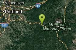
Wildwood Recreation Site
Mount Hood Village, Oregon
38.1 miles EWildwood Recreation Site is located along the Mount Hood Scenic Byway near the town of Welches, Oregon. Mount Hood, Oregon's tallest mountain, beckons travelers through a forested corridor to...
Hike, Mountain Bike, Swim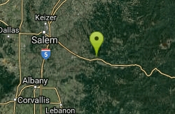
Shelburg Falls
Stayton, Oregon
39.7 miles SHead up the gravel road for several miles, past the lower falls, and then past the upper parking. There are multiple ways to configure loops. For the most trail, continue climbing to...
Mountain Bike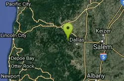
Burma Peak System
Dallas, Oregon
43.0 miles SWRide up until there is a fork and no obvious way to go. Directly ahead an a little to the right is a trial labeled Gonzo take that down then climb back up the road you just rode next...
Mountain Bike


