


120 Mountain Bike Trails near Provo Canyon
first prev 1 2 3 4 5 6 next lastShowing Mountain Bike Trails within 50 miles Distance miles of 988 Provo River Pkwy, Provo, UT 84604, USA City, Zip, or Address
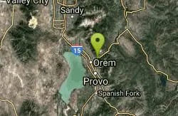
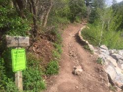
South Fork of the Provo
Provo, Utah
2.1 miles SWSouth Fork of the Provo is a fun, short, scenic singletrack ride. It is an ideal trail to introduce a new mountain biker to the joys of singletrack! The trail has one or two rocky...
Mountain Bike
Provo River Parkway Trail
Provo, Utah
2.3 miles NEThis isn't quite as much mountain biking as it is an easy downhill bike ride. The whole trail is paved. One of the best ways to do it is to take two vehicles and park one at Will's Canyon...
Hike, Mountain Bike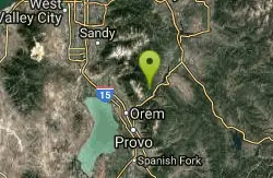
Archie's Loop
Sundance, Utah
4.1 miles NEArchie's Loop Trail, a 2.2 mile stretch of mountain biking/hiking trail, recently opened up totally new country. The intermediate-level trail runs from Scott's Pond loop to connect with...
Mountain Bike
Big Springs
Provo, Utah
4.6 miles ESingle track, winding through trees and an open meadow. Cross the service road about half way up to continue to the small water run off of Big Springs. There is approximately 1000 feet...
Mountain Bike
Grove Creek Trail
Pleasant Grove, Utah
5.8 miles NWThe Grove Creek Trail falls from the upper shoulder of Mount Timpanogos down Grove Creek Canyon to Pleasant Grove. It's usually ridden as a shuttled downhill -- because the climb up this...
Hike, Mountain Bike
Bonneville Shoreline Trail - Cedar Hills to Grove Creek Canyon
Pleasant Grove, Utah
5.9 miles NWThe Cedar Hills to Grove Creek Canyon portion of the Bonneville Shoreline Trail is an intermediate level trail. There are some flat spots that are on old dirt roads, as well as single track...
Mountain Bike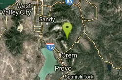
Ridge Trail #157
Provo, Utah
6.5 miles NThis trail is 15.7 miles in length and is commonly referred as the backbone of the American Fork Canyon trail system, because it connects several loop routes along the northern portion of the...
Mountain Bike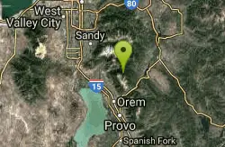
Timpanooke
Provo, Utah
6.7 miles NThis is a great trail. Intermediate tech and moderate aerobic. It winds through pine forests and grass meadows. Start by heading down the Timpanooke section of the Great Western Trail...
Mountain Bike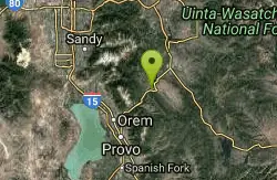
Deer Creek State Park
Wallsburg, Utah
7.6 miles NEDeer Creek State Park is one of the finest year-round fishing spots in all of Utah. There are many different kinds of fish here and it is sure to not disappoint fisherman. Other...
Mountain Bike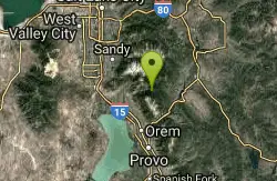
Bear Canyon Loop
Provo, Utah
8.0 miles NA route for the thrill seeker, the Bear Canyon Loop is an advanced mountain biking route. This a challenging route and should be done only by those who know how to handle their bike on steep rocky...
Mountain Bike
Tibble Fork
Provo, Utah
10.1 miles NThis trail is advanced tech and strenuous aerobic. This trail involves a few miles of riding on the pavement. Start by heading back down to the intersection with the South Fork of American Canyon and...
Mountain Bike
Rodeo Down
Alpine, Utah
11.2 miles NWBlack Dog. Trail winds from the middle of Corkscrew down to Flank and River, just south of the water tank. Some technical aspects, length 0.5 miles with 300 vertical feet elevation...
Mountain Bike
Squaw Peak Trail
Springville, Utah
11.5 miles SStart at Rock Canyon trailhead, ride straight up the trail, passing a green gate and subsequently 5 wooden bridges. 1/4 mile after the last bridge, take a left on "Squaw Peak Trail."...
Mountain Bike 1.7 mi
Schoolhouse Springs Trail
Alpine, Utah
12.7 miles NWSchoolhouse Springs trail has an elevation trail at 5,300 ft. It's located at the end of the town of Alpine. It features a lake and there's a number of activities including horse-back...
Hike, Mountain Bike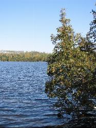
White Pine Lake
Sandy, Utah
14.6 miles NWhite Pine Canyon has long been the subject of intense controversy between advocates of wilderness and ski resort owners. The original boundaries of Lone Peak Wilderness Area, created in 1977, were...
Hike, Mountain Bike
Mercer Hollow Trail
Draper, Utah
14.8 miles NWMercer Hollow Trail is primarily used to bomb down the southern flanks of the ridge the Corner Canyon Trails sit on. It's filled with berms, rock features, rollers, and sweet, sweet...
Hike, Mountain Bike 1.3 mi
Eagle Crest Trail
Draper, Utah
15.1 miles NWEagle Crest trail is a beginner level trail mountain bike in Draper, Utah along the north side of Traverse Mountain. From the trail, riders can see the Salt Lake Valley, the Northern end of Utah...
Hike, Mountain Bike
Wardsworth Creek
Springville, Utah
15.2 miles SEThis trail is intermediate technical and moderate aerobic. The scenery is great as you follow the creek up the canyon. Enjoy some rooty and rocky climbs on your way up to a small pond...
Mountain Bike 1.7 mi
Jacob's Ladder Trail
Sandy, Utah
15.3 miles NWJacobs Ladder trail has an elevation trail of 5,700 ft. and the most popular trailhead out of the five trails in Lone Peak. It's located near a large area on the right side of the road...
Hike, Mountain Bike 0.2-1.8 mi
Lone Peak
Draper, Utah
15.3 miles NWEstablished in 1978 and located southeast of Salt Lake, Lone Peak is one of the taller peaks in the Wasatch range along the Wasatch Front. It has 5 main trailheads: Jacobs Ladder via Corner Canyon...
Hike, Mountain Bike, Rock Climb


