


16 Mountain Bike Trails near Ousel Falls
first prev 1 next lastShowing Mountain Bike Trails within 50 miles Distance miles of 2085 Ousel Falls Rd, Big Sky, MT 59716, USA City, Zip, or Address
Buck Ridge
Gallatin Gateway, Montana
5.3 miles SEThis is a ride you do for the scenery rather than the singletrack. It is an out-and-back on about 8 miles of doubletrack/atv trail. Most of the ride give you fantastic views of the...
Mountain Bike
Little Wapiti
Gallatin Gateway, Montana
14.3 miles SThe climb is partially double track. The descent is narrow, at times rocky, singletrack. Gorgeous views. At 9,000 plus feet...wolf tracks, too.
Mountain Bike
Garnett Mountain
Gallatin Gateway, Montana
14.6 miles NThis is a great singletrack but it is merciless. Just don't make it your first ride of the year. No problems following this trail, just follow the most obvious route. Though not overly...
Mountain Bike
Hyalite Creek Trail
Gallatin Gateway, Montana
21.6 miles NESummer activities are on a timeshare basis, with specific days and activities listed at the trailhead. The entire trail is 11 miles, with eleven waterfalls along the trail! Bear...
Hike, Horseback, Mountain Bike
Cabin Creek
West Yellowstone, Montana
25.8 miles SStarts out as a nice, buff trail. After a mile or two, there are a lot of tough creek crossings and when I rode it in 2010 there were a lot of trees down. This was from a recent...
Mountain Bike
Sheep Creek Trail
30.4 miles S
The trail has a few interesting spots (rocks, roots, etc.), but mostly it's pretty simple and straightforward. A pretty good climb, especially the last few hundred yards to the lake....
Mountain Bike 3.8 mi
Abandoned Railroad Bed Bike Trail
Gardiner, Montana
33.5 miles SEThe Abandoned Railroad Bed Bike Trail, otherwise known as Shortline Trail, is a easily accessible bike trail found just inside the North Entrance of Yellowstone National Park. This bike trail follows...
Mountain Bike
Mile Creek Trail
33.7 miles S
It is important to note that Mile Creek Trail is part of the Continental Divide Trail system, so it connects to other trails of various difficulties. Mile Creek Trail itself is a great...
Mountain Bike
Mammoth/Gardiner Back Road
Mammoth Hot Springs, Yellowstone National Park
35.9 miles SEThe only road open in Yellowstone National Park is Highway 89 at Gardiner, Montana to park Headquarters at Mammoth Hot Springs and from Mammoth Hot Springs to Silver Gate and Cooke City, Montana.
Hike, Mountain Bike 8.4 mi
Bunsen Peak Loop Bike Trail
Yellowstone National Park, Wyoming
36.6 miles SEBunsen Peak Loop Bike Trail is a challenging trail that follows several service roads around Bunsen Peak. This 10 mile loop has a total elevation change of 1,120 feet, with several miles of the trail...
Mountain Bike
Divide Road
Island Park, Idaho
38.0 miles SDivide Road criss-crosses the Continental Divide between Montana and Idaho. I have ridden it three times and didn't see a soul each time. I saw lots of deer and elk. There are bears...
Mountain Bike
Targhee Creek Trail
Island Park, Idaho
39.7 miles SSpecial attractions along the trail include five alpine lakes amid the mountains, abundant wildlife, wildflowers, and great scenic views of the mountains and valley floor. The Targhee...
Mountain Bike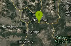
Rendezvous Loop
West Yellowstone, Montana
42.0 miles SGentle rolling hills that wind though tall stands of lodgepole pine and open meadows. Easy ride with great potential for speed.
Mountain Bike 0.4-3.9 mi
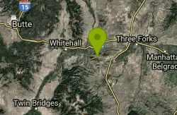
Lewis & Clark Caverns Trails
Whitehall, Montana
47.4 miles NWLewis & Clark Caverns State Park is a 3,000-acre park with over 10 miles of trails open to hikers and mountain bikers. It is easy to be one with nature as you explore these adventurous trails....
Hike, Mountain Bike
Sawtell Peak Trail
Island Park, Idaho
48.0 miles SThis trail offers great views of the valley floor, mountain peaks and wildlife. source: fs.usda.gov
Mountain Bike 1.0 mi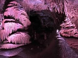
Lewis & Clark Caverns
Whitehall, Montana
48.7 miles NWThe Lewis & Clark Caverns State Park encompasses 3,015 acres that you can explore by foot, on a bike, in a canoe or in a tent. The most famous feature of the park is the Lewis & Clark...
Camp, Canoe, Cave, Hike, Mountain Bike


