


103 Mountain Bike Trails near Bitch Creek Trestle
first prev 1 2 3 4 5 6 next lastShowing Mountain Bike Trails within 50 miles Distance miles of Ashton - Tetonia Trail, Ashton, ID 83420, USA City, Zip, or Address

Badger Creek
Tetonia, Idaho
6.3 miles SBadger Creek is a stream located just 13.6 miles from Ashton, in Teton County, in the state of Idaho, United States, near France, ID. Whether you’re spinning, baitcasting or fly fishing your...
Camp, Cross-country Ski, Hike, Mountain Bike, Rock Climb 3.2-47.0 mi
Yellowstone Branch Line Trail
Ashton, Idaho
14.1 miles NWYellowstone branch line trail runs from Warm River to the Montana border totaling 39 miles. There are a few places to jump on and off the trail as well as a few smaller trails that branch off of this...
Backpack, Cross-country Ski, Hike, Horseback, Mountain Bike 1.7 mi
Rick's Basin
Driggs, Idaho
14.6 miles SEMountain Bike near Driggs, Idaho
Mountain Bike 0.6-4.0 mi

Grand Targhee XC Park
Moose, Wyoming
14.9 miles SEMountain Bike 1.1 mi

More Cowbell
Moose, Wyoming
14.9 miles SEThis singletrack trail winds through aspens, high alpine meadows and old growth conifers.
Mountain Bike 1.9 mi
Perm-a-grin
Moose, Wyoming
14.9 miles SEPerma Grin is guaranteed to fix a smile on your face indefinitely! This swooping, flowing, smooth singletrack descends the hillside above Rick's Basin.
Mountain Bike 2.1 mi
Buffalo Soldier
Moose, Wyoming
14.9 miles SETrail is a nice loop, all singletrack, with about 300' of elevation gain. Trail is about 1.8 miles one way. You can also use it as a connector to Mill Creek or lightning loop. Buffalo...
Mountain Bike 4.0 mi
Quakie Ridge
Moose, Wyoming
14.9 miles SETrail starts at the base ski area on a service road then heads out on nice single track. Trail winds through meadows of wildflowers. Some minor altitude gain along the trail. The...
Mountain Bike
Cold Springs
Moose, Wyoming
15.1 miles SETrail is easiet down as a loop but can be done as a shuttle as well. Take a right into Teton Canyon and park at the first big parking lot on the left. About 50 yards from Ski Hill rd....
Mountain Bike 0.6 mi
Packsaddle Lake
Tetonia, Idaho
15.5 miles SWPacksaddle is one of the less well known lakes/trails in the area. If you've got a good offroad vehicle, you can probably make it all the way to the end of the road, otherwise, it's just an...
Dive, Hike, Mountain Bike, Snowshoe, Swim 7.1 mi
Mill Creek Trail
Moose, Wyoming
15.6 miles SEThere are two ways to do this ride, one as a loop with the Targhee road providing the bulk of the climb, or as an out and back (up the trail and back down). Keep in mind that this trail is...
Cross-country Ski, Mountain Bike, Snowshoe 4.5 mi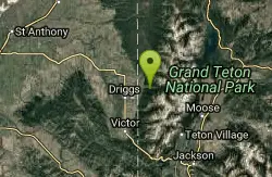
Sheep Bridge Trail
Driggs, Idaho
15.6 miles SEThis is a great easy trail for beginner hikers or mountain bikers. In the early summer, you'll find many beautiful wildflowers and large kaleidoscopes of butterflies to go with them. You...
Hike, Mountain Bike 3.9 mi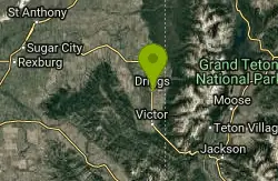
Three Wookie Trail
Driggs, Idaho
16.0 miles SMountain Bike near Driggs, Idaho
Mountain Bike 0.1-0.2 mi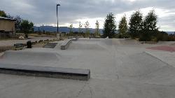
Driggs Bike and Skate Park
Driggs, Idaho
16.3 miles SThis is a great concrete skatepark and small mountain bike park with great features, both natural and wooden. There's a great pavilion right next to the skatepark and parking lot. While...
Mountain Bike, Skateboard
Wright Creek Trail
Tetonia, Idaho
16.3 miles SWOpen to MTB, horseback riding, snowshoeing, and hiking. source: fs.usda.gov
Mountain Bike 29.6 mi
Ashton to Tetonia Trail
Ashton, Idaho
16.5 miles NWThe Idaho Department of Parks and Recreation undertook the project to transform the old Teton Valley Branch of the Union Pacific Railroad from Ashton to Tetonia into a trail for bikes, ATVs, and...
Mountain Bike
Probation And Burg Bumper
Tetonia, Idaho
16.5 miles SWThe Probation part of the trail is the steepest downhill in the area. Has multiple bridges and log jumps in the short mile down. The Burg portion of the trail is uphill with some...
Mountain Bike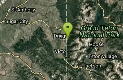
Spring Creek Trail
Alta, Wyoming
16.7 miles SThis trail starts at the remains of the historic Rapid Creek Ranger Station. The trail heads east following an old road. After crossing Rapid Creek, the trail climbs up to a ridge...
Mountain Bike
Sharks Belly
Driggs, Idaho
16.8 miles STrail system can start from Channel lock or Bovine. Channel Lock is an easier climb than Bovine. This description and mileage starts at the Channel Lock trail, forest service boundary marker. Take...
Mountain Bike
Southbound
Driggs, Idaho
16.9 miles STrail starts by going up the Channel lock trail. At the top of Channel Lock go right onto the Southbound trail. Trail will loop back to Channel lock which you take back to your car. Trail is...
Mountain Bike


