142 Mountain Bike Trails near Bella Vista Elementary School'
first prev 1 2 3 4 5 6 7 8 next lastShowing Mountain Bike Trails within 50 miles Distance miles of Bella Vista Elementary School, 2131 Fort Union Blvd, Cottonwood Heights, UT 84121, USA City, Zip, or Address

Ferguson Canyon
Cottonwood Heights, Utah
2.4 miles SEFerguson canyon is small canyon between Big and Little Cottonwood Canyons. This canyon has gained popularity over the last few year and is a popular destination for rock climbers. This is one hike...
Hike, Mountain Bike, Rock Climb 1.1-4.7 mi
Bells Canyon
Sandy, Utah
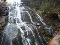
4.4 miles SBells Canyon is a moderate, 4.5 mile hike that begins in a residential area and ends at a waterfall in the enter of the canyon's forest. The first 1/2 mile of the hike is relatively...
Backpack, Hike, Mountain Bike, Snowshoe
Storm Mountain
Salt Lake City, Utah
4.5 miles EStorm Mountain is on of the smaller peaks included in the Wasatch Range. Storm Mountain is located in Cottonwood Canyon. Storm Mountain Day Use Area is just 3 miles up Big Cottonwood Canyon,...
Hike, Mountain Bike, Rock Climb 3.2 mi
Little Cottonwood Pipeline Trail
Sandy, Utah
4.7 miles SELocated in Sandy, UT, Little Cottonwood Pipeline trail starts at the mouth of Little Cottonwood Canyon and is a single-track trail with some rocky situations on the trail. The first portion of the...
Mountain Bike 0.4 mi
Hidden Valley Park trail
Sandy, Utah
5.9 miles SHidden Valley Trail has different levels and gradual uphill fun and makes for a good adventure trail. It's a wide, shallow valley that is hidden from view; hence the name. The valley’s...
Hike, Mountain Bike 0.2 mi
Orson Smith trail
Draper, Utah
7.1 miles SOrson Smith Trail is located north of the Corner Canyon Gate. It leads up to the suspension bridge and has become a popular spot for hiking and bike routes since the suspension...
Hike, Mountain Bike 0.8 mi
Bear Canyon Suspension Bridge
Draper, Utah
7.2 miles SThe Bear Canyon Suspension Bridge is a 185ft bridge that connects the Bear Canyon to the Bonneville Shoreline Trail. The bridge was built and completed in 2015 thanks to donations from residents and...
Hike, Mountain Bike
Mill Creek Pipeline
Salt Lake City, Utah
8.0 miles NEthere are quite a few hiking trails that connect into this trail coming up the mountain from your left you will go about 6.5 miles and then a sign post will mark the Rattlesnake down...
Mountain Bike 0.6 mi
Bst To Equestrian Center Loop
Draper, Utah
8.3 miles SAn intermediate trail with a length of 10 miles that's located in Draper, UT. It's a single track look trail that has an elevation of 417 ft. Start at the Equestrian Center and follow the...
Hike, Mountain Bike 1.6 mi
Corner Canyon Trail
Draper, Utah
8.3 miles SCorner Canyon is the "Go To" riding area in South Salt Lake and for many riders it is worth the drive (or ride) from Utah County. It is a good mix of everything from beginner training...
Backpack, Hike, Mountain Bike
Mt. Wire
Salt Lake City, Utah
8.7 miles NThe Mt. Wire Pipeline Trail is a great singletrack away from the crowds. The lower portion is steep with loose rock. The Pipeline itself is loose gravel and has more hills then a...
Mountain Bike 1.2 mi
Ghost Falls Trail
Sandy, Utah
9.1 miles SGhost Falls is located in the corner canyon riding area of Draper, Utah and one of the first mountain bike routes in the canyon. It's a family-friendly hike, named for the...
Hike, Mountain Bike, Snowshoe 0.2-1.8 mi
Lone Peak
Draper, Utah
9.1 miles SEstablished in 1978 and located southeast of Salt Lake, Lone Peak is one of the taller peaks in the Wasatch range along the Wasatch Front. It has 5 main trailheads: Jacobs Ladder via Corner Canyon...
Hike, Mountain Bike, Rock Climb 1.7 mi
Jacob's Ladder Trail
Sandy, Utah
9.1 miles SJacobs Ladder trail has an elevation trail of 5,700 ft. and the most popular trailhead out of the five trails in Lone Peak. It's located near a large area on the right side of the road...
Hike, Mountain Bike 0.6 mi
Potato Hill Trail
Draper, Utah
9.5 miles SLocated in Draper, UT, Potato Hill Trail start at the trailhead on Transverse Mountain Road. and goes down to the (BST) or Bonneville Shoreline Trail west of Coyote Hollow. There are some trails that...
Hike, Mountain Bike
Little Valley Trail
Draper, Utah
9.6 miles SOne of the best places in the Salt Lake valley to take kids mountain biking is the Little Valley Instructional Trails. Fortunately, these superbly constructed “flow” trails are just as...
Hike, Mountain Bike 0.8 mi
Red Rock Trail
Draper, Utah
9.7 miles SThe Red Rock trail located in Draper, Utah is a short loop trail just down the road from the Draper LDS Temple. The hike itself may be short, but since it is along the cliffs of the southern end of...
Hike, Mountain Bike, Rock Climb
Bonneville Shoreline Trail - Northern Salt Lake City
Salt Lake City, Utah
9.8 miles NThe Bonneville Shoreline Trail is a series of trails along the slope of the Wasatch Mountains where the old shoreline of Lake Bonneville met the hills. Good aerobic ride. Can be...
Mountain Bike
White Pine Lake
Sandy, Utah
9.8 miles SEWhite Pine Canyon has long been the subject of intense controversy between advocates of wilderness and ski resort owners. The original boundaries of Lone Peak Wilderness Area, created in 1977, were...
Hike, Mountain Bike
Mercer Hollow Trail
Draper, Utah
10.1 miles SMercer Hollow Trail is primarily used to bomb down the southern flanks of the ridge the Corner Canyon Trails sit on. It's filled with berms, rock features, rollers, and sweet, sweet...
Hike, Mountain Bike


