98 Mountain Bike Trails near Alta Nordic Trail
first prev 1 2 3 4 5 next lastShowing Mountain Bike Trails within 50 miles Distance miles of 250 Targhee Towne Rd, Alta, WY 83414, USA City, Zip, or Address

Cold Springs
Moose, Wyoming
1.9 miles ETrail is easiet down as a loop but can be done as a shuttle as well. Take a right into Teton Canyon and park at the first big parking lot on the left. About 50 yards from Ski Hill rd....
Mountain Bike
Spring Creek Trail
Alta, Wyoming
2.1 miles SThis trail starts at the remains of the historic Rapid Creek Ranger Station. The trail heads east following an old road. After crossing Rapid Creek, the trail climbs up to a ridge...
Mountain Bike 4.5 mi
Aspen Trail
Alta, Wyoming
2.4 miles SAspen Trail (tr 034) is single track trail for 4.35 miles along 6,800 ft contour to Darby Canyon (tr 012). Spring Creek Trail (tr 032) is double track trail for 3.68 miles to end. The trail starts...
Hike, Mountain Bike 7.1 mi
Mill Creek Trail
Moose, Wyoming
2.5 miles EThere are two ways to do this ride, one as a loop with the Targhee road providing the bulk of the climb, or as an out and back (up the trail and back down). Keep in mind that this trail is...
Cross-country Ski, Mountain Bike, Snowshoe 4.5 mi
Sheep Bridge Trail
Driggs, Idaho
2.5 miles EThis is a great easy trail for beginner hikers or mountain bikers. In the early summer, you'll find many beautiful wildflowers and large kaleidoscopes of butterflies to go with them. You...
Hike, Mountain Bike 0.1-0.2 mi
Driggs Bike and Skate Park
Driggs, Idaho
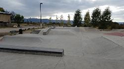
4.0 miles SWThis is a great concrete skatepark and small mountain bike park with great features, both natural and wooden. There's a great pavilion right next to the skatepark and parking lot. While...
Mountain Bike, Skateboard 3.9 mi
Three Wookie Trail
Driggs, Idaho
4.3 miles SWMountain Bike near Driggs, Idaho
Mountain Bike 4.0 mi
Quakie Ridge
Moose, Wyoming
4.4 miles NETrail starts at the base ski area on a service road then heads out on nice single track. Trail winds through meadows of wildflowers. Some minor altitude gain along the trail. The...
Mountain Bike 2.1 mi
Buffalo Soldier
Moose, Wyoming
4.4 miles NETrail is a nice loop, all singletrack, with about 300' of elevation gain. Trail is about 1.8 miles one way. You can also use it as a connector to Mill Creek or lightning loop. Buffalo...
Mountain Bike 1.9 mi
Perm-a-grin
Moose, Wyoming
4.5 miles NEPerma Grin is guaranteed to fix a smile on your face indefinitely! This swooping, flowing, smooth singletrack descends the hillside above Rick's Basin.
Mountain Bike 1.1 mi
More Cowbell
Moose, Wyoming
4.5 miles NEThis singletrack trail winds through aspens, high alpine meadows and old growth conifers.
Mountain Bike 0.6-4.0 mi
Grand Targhee XC Park
Moose, Wyoming
4.5 miles NEMountain Bike 1.7 mi

Rick's Basin
Driggs, Idaho
4.9 miles NEMountain Bike near Driggs, Idaho
Mountain Bike
Badger Creek
Tetonia, Idaho
9.3 miles NWBadger Creek is a stream located just 13.6 miles from Ashton, in Teton County, in the state of Idaho, United States, near France, ID. Whether you’re spinning, baitcasting or fly fishing your...
Camp, Cross-country Ski, Hike, Mountain Bike, Rock Climb
Big Hole Crest Trail
Driggs, Idaho
9.7 miles SWThis is a tough ride. Definately for advanced riders. Lots of climbing and descending. The trail at either end is well used and really fun. Not too much technical riding, just fun...
Mountain Bike
Twin Creek Trail
Driggs, Idaho
10.3 miles WThe Twin Creek trail is 2.3 miles long. It begins at Trail 6195 and ends at Trail 6219. source: fs.usda.gov
Mountain Bike
Victor Bike Park
Victor, Idaho
11.3 miles SThe Victor Bike Park is home to a progressive jump line, pumptrack, and more stunts.
Mountain Bike
Henderson Canyon
Victor, Idaho
11.8 miles SWTrail begins as dirt road/double track with numerous "cow" trails breaking off of road. Some of these trails see more tire tracks than others.
Mountain Bike
Sharks Belly
Driggs, Idaho
12.3 miles WTrail system can start from Channel lock or Bovine. Channel Lock is an easier climb than Bovine. This description and mileage starts at the Channel Lock trail, forest service boundary marker. Take...
Mountain Bike
Southbound
Driggs, Idaho
12.3 miles WTrail starts by going up the Channel lock trail. At the top of Channel Lock go right onto the Southbound trail. Trail will loop back to Channel lock which you take back to your car. Trail is...
Mountain Bike


