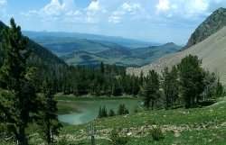
Lake Marie
Island Park, Idaho
| Address: | Sawtell Peak Rd, Island Park, ID 83429, USA |
| GPS: |
44°33'14.9"N 111°26'42.6"W Maps | Directions |
| State: | Idaho |
| Trail Length: | 9.00 miles |
| Trail Type: | Out & Back |
| Hike Difficulty: | Beginner |
| Trails/Routes: | 4.2 mi |
Backpack and Hike
Lake Marie sits on the North slope of Mount Jefferson in Fremont County, Idaho. The trail to get there cuts back and forth across the Idaho Montana border 4 times. Much of the trail is fairly flat along the ridge of the Continental Divide with mild ups and downs going each way. When the ridge begins to ascend toward Mount Jefferson, the trail vears North as it works it way across Jefferson. You'll go down some switchbacks through the trees which is about the only real shade on the trail. Then you'll travel West through a meadow full of wildflowers of all colors. After the meadow, you'll follow along the rocky trail across the Northern slope until it does a sharp turn to go back East. From there, there are a couple of options but essentially, you just need to head North until you see Rock Creek and ultimately drop in to Lake Marie.
Once you reach the lake, there is a beautiful meadow. with the trickling rock creek coming into it and another small stream leading out of it. Because Lake Marie is so freshly fed by the snowmelt from Mount Jefferson, the size varies dramatically between spring and fall but one thing will be constant: the water is cold.
More Information
Add ResourceBe courteous, informed, and prepared. Read trailhead guidelines, stay on the trail, and don't feed the wildlife.
Read MoreDirections
From Island Park, Idaho
- Head north on US-20 E toward Forest Rd 139 (7.1 mi)
- Turn left onto Sawtelle Peak RdDestination will be on the left(9.7 mi)
endovereric
9/1/17 11:50 amTrails
Distance ?
4.2 milesElevation Gain ?
-303 feetReal Ascent ?
902 feetReal Descent ?
1,205 feetAvg Grade (-1°)
-1%Grade (-22° to 24°)
-40% to 45%Elevation differences are scaled for emphasis. While the numbers are accurate, the cut-away shown here is not to scale.
Other Hiking Trails and Backpacking Trails Nearby
Mount Jefferson
Island Park, Idaho
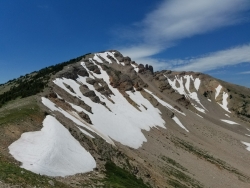
0.0 miles SMount Jefferson, at 10, 203 feet is the highest point in the Centennial Mountains, a small, local range on the border of Idaho and Montana a little west of Yellowstone. These mountains consist of a...
Hike 5.8 mi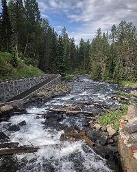
Box Canyon Trail
Island Park, Idaho
10.0 miles SVarious species of tress and wildflowers can be seen on the trail, as well as songbirds, waterfowl and occasional wildlife. The trail is open for the following uses: Motorcycle Trail Riding, Off...
Hike, Mountain Bike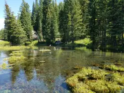
Big Springs
Island Park, Idaho
10.1 miles SEThere's also a great little walking trail along the river with placards that tell about the ecosystem and history of the area. There's about a 1/2 mile that's paved and then a 1/2 mile...
Camp, Hike 0.6-4.7 mi
Harriman State Park
Island Park, Idaho
16.0 miles SHarriman State Park is found 38 miles from Yellowstone along Henry's Fork. This 11,000-acre wildlife refuge is open year round for most activities. In addition to having beautiful scenery and...
Cross-country Ski, Hike, Horseback, Mountain Bike, Snowshoe 4.8 mi
Aldous Lake and Hancock Lake
Kilgore, Idaho
19.8 miles WA pair of alpine lakes near Kilgore, Idaho. Good road all the way to the trailhead. Easy to moderate 1.5mi hike to the first lake (Aldous) and another mile of moderate hiking to Hancock. Beautiful...
Backpack, Camp, Hike, Horseback, Swim
Sheep Falls on Henry's Fork
Island Park, Idaho
24.6 miles SSheep Falls cascades approximately 25' through a narrow basalt chute on the North Fork of the Snake River near Island Park, Idaho. Compared to nearby Lower and Upper Mesa Falls, that height may...
Hike 14.8 mi
Biscuit Basin to Fairy Falls and Firehole Meadows
Old Faithful, Yellowstone National Park
25.9 miles EFreight Road trail is a almost 15 mile hike that leaves from Biscuit Basin or Fountain Flats Drive. This hike is a beautiful remote hike that passes several unique landmarks, breaking up this hike...
Backpack, Camp, Hike
Mesa Falls
Ashton, Idaho
25.9 miles SUpper Mesa Falls, aka Big Falls, is an absolutely awesome waterfall on the Henrys Fork of the Snake River. The falls drop 114 ft. and measure 300 ft. across. To get to the falls from the parking lot...
Cross-country Ski, Hike, Kayak
Pine Butte / The Caldera
St. Anthony, Idaho
27.4 miles SWThis is about as close to an oasis as you can get in the deserts of Idaho. It's an old volcano in the middle of the sagebrush desert. As soon as you start down the path, you can feel the air...
Camp, Hike, Horseback 17.5 mi
Tear Drop Lake
Ashton, Idaho
27.7 miles SENestled in the Targhee National Forest just off of Ashton's Fish Creek Road, this tear drop shaped lake is a family adventure waiting to happen. The lake isn't very big but it is teeming with...
Camp, Canoe, Hike, Kayak, Mountain Bike, Swim 0.8 mi
Harlequin Lake Trail
Madison, Yellowstone National Park
28.1 miles EHarlequin Lake Trail is a beautiful short hike that can be taken in under an hour. This scenic hike is easy and family friendly, making it the perfect activity to add to any Yellowstone visit....
Hike 0.3-0.6 mi
Bear Gulch
Ashton, Idaho
28.9 miles SBear Gulch is an abandoned ski hill out of operation since 1969. While the vegetation is beginning to take over, there's still some great sledding to be had. It's just far enough into the...
Camp, Cross-country Ski, Hike, Sled 0.3-0.5 mi
Mystic Falls
Old Faithful, Yellowstone National Park
29.6 miles EMystic Falls is a 70-foot cascading waterfall on Little Firehole River. The area around the falls is quiet and beautifully forested. Mystic Falls is a lesser known spot in Yellowstone National Park....
Hike 6.1 mi
Purple Mountain Trail
Madison, Yellowstone National Park
29.7 miles EPurple Mountain Trail is a 6 mile out and back trail to the peak of purple mountain. This is a beautifully forested trail with little foot traffic is a quiet respite from the crowds of...
Hike
Sentinel Meadows & Queen's Laundry
Madison, Yellowstone National Park
30.0 miles EThe hike to Sentinel Meadows and Queens Laundry gives you a level trail with wide open meadows, hot springs, ponds, birds, and a little bit of Yellowstone National Park history. The trail can be done...
Hike 0.7 mi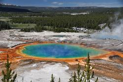
Grand Prismatic Spring
Old Faithful, Yellowstone National Park
30.1 miles EThe Grand Prismatic Spring in Yellowstone National Park is the largest hot spring in the United States, and the third largest in the world, after Frying Pan Lake in New Zealand and Boiling Lake...
Hike 0.3-5.0 mi
Fairy Falls
Old Faithful, Yellowstone National Park
30.3 miles EFairy Falls is something out of a fantasy novel. Fairy Falls is a wonderful portion of Yellowstone. It has stolen the hearts of many who have had a little pixie dust sprinkled on them...
Hike 2.0 mi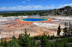
Grand Prismatic Spring Overlook Trail
Old Faithful, Yellowstone National Park
30.3 miles EThe Grand Prismatic Spring Overlook Trail gives hikers an opportunity to see the famous aerial view of the Grand Prismatic Spring. The vibrant rainbow waters of the Grand Prismatic Spring are...
Hike 3.2-47.0 mi
Yellowstone Branch Line Trail
Ashton, Idaho
30.7 miles SYellowstone branch line trail runs from Warm River to the Montana border totaling 39 miles. There are a few places to jump on and off the trail as well as a few smaller trails that branch off of this...
Backpack, Cross-country Ski, Hike, Horseback, Mountain Bike
Old Faithful Geyser
Old Faithful, Yellowstone National Park
31.1 miles EOld Faithful is a cone geyser located in Yellowstone National Park in Wyoming, United States. It was named in 1870 during the Washburn-Langford-Doane Expedition and was the first geyser in the park...
HikeNearby Campsites

Upper Coffee Pot Campground
Island Park, Idaho
5.8 miles SEUpper Coffeepot Campground stretches along a floatable section of Henry's Fork of the Snake River. A mixed growth lodgepole pine forest provides partial shade and summer wildflowers are...
Camp, Canoe 0.9 mi
Buffalo River Campground
Island Park, Idaho
9.6 miles SEThe float here is nice and easy. It's a great early season float. Later in the season the shallow spots will force you to walk a good chunk of the float. The water is super clear and often pretty...
Camp, Canoe, Kayak, Swim
Big Springs
Island Park, Idaho
10.1 miles SEThere's also a great little walking trail along the river with placards that tell about the ecosystem and history of the area. There's about a 1/2 mile that's paved and then a 1/2 mile...
Camp, Hike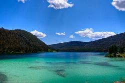
Wade Lake
Cameron, Montana
18.5 miles NCamp, Canoe, Kayak, and Swim near Cameron, Montana
Camp, Canoe, Kayak, Swim 4.8 mi
Aldous Lake and Hancock Lake
Kilgore, Idaho
19.8 miles WA pair of alpine lakes near Kilgore, Idaho. Good road all the way to the trailhead. Easy to moderate 1.5mi hike to the first lake (Aldous) and another mile of moderate hiking to Hancock. Beautiful...
Backpack, Camp, Hike, Horseback, Swim 14.8 mi
Biscuit Basin to Fairy Falls and Firehole Meadows
Old Faithful, Yellowstone National Park
25.9 miles EFreight Road trail is a almost 15 mile hike that leaves from Biscuit Basin or Fountain Flats Drive. This hike is a beautiful remote hike that passes several unique landmarks, breaking up this hike...
Backpack, Camp, Hike
Pine Butte / The Caldera
St. Anthony, Idaho
27.4 miles SWThis is about as close to an oasis as you can get in the deserts of Idaho. It's an old volcano in the middle of the sagebrush desert. As soon as you start down the path, you can feel the air...
Camp, Hike, Horseback 17.5 mi
Tear Drop Lake
Ashton, Idaho
27.7 miles SENestled in the Targhee National Forest just off of Ashton's Fish Creek Road, this tear drop shaped lake is a family adventure waiting to happen. The lake isn't very big but it is teeming with...
Camp, Canoe, Hike, Kayak, Mountain Bike, Swim 0.3-0.6 mi
Bear Gulch
Ashton, Idaho
28.9 miles SBear Gulch is an abandoned ski hill out of operation since 1969. While the vegetation is beginning to take over, there's still some great sledding to be had. It's just far enough into the...
Camp, Cross-country Ski, Hike, Sled
Madison Campground
Madison, Yellowstone National Park
29.1 miles EMadison Campground is named for its proximity to the Madison River, which runs through the area in a lush mountain setting rich in wildlife. Madison Campground is at an elevation of 6,800’ and...
Camp
Warm River Campground
Ashton, Idaho
30.7 miles SWarm River Campground is located nine miles northeast of Ashton, Idaho, along the slow-moving Warm River at an elevation of 5,200 feet. Willows line the riverbanks and pine trees offer partial...
Camp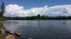
Horseshoe Lake
Ashton, Idaho
32.0 miles SEHorseshoe Lake is hidden back in the Targhee National Forest. It's a beautiful lake with plenty of lily pads. The road to get there is well maintained and there are many options for pull-outs...
Camp, Canoe, Dive, Swim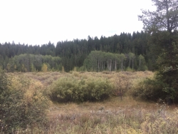
Porcupine Creek
Ashton, Idaho
34.1 miles SPorcupine Creek is a hunting, fishing, camping, and swimming spot near Ashton, Idaho in Fremont County within Targhee National Forest. It's surrounded by forests, meadows, and a creek...
Camp, Swim
Cave Falls of Yellowstone
Ashton, Idaho
36.0 miles SEThis campgrond is situated on the banks of Fall River in Wyoming along the south border of Yellowstone National Park. Cave Falls Campground has 23 single site units and a terrific area for...
Camp, Hike
Sheep Falls on Fall River
Ashton, Idaho
37.1 miles SEThe lesser known Sheep Falls on Fall River is a local treasure off of Cave Falls road. There are primitive campsites and beautiful views for a great picnic spot. The water splits and comes down in...
Camp
Norris Campground
Norris, Yellowstone National Park
38.9 miles ENorris campground is centrally located in Yellowstone National Park and offers a good spot for those planning to visit many of the most famous features in Yellowstone. Norris is a relatively short...
Camp
Loon Lake
Ashton, Idaho
39.1 miles SECamp, Kayak, and Swim near Ashton, Idaho
Camp, Kayak, Swim
Stoddard Creek
Spencer, Idaho
39.2 miles WStoddard Creek Campground is located just 1 mile off I-15 and 17 miles north of the town of Dubois, Idaho. Visitors come to the area to enjoy the abundance of trails, wildlife viewing opportunities...
Camp
Indian Creek Campground Yellowstone
Mammoth Hot Springs, Yellowstone National Park
41.5 miles NEIndian Creek Campground is a quiet and secluded wooded campground within Yellowstone National Park, ideal for tent campers. It’s close to lots of hiking and fishing, and only a few miles to...
Camp 1.5-3.8 mi
Little Gibbon Falls
Norris, Yellowstone National Park
41.6 miles EIce Lake and Little Gibbon Falls Loop is a 4.5 mile loop trail located near Yellowstone National Park, Wyoming. The trail is good for all skill levels and primarily used for hiking, but there are...
Camp, Canoe, Hike


