


Map of 4 Hiking Trails near Yorktown Heights, New York
first prev 1 next lastShowing Hiking Trails within 50 miles Distance miles of Yorktown Heights, NY 10598, USA City, Zip, or Address
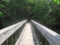
Steep Rock
Washington, Connecticut
31.5 miles NEFrom Judd's Bridge, follow the road towards Washington and Steep Rock, go straight on the road that is perpendicular to the bridge. Follow it up into a curve and on the left there is a house with...
Hike, Mountain Bike
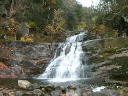
Kent Falls State Park
Kent, Connecticut
39.5 miles NEPer the CT Dept of Energy and Environmental Protection: When the parking lot has reached capacity, the park is closed. It will reopen when the lot has 10 available spaces. Please note that there is...
Hike 0.3 mi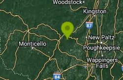
Stony Kill Falls
Kerhonkson, New York
41.5 miles NWStony Kill Falls is a unique and hidden waterfall in the Shawangunks. Known mostly to locals this uncrowded area is the perfect place to visit to reconnect with nature. The hike to the...
Hike, Swim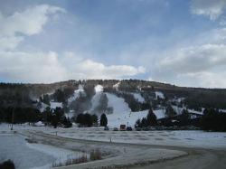
Mohawk Mountain State Park
Cornwall, Connecticut
45.8 miles NEmostly logging roads, can be ridden rigid. Climb to the top of mohawk mountain and back down. Lots more to be explored, this is a good 15 miles and 1.5 hours of riding.1) at the dead end first road...
Cross-country Ski, Hike, Mountain Bike


