


Map of 31 Hiking Trails near Yarnell, Arizona
first prev 1 2 next lastShowing Hiking Trails within 50 miles Distance miles of Yarnell, AZ, USA City, Zip, or Address

Granite Mountain Hotshots Memorial
Yarnell, Arizona
2.0 miles SWFrom the Observation Deck, you can see the Fatality Site 400’ below and the Town of Yarnell to the east. Additional interpretive signage outlines the tragic events of the Yarnell Hill Fire. A...
Hike 0.1-7.8 mi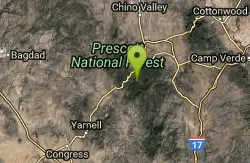
Wolf Creek Falls
Sedona, Arizona
22.7 miles NEWolf Creek Falls is a wonderful space to explore and be immersed in nature. With it's six miles of trails, beautiful waterfalls and two campgrounds this is the perfect place to spend a...
Camp, Hike, Swim

Discovery Trail
Peoria, Arizona
41.4 miles SEDiscovery Trail is a path within Peoria, Arizona for residents of Vistancia. This concrete paved, 3.5 mile path meant for walking, running, and biking. Yoga, stargazing, and picnicking are...
Hike
West Wing Mountain Advanced Trail
Peoria, Arizona
44.3 miles SEHike near Peoria, Arizona
Hike
Sunrise Mountain Trail
Peoria, Arizona
44.5 miles SEThe Sunrise Mountain Trail can be found within the suburban area of Peoria, Arizona; it is made of up 3 sequential loops; each loop harder than the last. The trail is easy to find, as...
Hike, Mountain Bike
Mule Deer Trail (Maricopa Trail)
Waddell, Arizona
46.1 miles SMule Deer trail is a 3.5 mile out-and-back trail that it part of the Maricopa Trail within White Tank Mountain Regional Park. This is a beginner to moderate friendly trail for both hikers and...
Hike, Horseback, Mountain Bike
Wildlife Trail
Waddell, Arizona
46.1 miles SA short trail which terminates at a small pond.
Hike, Horseback
Black Rock Loop Trail
Waddell, Arizona
46.3 miles SBlack Rock Trail is a 1.3 mile loop trail located near Waddell, Arizona and is good for all skill levels. The trail is primarily used for hiking and is accessible year round. Black...
Hike
Goat Camp Trail
Buckeye, Arizona
47.2 miles SGoat Camp Trail is a well-liked mountain biking and hiking trail in White Tank Mountain Regional Park. This is a 16 mile out-and-back trail that is rated as advanced due to the length, as well as the...
Hike, Mountain Bike
South, Bajada, Mule Deer Loop Trail
Waddell, Arizona
47.5 miles SSouth - Bajada - Mule Deer Loop is a 4.1 mile loop trail located near Waddell, Arizona that offers the chance to see wildlife. The trail is rated as moderate and is accessible from...
Hike, Horseback, Mountain Bike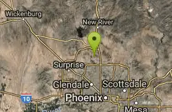
Deem Hills Circumference Trail
Phoenix, Arizona
47.7 miles SEDeem Hills s a 10.5 mile loop trail located near Phoenix, Arizona. The trail is rated as moderate and primarily used for mountain biking.
Hike, Horseback, Mountain Bike
Deem Hills Circumference Trail with Summit
Phoenix, Arizona
47.8 miles SEDeem Hills is one of the newer parks in Phoenix to open (2010) and as such a lot of people still don't know it's there. This means that it has much more of a secluded feel then some of...
Hike
Sidewinder-Ocotillo-West Loop
Phoenix, Arizona
48.1 miles SEThis loop starts at Carefree Hwy and 7th Ave, be aware there is limited parking at the trailhead. The Ocotillo part of the trail is relatively flat and the Sidewinder part has some good...
Hike, Horseback, Mountain Bike
Tower Road - Sonoran Preserve
Phoenix, Arizona
48.1 miles SEShort and steep (.6 mile each way) out and back asphalt road to the radio tower.
Hike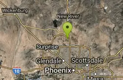
Deem Hills Inner Loop
Phoenix, Arizona
48.4 miles SEHike and Mountain Bike near Phoenix, Arizona
Hike, Mountain Bike
Palisade to Basalt to Circumference Trail Loop
Phoenix, Arizona
48.4 miles SEHike near Phoenix, Arizona
Hike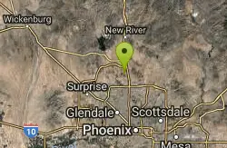
Deem Hills East Trail
Phoenix, Arizona
48.4 miles SEDeem Hills is one of the newer parks in Phoenix to open (2010) and as such a lot of people still don't know it's there. This means that it has much more of a secluded feel then some of...
Hike
Bobcat Trail - Sonoran Preserve
Phoenix, Arizona
48.5 miles SEBobcat Trail is a short, easy trail, often used for connecting to other bigger trails in the Sonoran Desert Preserve. This is a 2 mile out-and back trail. There isn't much of a parking...
Hike
H-1 to H-4 Trails Loop
Glendale, Arizona
48.8 miles SEThunderbird Park in Glendale, AZ consists of 5 H-Trails, named so because of the Hedgpeth Hills through which they wind. H-1: One-Way - 5.0 miles H-1a: Loop trail - 2.5 miles - 400...
Hike, Mountain Bike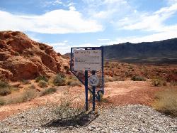
Arrowhead Point Trail
Glendale, Arizona
48.8 miles SEArrowhead Trail is a 2.4 mile hiking and mountain biking trail within Thunderbird Conservation Park. This trail is manageable enough for beginners, but offers enough challenge for more experienced...
Hike, Mountain Bike


