


5 Hiking Trails near Stearns, Kentucky
first prev 1 next lastShowing Hiking Trails within 50 miles Distance miles of Stearns, KY, USA City, Zip, or Address
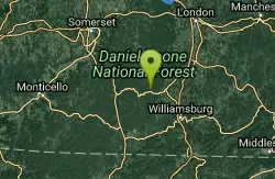
Dog Slaughter Falls
Williamsburg, Kentucky
14.3 miles NEDog Slaughter Falls is a beautiful 15-foot waterfall in the Danial Boone National Forrest. Despite it's less than pleasant name this is the perfect place to play for a picturesque day. The...
Hike, Swim 1.0 mi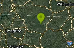
Gentleman's Swimming Hole
Oneida, Tennessee
17.5 miles SWGentleman's Swimming Hole is a popular hike and swimming hole in Big South Fork National Forrest. This section of the Clear Fork River Runs slow and is deep enough for an actual...
Hike, Swim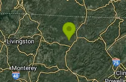
Big South Fork Area
Helenwood, Tennessee
23.1 miles SBig South Fork is a National Recreation Area that straddles the boarder between Kentucky and Tennessee. This large park provides miles of trails, forests and riverfront making it the perfect place to...
Camp, Hike, Swim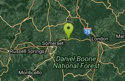
Short Creek
Somerset, Kentucky
31.3 miles NShort Creek is well known for being the shortest creek in the world. This is a 150 foot section of creek that emerges from an underground river. The water flowing from underground make this water...
Cave, Hike, Swim
Clear Creek
Lebanon, Kentucky
41.6 miles EClear Creek is a wide multi-purpose trail that follows a beautiful creek. This trail is open to hikers, runners, mountain bikers, fishermen, horse back riders and off-road vehicles under 50 inches....
Hike, Horseback, Mountain Bike, Swim


