Map of 130 Hiking Trails near Queen Creek, Arizona
first prev 1 2 3 4 5 6 7 next lastShowing Hiking Trails within 50 miles Distance miles of Queen Creek, AZ, USA City, Zip, or Address

Riparian Preserve at Water Ranch Trail
Gilbert, Arizona
9.9 miles NWThe Riparian Preserve is an urban park with a series of loop trails surrounding seven ponds stocked with fish and birds. It is located at 2757 E. Guadalupe Road, Gilbert AZ. Several...
Canoe, Hike
Crismon Wash Trail
Mesa, Arizona
14.1 miles NThe Crismon Wash Trail is 1.8 mile trail that is accessible from the south at the Crismon road trailhead. It is also accessible from the Blevins train to the north. There are several...
Hike, Horseback, Mountain Bike 1.7 mi
Levee Trail
Mesa, Arizona
14.5 miles NLocated within the Usery Mountain Regional Park, the Levee trail is named so because it mostly follows the top of levee, running parallel to a large section of the channel trail and a Phoenix...
Hike, Horseback, Mountain Bike 1.5 mi
Moon Rock Loop
Apache Junction, Arizona
14.9 miles NLocated within the larger Usery Mountain Regional Park, the Moon Rock loop is a fast and smooth trail that adds 1.3 miles to the more famous Blevins Trail. Although the Moon Rock loop is not known as...
Hike, Horseback, Mountain Bike
Buckhorn Campground Nature Trail
Apache Junction, Arizona
15.6 miles NCamp and Hike near Apache Junction, Arizona
Camp, Hike
Desert Trails Bike Park
Mesa, Arizona
15.7 miles NHike and Mountain Bike near Mesa, Arizona
Hike, Mountain Bike
Siphon Draw Trailhead to Flatiron
Apache Junction, Arizona
17.1 miles NEThe Siphon Draw Trail up to Flatiron is a beautiful trail within the Lost Dutchman State Park. It is a 5.5 mile, there and back trail near Apache Junction, Arizona. It is a more advanced hike with...
Hike 7.5 mi
Hawe's Loop
Mesa, Arizona
18.0 miles NMost of the trails in the Phoenix metropolitan area were originally built by mountain bikers, and the Hawe's loop trail system and trail are no exeptions. This trail features fantastic...
Hike, Mountain Bike 1.5 mi
The Saddle
Mesa, Arizona
18.1 miles NSaddle trail is an intermediate mountain biking trail that connects to the greater Hawes trail network. The trail is 1.5-2mi long and it offers beautiful views of the neighboring Salt River and Red...
Hike, Mountain Bike 2.1 mi
Lower Salt River Nature Trail
Fort McDowell, Arizona
20.6 miles NThe Lower Salt River Nature Trail is a scenic walk to take at the Tonto National Forest. This trail provides stunning views as you walk alongside the Salt River. This rustic trail is older and less...
Camp, Hike
'A' Mountain at Hayden Butte
Tempe, Arizona
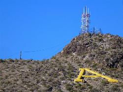
21.2 miles NW'A' Mountain aka Hayden Butte, is a popular hike in downtown in Tempe, Arizona. This hike located partially on Arizona State University's campus, is a short, easy walk, though it's...
Hike
Hayden Butte And Tempe Town Lake Trail
Tempe, Arizona
21.5 miles NWHike near Tempe, Arizona
Hike
Desert Classic - Goat Trail
Phoenix, Arizona
21.8 miles WHike and Mountain Bike near Phoenix, Arizona
Hike, Mountain Bike
South Mountain National Trail
Phoenix, Arizona
21.8 miles WThe National Trail crosses South Mountain Park from the east to the west ends and intersects with most of the other trails in the park. A very scenic hike with moderate ups and downs...
Hike, Mountain Bike 1.5 mi
Desert Classic
Phoenix, Arizona
21.8 miles WThe Desert Classic trail is just that, a classic at the South Mountain Park area. Because it is such a classic, the trail is well marked and well worn by high traffic flow of riders and hikers....
Hike, Mountain Bike
National to Hidden Valley to Mormon Loop
Phoenix, Arizona
21.8 miles WHike near Phoenix, Arizona
Hike
Pima Wash Trail to West Loop
Phoenix, Arizona
21.8 miles WHike near Phoenix, Arizona
Hike
South Mountain Trails (Desert Classic Trail)
Phoenix, Arizona
21.8 miles WHike and Mountain Bike near Phoenix, Arizona
Hike, Mountain Bike 2.1 mi
Marcos de Niza & Pima
Phoenix, Arizona
21.8 miles WIf you're looking to: get off the tourist highway trail, enjoy killer South Mountain views, take a rollercoaster for a hike with an easy stroll or jog back to the start - this is a loop you...
Hike 2.0 mi
Loma and Canal Trails
Tempe, Arizona
22.0 miles NWTrails open to mountain biking and hiking that wind through the Papago Park in Tempe, Arizona. The Loma Trail winds around lots of uphill and downhill paths, and leads to a park with a small lake and...
Hike, Mountain Bike


