


8 Hiking Trails near Palo Cedro, California
first prev 1 next lastShowing Hiking Trails within 50 miles Distance miles of Palo Cedro, CA 96073, USA City, Zip, or Address
Whiskeytown lake
Redding, California
15.2 miles WWhiskeytown Lake’s beautiful sapphire-blue waters, surrounded by mountain peaks, are perhaps the most prominent feature of the park. However, water-based recreation is only a small part of...
Hike
Whiskeytown Falls
French Gulch, California
23.5 miles WWhiskeytown Falls trail is located within Whiskeytown State Park just about 15 miles outside of Redding. The state park has a lot of activities to do, but it is also home to one of the "best...
Hike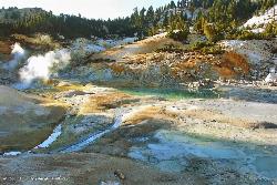
Bumpass Hell
38.7 miles E
Bumpass Hell is the largest collection of hydrothermal features in Lassen Volcanic National Park. The overall 3 mile round trip hike takes visitors around some of the hottest and largest features in...
Hike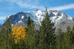
Lassen Peak
Mineral, California
39.1 miles ELassen Peak is the largest plug dome volcano in the world and the second tallest volcano in Northern California. It is situated in Lassen Volcanic National Park, one of the few places in the world...
Backpack, Hike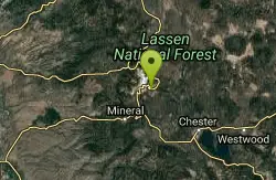
Kings Creek Falls
Shasta County, California
41.6 miles EWhile Lassen Volcanic National Park is known for its wide variety of hydrothermal features, there are a few other sights in the park worth seeing, including Kings Creek Falls. The trail is accessible...
Hike, Horseback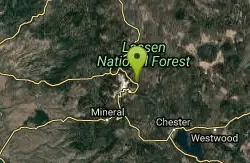
Lassen Volcanic National Park
Redding, California
42.5 miles ELassen Volcanic National Park is home to smoking fumaroles, meadows freckled with wildflowers, clear mountain lakes, and numerous volcanoes. Jagged peaks tell the story of its eruptive past while...
Backcountry Ski, Camp, Canoe, Hike, Horseback, Hot Springs, Mountain Bike, Snowshoe 0.3 mi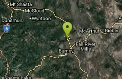
Burney Falls
Burney, California
43.7 miles NEBurney Falls has been considered one of the most spectacular waterfalls in the state. It stands at 129 feet tall and is coated by curtains of green fern. The best part about this waterfall, for many...
Hike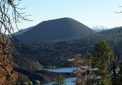
Cinder Cone and the Fantastic Lava Beds
Lassen County, California
49.2 miles EOne of the four types of volcanos found in Lassen Volcanic National Park, Cinder Cone stands at 6,907 ft elevation and 750 ft above the surrounding landscape. Cinder Cone was formed in the...
Hike


