


3 Hiking Trails near Kenosha, Wisconsin
Showing Hiking Trails within 50 miles Distance miles of Kenosha, WI, USA City, Zip, or Address
Add Location
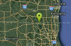
Gander
Antioch, Illinois
19.9 miles WWithin this 301-acre preserve is Lake County's highest natural elevation. Gander Mountain tops out at 957 feet above sea level. The site's 125-foot hill is the result of deposits left from...
Hike
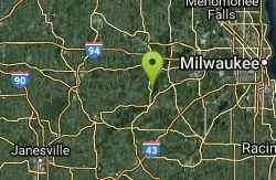
Kettle Morain South Trail Head
Dousman, Wisconsin
40.6 miles NWThe John Muir Trails combined with the Emma Carlin Trails via a connector trail system offers over 30 miles of connected mostly single-track trails in the Southern Unit of Kettle Moraine State...
Camp, Cross-country Ski, Hike, Swim
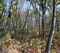
Emma Carlin Trail
Whitewater, Wisconsin
41.6 miles NWThis trail system, on County Highway Z just south of State Highway 59, goes through a hardwood forest with mostly hilly terrain. Three color coded trails ranging from 3.5 to 8 miles. Parking,...
Cross-country Ski, Hike, Mountain Bike, Snowshoe


