


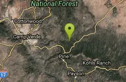
Map of 40 Hiking Trails near Happy Jack, Arizona
first prev 1 2 next lastShowing Hiking Trails within 50 miles Distance miles of Happy Jack, AZ 86024, USA City, Zip, or Address
Maxwell Trail No. 37
Happy Jack, Arizona
12.6 miles SThe Maxwell Trail leads over the Mongollan Rim down the canyon into West Clear Creek. Although still somewhat steep, it is an easier hike than shorter neighboring Tramway trail, which shares its...
Hike, Swim 0.6-2.9 mi
Tramway Trail No. 32
Happy Jack, Arizona
12.8 miles STramway Trail is a very short but very steep hike down the ridge of the Colorado Plateau to the nearby West Clear Creek. The trail crosses over the sharp edge of the Mogollan Rim, and descends to the...
Hike, Rock Climb, Swim 7.1 mi

The Crack at Wet Beaver Creek
Rimrock, Arizona
18.1 miles WThe Crack is a popular swimming hole found by hiking the Bell Trail down to Wet Beaver Creek. After following the trail for about 3.5 miles away from the parking lot, take a detour to the left just...
Dive, Hike, Horseback, Swim 1.6-3.6 mi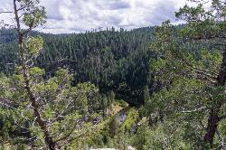
Kinder Crossing Trail #19
Happy Jack, Arizona
19.0 miles SEKinder Crossing Trail #19 travels down to the beauty of East Clear Creek, and then extends up until reaching FR 137; but many people use the trail to reach the creek waters and play in the water. The...
Hike, SwimEast Clear Creek
Happy Jack, Arizona
19.3 miles SEEast Clear Creek is a river that stretches through the Mogollon Rim area of Arizona. It provides water to the surrounding desert landscape, fishing opportunities, and various areas to hike,...
Canyoneer, Hike, Swim 8.5 mi
Munds Wagon Trail
Sedona, Arizona
19.3 miles NWMunds Wagon Trail is different from many of the other more “classic†rides around Sedona. If you come from somewhere else and are missing the feel of loose rocks...
Hike, Mountain Bike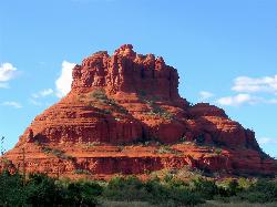
Schnebly Hill Vista Overlook
Sedona, Arizona
19.6 miles NWThe Schnebly Hill Formation is a beautiful red rock gem in Sedona, Arizona. This rock formation is considerably big, which is why it is divided into four different sections that are called...
Hike 3.4 mi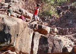
Grasshopper Point
Sedona, Arizona
21.0 miles NWGrasshopper Point is a beautiful swimming hole located in Sedona, Arizona. Grasshopper Point is the perfect place to cool off in the summer after a nice hike, or a hot summer day. This swimming...
Dive, Hike, Swim 6.0 mi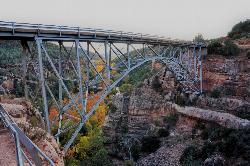
Huckaby Trail
Sedona, Arizona
21.2 miles NWOn the hunt for adventure? Established in 1998, Huckaby Trail is just the adventuresome route for both avid hikers and mountain bikers. It offers up forestry of Arizona Sycamores and picturesque...
Canoe, Hike, Mountain Bike
Midgley Bridge Trail
Sedona, Arizona
21.4 miles NWHike near Sedona, Arizona
Hike
Wilson Mountain Trail
Sedona, Arizona
21.4 miles NWHike near Sedona, Arizona
Hike 3.0 miBlodgett Basin Trail No. 31
Camp Verde, Arizona
22.0 miles SWBlodgett Basin Trail is one of a select few trails that shows off the riparian desert beauty unique to West Clear Creek Wilderness. The trail stretches from Bull Pen Trailhead through the canyon and...
Backpack, Hike, Swim
Chavez Crossing
Sedona, Arizona
22.1 miles WChavez Crossing is a campground in Sedona, Arizona. It sits perfectly nestled in Arizona's most beautiful red rock attractions along with the grand summer sunsets. If that didn't sound...
Camp, Hike, Swim
Bullpen Day Use Area
Camp Verde, Arizona
22.1 miles SWBullpen has something for everyone. Whether you park here and use the trail head to start on one of several hikes that lead down West Clear Creek, or stay nearby to use the picnic areas and...
Backpack, Dive, Hike, Swim 16.9 mi
West Clear Creek Trail No. 17
Camp Verde, Arizona
22.1 miles SWWest Clear Creek Trail No. 17 is a great way to reach the running waters of West Clear Creek. By far the most accessible and popular, it starts from the Bull Pen Ranch parking lot and winds down the...
Backpack, Hike, Swim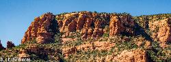
Red Rock State Park
Sedona, Arizona
23.4 miles WRed Rock in Sedona, Arizona details the beauty in the layers of sedimentary rock that has been constructed over millions of years. It is at Red Rock that you can see "Schnebly Hill...
Hike, Swim
Bearfoot Trail
Strawberry, Arizona
23.7 miles SHike and Mountain Bike near Strawberry, Arizona
Hike, Mountain Bike 0.3 mi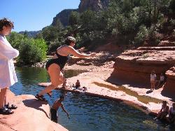
Slide Rock
Sedona, Arizona
24.0 miles NWSlide Rock is one of the most popular locations in the Sedona area. Slide Rock is natures most thrilling water slides. Slide Rock is a gargantuan 80 feet long, and 2-4 feet wide. This slippery slope...
Hike, Swim 2.2-6.1 mi
Fossil Creek Dam (Toilet Bowl)
Pine, Arizona
25.0 miles SHidden within the vast Arizona desert is an oasis of a river that brings the surrounding banks to life around it. This is Fossil Creek--one of Arizona's two designated "Wild and...
Dive, Hike, Swim 0.1-3.8 mi
Fossil Springs Trail No. 18
Pine, Arizona
25.0 miles SLocated within the Fossil Springs Wilderness, this trail leads down a canyon to the springs for which it is named. At the trailhead, there are several hikes, some of which are available for...
Hike, Horseback, Swim


