


Map of 5 Hiking Trails near Galt, California
first prev 1 next lastShowing Hiking Trails within 50 miles Distance miles of Galt, CA, USA City, Zip, or Address
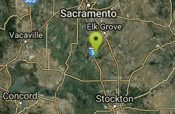
Cosumnes River Preserve
Galt, California
7.6 miles WThe Cosumnes River Preserve consists of approximately 45,859 acres of wildlife habitat and agricultural lands owned by seven land-owning Partners. The Partners include The Nature Conservancy,...
Canoe, Hike
New Hogan Lake
Valley Springs, California
27.0 miles EBackpack, Camp, Hike, and Swim near Valley Springs, California
Backpack, Camp, Hike, Swim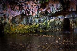
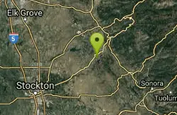
Natural Bridges
Sonora, California
47.2 miles ENatural Bridges is well known among the locals of Calaveras County. Calavers itself has many caverns throughout the mountains, but most are fee based. Natural Bridges however, is open to the...
Hike, Swim 1.2-2.7 mi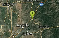
Lake Clementine Trail Loop
Auburn, California
47.9 miles NLocated in Auburn, California, Lake Clementine Trail Loop is a hike along the North Fork American River is an easy to moderate trail with an elevation gain of 785 ft. It's wheelchair...
Camp, Canoe, Hike, Kayak, Mountain Bike, Swim 5.6 mi
Quarry Trail
Cool, California
48.0 miles NThis is a hike along the river and an old, historic railway. The trail leads you to a a beautiful amphitheater carved from limestone.You are surrounded by beautiful nature and peaceful...
Hike


