Map of 32 Hiking Trails near Dubois, Idaho
Showing Hiking Trails within 50 miles Distance miles of Dubois, ID 83423, USA City, Zip, or Address
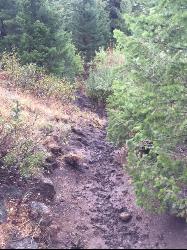
Pine Butte / The Caldera
St. Anthony, Idaho
21.1 miles EThis is about as close to an oasis as you can get in the deserts of Idaho. It's an old volcano in the middle of the sagebrush desert. As soon as you start down the path, you can feel the air...
Camp, Hike, Horseback
Webber Creek
Dubois, Idaho
26.0 miles NW7000-foot elevation. A dispersed area with a trailhead, the only amenity is a toilet. Picnicking. The Webber Creek Trail departs from here, and heads west toward Scott Peak. Fishing in the creek....
Backpack, Camp, Hike, Horseback, Hot Springs, Mountain Bike 2.1-2.3 mi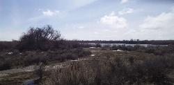
Market Lake Wildlife Management Area
Roberts, Idaho
28.2 miles SMallards, Canada geese, canvasbacks, cinnamon and green-winged teal, northern shovelers and ruddy ducks are common waterfowl species nesting and raising broods on the WMA. Several thousand...
Hike, Horseback 0.6-2.0 mi
North Menan Butte ('R' Mountain)
Menan, Idaho
29.6 miles SEThe North Menan Butte is more commonly known to the locals and college students as R Mountain. Many kids know it better as Ou'R' Mountain. The butte is a rare and unique geological area and provides...
Camp, Cave, Hike 4.8 mi
Aldous Lake and Hancock Lake
Kilgore, Idaho
29.9 miles NEA pair of alpine lakes near Kilgore, Idaho. Good road all the way to the trailhead. Easy to moderate 1.5mi hike to the first lake (Aldous) and another mile of moderate hiking to Hancock. Beautiful...
Backpack, Camp, Hike, Horseback, Swim
Henry's Fork Green Way (St. Anthony Green Belt)
Saint Anthony, Idaho
30.6 miles SEThis is a great walk along the river. While it is nestled right next to the highway, the closeness and beauty of the river flowing on the other side of the trail more than make up for it. Halfway...
Hike 0.1-0.5 mi
Eagle Park
Rexburg, Idaho
32.0 miles SEEagle Park is a little urban oasis. Once you drive in to this cottonwood forest along the river, you may forget that you're still inside Rexburg city limits. You can camp, picnic, throw rocks in...
Camp, Hike, Mountain Bike, Sled 0.1-2.3 mi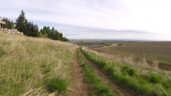
Hidden Valley Trails
Rexburg, Idaho
33.7 miles SERight on the edges of town outside of the Hidden Valley subdivision, you'll find this fun little set of trails that's pretty good for mountain bikes. It is mostly a dirt bike...
Hike, Mountain Bike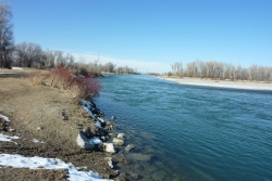
Lorenzo Boat Ramp
Rigby, Idaho
35.1 miles SEHike and Kayak near Rigby, Idaho
Hike, Kayak 1.0-1.3 mi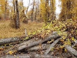
Lorenzo Bridge
Rexburg, Idaho
35.6 miles SEThis is the old site of the Lorenzo Boat Launch, which has moved to the other side of the river a little further downstream. This spot sees very little traffic. There are beautiful, yet...
Airsoft, Hike, Paintball 0.6-4.7 mi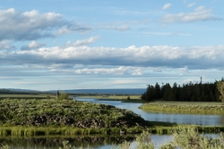
Harriman State Park
Island Park, Idaho
39.4 miles EHarriman State Park is found 38 miles from Yellowstone along Henry's Fork. This 11,000-acre wildlife refuge is open year round for most activities. In addition to having beautiful scenery and...
Cross-country Ski, Hike, Horseback, Mountain Bike, Snowshoe
Sheep Falls on Henry's Fork
Island Park, Idaho
41.2 miles ESheep Falls cascades approximately 25' through a narrow basalt chute on the North Fork of the Snake River near Island Park, Idaho. Compared to nearby Lower and Upper Mesa Falls, that height may...
Hike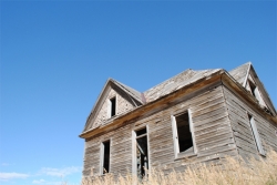
Herbert Idaho Ghost Town
Ririe, Idaho
43.2 miles SECLOSED. Private property marked NO TRESPASSING. Herbert is a small ghost town that was operated until the 40s, but with the invention of the automobile, it was much more convenient to live in Rexburg...
Hike 0.3-0.6 mi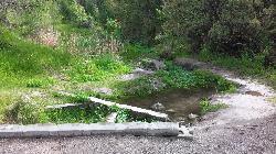
Cress Creek Nature Trail
Rexburg, Idaho
44.0 miles SEMeandering along the scenic South Fork of the Snake River, the beautiful 1¼ mile Cress Creek Nature Trail will lead you on a journey through sagebrush-grass communities, over juniper covered...
Hike 0.8 mi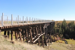
Conant Creek Pegram Truss Railroad Bridge
Ashton, Idaho
44.1 miles EAs part of the Rails to Trails project, this old railroad bridge has been transformed into a very safe little viewing experience for the whole family. You can drive right up to the bridge where there...
Hike
17 Mile Cave
Idaho Falls, Idaho
44.3 miles SSeventeen Mile Cave is a lava tube, a cave created by the pocket in which lava used to flow and was left empty when the volcano became inactive. The cave gets its name from its location, just 17...
Cave, Hike 0.9 mi
Hell's Half Acre Lava Walk
Blackfoot, Idaho
44.3 miles SThe Lava Trails traverse the desert of the Snake River Plain through contorted landscapes created from multiple lava flows. These Hawaiian-type lava flows are associated with the stretching of the...
Hike 5.8 mi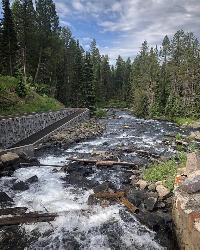
Box Canyon Trail
Island Park, Idaho
44.6 miles EVarious species of tress and wildflowers can be seen on the trail, as well as songbirds, waterfowl and occasional wildlife. The trail is open for the following uses: Motorcycle Trail Riding, Off...
Hike, Mountain Bike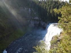
Mesa Falls
Ashton, Idaho
44.8 miles EUpper Mesa Falls, aka Big Falls, is an absolutely awesome waterfall on the Henrys Fork of the Snake River. The falls drop 114 ft. and measure 300 ft. across. To get to the falls from the parking lot...
Cross-country Ski, Hike, Kayak 3.2-47.0 mi
Yellowstone Branch Line Trail
Ashton, Idaho
45.8 miles EYellowstone branch line trail runs from Warm River to the Montana border totaling 39 miles. There are a few places to jump on and off the trail as well as a few smaller trails that branch off of this...
Backpack, Cross-country Ski, Hike, Horseback, Mountain Bike


