Map of 10 Hiking Trails near Cameron, Ennis, Montana
first prev 1 next lastShowing Hiking Trails within 50 miles Distance miles of Cameron, Ennis, MT 59720, USA City, Zip, or Address

Ousel Falls
Gallatin Gateway, Montana
16.3 miles EOusel Falls Park Trail is a 1.7 mile out and back trail located near Big Sky, Montana that features a waterfall. The trail is primarily used for hiking and is accessible from May until October.
Hike, Rock Climb, Swim
Daly Creek
Gallatin Gateway, Montana
28.4 miles EDaly Creek Trail is a 5.2 mile out and back trail located near Gallatin Gateway, Montana and is good for all skill levels. The trail is primarily used for hiking and is accessible from May until...
Hike 10.1 mi
Sky Rim Trail to Sheep Mountain
Big Sky, Montana
29.9 miles SESky Rim Trail to Sheep Mountain is a challenging hike with stunning and famous views. This 10 mile out-and-back trail starts at Dailey Creek Trailhead (WK1). The trail follows Dailey Creek over...
Backpack, Hike
Hyalite Creek Trail
Gallatin Gateway, Montana
37.9 miles NESummer activities are on a timeshare basis, with specific days and activities listed at the trailhead. The entire trail is 11 miles, with eleven waterfalls along the trail! Bear...
Hike, Horseback, Mountain Bike 0.4-3.9 mi
Lewis & Clark Caverns Trails
Whitehall, Montana
43.8 miles NLewis & Clark Caverns State Park is a 3,000-acre park with over 10 miles of trails open to hikers and mountain bikers. It is easy to be one with nature as you explore these adventurous trails....
Hike, Mountain Bike 1.0 mi
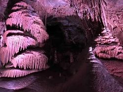
Lewis & Clark Caverns
Whitehall, Montana
44.8 miles NThe Lewis & Clark Caverns State Park encompasses 3,015 acres that you can explore by foot, on a bike, in a canoe or in a tent. The most famous feature of the park is the Lewis & Clark...
Camp, Canoe, Cave, Hike, Mountain Bike 4.2 mi
Lake Marie
Island Park, Idaho
46.3 miles SLake Marie sits on the North slope of Mount Jefferson in Fremont County, Idaho. The trail to get there cuts back and forth across the Idaho Montana border 4 times. Much of the trail is fairly flat...
Backpack, Hike 7.6 mi
Mount Jefferson
Island Park, Idaho
46.3 miles SMount Jefferson, at 10, 203 feet is the highest point in the Centennial Mountains, a small, local range on the border of Idaho and Montana a little west of Yellowstone. These mountains consist of a...
Hike 4.8 mi
Aldous Lake and Hancock Lake
Kilgore, Idaho
48.7 miles SA pair of alpine lakes near Kilgore, Idaho. Good road all the way to the trailhead. Easy to moderate 1.5mi hike to the first lake (Aldous) and another mile of moderate hiking to Hancock. Beautiful...
Backpack, Camp, Hike, Horseback, Swim 7.9 mi
Rescue Creek Trail
Mammoth Hot Springs, Yellowstone National Park
49.8 miles ERescue Creek Trail is an 8 mile hike that crosses the Montana/Wyoming boarder. This double trail makes for a leisurely hike through beautiful hills and colorful yellow green grasslands. This trail,...
Hike


