


Map of 5 Hiking Trails near Boulder, Wyoming
first prev 1 next lastShowing Hiking Trails within 50 miles Distance miles of Boulder, WY 82923, USA City, Zip, or Address
Fremont Peak
Pinedale, Wyoming
17.9 miles NFremont Peak is the third highest peak in Wyoming and straddles the boundary between Fremont and Sublette counties. It is named for American explorer John C. Fremont who climbed the peak with Charles...
Backpack, Hike 11.9 mi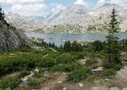
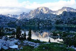
Island Lake
Pinedale, Wyoming
17.9 miles NBackpack, Hike, and Horseback near Pinedale, Wyoming
Backpack, Hike, Horseback 21.2-25.2 mi
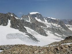
Gannett Peak
30.5 miles N
At 13,308 feet in elevation, Gannett Peak is considered to be one of the most difficult state highpoints, rivaled only by Alaska's Denali, Washington's Mount Rainier, and Montana's...
Backpack, Hike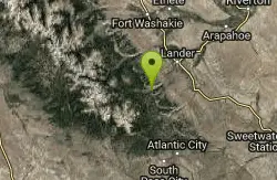
Popo Agie Water Slide (Trail Head)
Lander, Wyoming
43.8 miles EThe Popo Agie waterslide is a small waterfall on some slick rocks above a swimming hole located near near Lander, Wyoming. The slide drops off about 10 feet in to the water.
Hike, Mountain Bike, Swim
Sinks Canyon State Park
Lander, Wyoming
46.9 miles ESinks Canyon State Park is located in the Wind River Mountains. The park gets its name "The Sinks", from the part of the Popo Agie river that flows underground into a...
Cave, Hike, Rock Climb, Whitewater


