


137 Hiking Trails near X-Court BMX Park
first prev 1 2 3 4 5 6 7 next lastShowing Hiking Trails within 50 miles Distance miles of 6101 N 83rd Ave, Glendale, AZ 85303, USA City, Zip, or Address

Glendale Canal
Glendale, Arizona
6.8 miles NEHike, Horseback, and Mountain Bike near Glendale, Arizona
Hike, Horseback, Mountain Bike 23.0 mi
Grand Canal Trail
Phoenix, Arizona
7.5 miles EThe Grand Canal Trail is a 23-mile long system of paved and unpaved trails located in Glendale, Phoenix and Tempe that travels through...
Hike
Maxine Lakin Nature Trail
Phoenix, Arizona
9.6 miles EHike near Phoenix, Arizona
Hike

North Mountain National Trail
Phoenix, Arizona
10.7 miles NENorth Mountain National Trail is a 2.3 mile moderate, loop trail near Phoenix. It's easy to travel on if you go up the paved sections. The inclines are steep in parts, making it a real...
Hike
Shaw Butte and Charles M Christiansen Loop Trail
Phoenix, Arizona
10.9 miles NEWhen you say "North Mountain," I think most Arizonans know where it is or can find it. When you say "Shaw Butte," it seems like you get a lot more questioning glances and "huh?". Shaw...
Hike, Mountain Bike 4.6 mi
Perl Charles Memorial Trail (#1A)
Phoenix, Arizona
11.3 miles EThis is a technical singletrack loop with some very steep up and down sections located in the Phoenix Mountain Preserves. This trail is for advanced riders who like to bleed and leave their skin on...
Hike, Horseback, Mountain Bike
H-1 to H-4 Trails Loop
Glendale, Arizona
11.5 miles NThunderbird Park in Glendale, AZ consists of 5 H-Trails, named so because of the Hedgpeth Hills through which they wind. H-1: One-Way - 5.0 miles H-1a: Loop trail - 2.5 miles - 400...
Hike, Mountain Bike
Rio Salado Habitat Restoration Area
Phoenix, Arizona
11.8 miles SEHike near Phoenix, Arizona
Hike 8.3 mi
Estrella Mountains Competitive Track
Tolleson, Arizona
12.0 miles SThe third competitive track in the Maricopa County Regional Park system, located in Estrella Mountain Regional Park, was completed in February 2000. The track consists of two loops totaling 13 miles....
Hike, Horseback, Mountain Bike 1.3 mi
Dreamy Draw Loop Trail
Phoenix, Arizona
12.2 miles EThe Dreamy Draw Nature Trail is a short multi-access loop trail that provides a true Sonoran Desert experience. The trail crosses a number of desert washes and, at times, becomes somewhat rocky....
Hike, Horseback, Mountain Bike
Arizona Canal Trail
Phoenix, Arizona
12.2 miles EMulti-purpose canal trails set apart from normal city traffic and noise. The Arizona Canal is one of the many canals used to supply the valley with its water needs (irrigation). These canals were...
Hike, Horseback
Thunderbird H-1 H-2 H-3 Loop Trail
Glendale, Arizona
12.2 miles NHike and Mountain Bike near Glendale, Arizona
Hike, Mountain Bike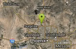
Thunderbird H-2 Trail
Glendale, Arizona
12.3 miles NThe trail is great for hiking and normally takes 1-3 hours. This is a nice, steady, non-strenuous, climb to the summit for anyone who is somewhat active. The type of incline where you...
Hike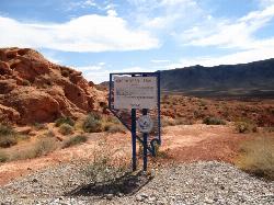
Arrowhead Point Trail
Glendale, Arizona
12.3 miles NArrowhead Trail is a 2.4 mile hiking and mountain biking trail within Thunderbird Conservation Park. This trail is manageable enough for beginners, but offers enough challenge for more experienced...
Hike, Mountain Bike 3.8 mi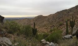
Freedom Loop Trail (#302)
Phoenix, Arizona
12.3 miles EFreedom Trail (#302), also known as Piestewa Circumference, is a 3.8 mile, moderate loop trail. You can access this trail from all the inner trailheads. The easiest and least...
Hike 2.2 mi
Piestewa Peak Summit Trail #300
Phoenix, Arizona
12.3 miles ESome people still refer to the Peak by its original name of "Squaw Peak" before its name changed to "Piestewa Peak" in honor of Lori Piestewa who died serving her country in the...
Hike 1.4 mi
Mohave Trail (#200)
Phoenix, Arizona
12.6 miles EAn invigorating swift hike is what Mohave Trail 200 provides for anyone looking for a free and quick escape. Though the main attraction of the Phoenix Mountain’s Preserve is the larger Piestewa...
Hike, Horseback
Baseline Trail
Goodyear, Arizona
12.6 miles SWThe Baseline trail is a 2.6 mile loop at Estrella Mountain Regional Park. This listing is based on access from a spur trail (33.378981, -112.371072) off of the Gila trail. Access is...
Hike
Lookout Mountain Circumference Trail
Phoenix, Arizona
12.8 miles NEHike near Phoenix, Arizona
Hike
Lookout Mountain Summit Trail
Phoenix, Arizona
12.8 miles NELookout Mountain Summit Trail is a short, 1 mile trail in Phoenix, Arizona. The trail is steep, especially towards the summit, but it's manageable, and well worth the...
Hike


