


11 Hiking Trails near The Eagle's Claw
first prev 1 next lastShowing Hiking Trails within 50 miles Distance miles of 6791 Catharpin Rd, Gainesville, VA 20155, USA City, Zip, or Address
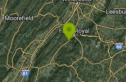
Gooney Creek
Front Royal, Virginia
34.5 miles WCamp, Hike, and Swim near Front Royal, Virginia
Camp, Hike, Swim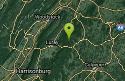
Piney River
Sperryville, Virginia
36.4 miles WPiney River is a great location for visitors hoping to experience multiple swimming holes in the same location. Visitors hoping to reach the swimming holes should follow Cumberland Trail down Piney...
Hike, Swim 5.1 mi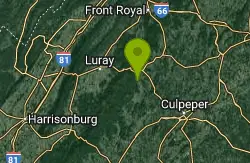
Hazel River Falls
Sperryville, Virginia
37.2 miles WHazel River Falls is a moderately difficult trail located inside Shenandoah National Park. This 5.3 mile hike follows Hazel River from the Meadow Spring Parking Area. This trail has a change in...
Hike, Swim 3.8 mi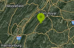
Overall Run Falls
Overall, Virginia
38.1 miles WOverall Run Falls is a challenging hike along one of Virginia's longest consecutively running waterfalls. Located in Shenandoah National Park, Overall Run Falls is accessible from Hogback...
Hike, Swim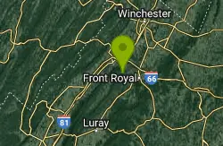
Buzzard Rock Hole
Strasburg, Virginia
38.2 miles WBuzzard Rock Hole is a popular swimming hole in the forests below the famous Buzzard Rock. The hike to Buzzard Rock is a moderate hike that can be anywhere from 4 to seven miles depending on what...
Hike, Swim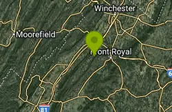
Elizabeth Furnace
Strasburg, Virginia
39.4 miles WElizabeth Furnace is a recreation area with many options for people hoping to reconnect with nature. This beautiful area is equip with a campground that allows visitors to explore for multiple days....
Camp, Hike, Mountain Bike, Rock Climb, Swim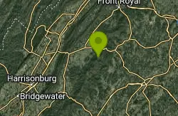
Nicholson Hollow Trail
Morning Star, Virginia
42.4 miles WNicholson Hollow Trail is a moderately strenuous trail that explores a more remote area of Shenandoah National Park. Hikers hoping to access this trail can find it off of Skyline Drive between Stoney...
Hike, Swim
Whiteoak Canyon
Syria, Virginia
43.9 miles WWhiteoak Canyon is a beautiful hiking area in Shenandoah National Park. This hike features two very unique waterfalls, Upper Whiteoak Falls and Lower Whiteoak Falls. Lower Whiteoak Falls is...
Hike, Swim 2.8 mi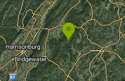
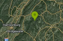
Cedar Run Falls
Oldrag, Virginia
44.7 miles SWCedar Run Falls is a strenuous but rewarding hiking trail located in central Shenandoah National Park. This over 8 mile trail gives hikers views of six different waterfalls along the trail...
Hike, Swim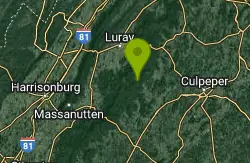
Rose River
Syria, Virginia
45.4 miles SWRose River Falls is a beautiful forested hike in Shenandoah National Park. The lush greenery in this area provides ample shade for hikers as they explore this four mile trail. Rose River Trail is...
Hike, Swim 0.3 mi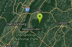
Big Rock Falls
Syria, Virginia
48.8 miles SWBig Rock Falls is an easy hike to a beautiful cascading waterfall. The hike follows Mill Prong River giving hikers a beautiful view of the flowing water, forests and rock formations for the entire...
Hike, Swim


