


138 Hiking Trails near Sunrise
first prev 1 2 3 4 5 6 7 next lastShowing Hiking Trails within 50 miles Distance miles of Lost Dog Wash Trailhead, Scottsdale, AZ 85255, USA City, Zip, or Address
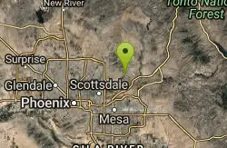
Sunrise Peak via Sunrise Trail
Scottsdale, Arizona
2.5 miles EHike near Scottsdale, Arizona
Hike
Sonoran Trail Fountain Hills
Fountain Hills, Arizona
3.5 miles NEHike near Fountain Hills, Arizona
Hike
Dixie Mine
Fountain Hills, Arizona
3.5 miles NEMcDowell Mountain Regional Park 16300 McDowell Mountain Park Dr. MMRP Arizona 85255 Ph: 480-471-0173 Fax: 602-372-8507 [email protected] Mailing...
Hike
Thompsons Peak
Fountain Hills, Arizona
3.5 miles NEHike near Fountain Hills, Arizona
Hike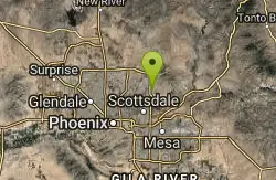
Indian Bend Bike Trail
Scottsdale, Arizona
4.2 miles WIndian Bend Wash Greenbelt is a urban, concrete paved path, primarily used for biking and walking/jogging, in Scottsdale, Arizona. This point A to point B, 11 mile long trail takes you past parks,...
Hike, Mountain Bike
Tom's Thumb Trail South
Scottsdale, Arizona
4.3 miles NWHike near Scottsdale, Arizona
Hike
Tom's Thumb to Bell Pass
Scottsdale, Arizona
4.3 miles NWHike and Mountain Bike near Scottsdale, Arizona
Hike, Mountain Bike
Gateway and Tom's Thumb Loop Trail
Scottsdale, Arizona
4.3 miles NWStarting at the 104th St trailhead, head toward the Gateway loop trail. Turn right at the Gateway loop. Next take the Bell pass trail and be prepared for a steep climb. Once you hit...
Hike, Horseback, Mountain Bike
Inspiration Point
Scottsdale, Arizona
4.3 miles NWInspiration Point is a 5.7, moderate hike located on the McDowell Sonoran Preserve near Scottsdale, Arizona. You'll begin your hike at the Gateway area, where you can find a parking lot...
Hike, Mountain Bike
Gatewa-Prospector-Thompson Peak Road Trail
Scottsdale, Arizona
4.3 miles NWHike near Scottsdale, Arizona
Hike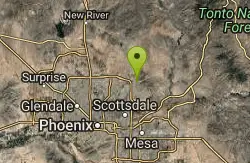
Horseshoe Loop Hike
Scottsdale, Arizona
4.3 miles NWHike near Scottsdale, Arizona
Hike
Saguaro Loop and Nature Trail
Scottsdale, Arizona
4.3 miles NWHike near Scottsdale, Arizona
Hike 0.6 mi
Horseshoe Trail
Scottsdale, Arizona
4.4 miles NWHorseshoe trail is a short, fun singletrack with a lot of quick turns created by wash areas and rocks. It's a nice warm-up heading to Gateway Loop Trail. In some areas there are a lot of cactus,...
Hike, Horseback, Mountain Bike

Fountain Park Trail
Fountain Hills, Arizona
5.7 miles EFountain views, Four Peaks view, desert vegetation, close to coffee! The trail is well groomed and well marked. It parallels some house as you begin to go up the first hill. About 15...
Hike, Mountain Bike
Fountain Hills Park
Fountain Hills, Arizona
6.0 miles EFountain Park is a 1.3 mile loop trail located near Phoenix, Arizona ( in Fountain Hills) and is good for all skill levels. The trail is primarily used for hiking and is accessible...
Hike
Tom's Thumb, Feldspar, and Marcus Landslide Loop
Scottsdale, Arizona
6.5 miles NHike near Scottsdale, Arizona
Hike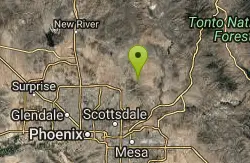
Tom's Thumb Trail
Scottsdale, Arizona
6.6 miles NTom's Thumb Trail is a popular trail on the McDowell Sonoran Preserve due to its unique thumb-like granite rock formation. This is a 4.7 out-and-back, intermediate trail because of its 1,200...
Hike, Mountain Bike, Rock Climb 2.2 mi
Marcus Landslide Trail
Scottsdale, Arizona
6.6 miles NThe Marcus Landslide Trail is named after ASU professor Melvin Marcus, a renouned geographer, after the discovery and recognition of the interesting geographical area in 2002. More than 500,000...
Hike, Horseback, Mountain Bike, Rock Climb
Wagner-Granite-Bluff Trails
Scottsdale, Arizona
8.0 miles NEHike and Mountain Bike near Scottsdale, Arizona
Hike, Mountain Bike
Wagner Trail
Scottsdale, Arizona
8.0 miles NEWagner Trail is a 2.2 mile, beginner to intermediate loop trail located in the McDowell Sonoran Preserve. The trail is well-marked and easy to follow; this wide, but rugged...
Hike, Horseback, Mountain Bike


