


45 Hiking Trails near Strawberry Narrows
first prev 1 2 3 next lastShowing Hiking Trails within 50 miles Distance miles of Forest Road 090, Heber City, UT 84032, USA City, Zip, or Address

Fifth Water Hot Springs
Provo, Utah
17.0 miles WAKA Diamond Fork Hot Springs A beautiful drive and a 2.5 mile hike along the river will end you at an amazing set of hot springs that's well worth the trip. There's a variety of...
Backpack, Camp, Hike, Hot Springs, Mountain Bike, Swim
Dripping Rock
Spanish Fork, Utah
29.6 miles WDripping Rock is along a paved path adjacent to Spanish Oaks Golf Course.
Hike

Y-Mountain Summit Trail
Provo, Utah
31.0 miles WY Mountain is located directly east of Brigham Young University (BYU) in Provo, Utah, United States. The Slide Canyon/Y Mountain Trail leads to a large block Y located 1.2 miles (1.9 km) from a...
Camp, Hike
Bicentennial Park
Provo, Utah
31.8 miles WBicentennial Park is a favorite among disc golfers and families in the Provo area. The park has a 16-hole golf course, a duck pond, a playground, and a nature trail which features natural springs...
Disc Golf, Hike, Sled
Provo River Parkway Trail
Provo, Utah
32.1 miles NWThis isn't quite as much mountain biking as it is an easy downhill bike ride. The whole trail is paved. One of the best ways to do it is to take two vehicles and park one at Will's Canyon...
Hike, Mountain Bike
Timpanogos Falls
Provo, Utah
35.2 miles NWOne of the many waterfalls in the Mt Timpanogos area, Timpanogos Falls is a lesser known and visited waterfall. The trail for Timpanogos Falls departs from the same parking lot as Stewart Falls,...
Hike
Stewart Falls
Provo, Utah
35.3 miles NWStewart Falls is found nestled in the forest along the east side of Mt. Timpanogos. Fed by a glacier on the mountain, the crystal clear falls will leave visitors refreshed on a warm summer day. Those...
Hike 2.3 mi
Gordon Creek Falls
Helper, Utah
35.5 miles SGordon Creek Falls is a set of waterfalls (upper and lower) accessable usually by ATV, but also by hiking, if desired. The trail will take you to the first set of falls, as marked below, and from...
Hike, Mountain Bike, Swim
Grotto Falls
Payson, Utah
35.9 miles WGrotto Falls is a short trail into the Payson Canyon. Visitors will enjoy a quick walk through the woods along the creek, as they cross over several bridges and make their way towards the Grotto....
Hike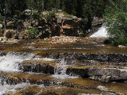
Provo River Falls
Kamas, Utah
36.7 miles NFrom the highway on the way to Mirror Lake, drivers will see the Provo River flow and cascade over several waterfalls on its way to the valley. Both the upper and lower falls are visible and...
Hike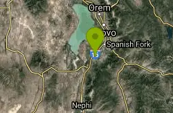
P Mountain and Little Mountain
Payson, Utah
37.1 miles WP mountain can be seen from many of the points in Payson. Ask any local and they can guide you there!
Hike 1.6-14.1 mi
Mount Timpanogas
Provo, Utah
37.8 miles NWMt. Timp, as the locals call it, is the 2nd highest mountain in the Wasatch range (only Mt. Nebo is higher). What sets "Timp" apart is its location. It towers over the Provo, Orem, Pleasant...
Camp, Hike, Horseback, Swim 1.2 mi
Battle Creek Falls
Pleasant Grove, Utah
38.4 miles NWBattle Creek Falls, located near Pleasant Grove, Utah, is a scenic waterfall that also has a rappelling and rock climbing area nearby. Hikers are allowed to see the falls from two view points, below...
Canyoneer, Hike
G Mountain Trail
Pleasant Grove, Utah
38.4 miles NWThe trail starts at Kiwanis Park which is south of the 'G' at the end of Battle Creek Road. The trail starts out a little steep for about .25 mile and the very last bit is a...
Hike
Grove Creek Trail
Pleasant Grove, Utah
39.2 miles NWThe Grove Creek Trail falls from the upper shoulder of Mount Timpanogos down Grove Creek Canyon to Pleasant Grove. It's usually ridden as a shuttled downhill -- because the climb up this...
Hike, Mountain Bike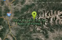
Mirror Lake
Salt Lake City, Utah
40.4 miles NMirror Lake is a beautiful recreation area packed with opportunities to experience nature. Because of the stillness and clarity of the water, Mirror Lake is a beautiful reflection of the surrounding...
Backpack, Hike, Mountain Bike, Swim 1.5 mi
Timpanogas Cave
Provo, Utah
41.2 miles NWKnown for it's colorful cave decorations, the Timpanogas cave attracts numerous visitors per year, is steep but it's paved so that visitors can access the cave. To access the cave, visitors...
Backpack, Cave, Hike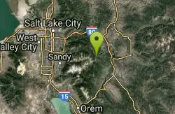
Wasatch Crest
Salt Lake City, Utah
42.6 miles NWThe Wasatch Crest Trail (GWT) is probably one of the best, if not the very best, singletrack trail in Utah! I prefer to do this ride as an out and back, starting at Millcreek Canyon's Big Water...
Hike, Mountain Bike
Sugarloaf Peak
Alta, Utah
43.0 miles NWSugarloaf Peak is an easily reached 11,000 ft. summit which overlooks Albion Basin, Secret Lake, and much of Utah's Alta ski resort. The easy terrain and relatively high trailhead elevation...
Hike
Cecret (Secret) Lake
Alta, Utah
43.1 miles NWCecret (pronounced "Secret") Lake is a beautiful lake located among alpine meadows in Little Cottonwood Canyons Albion Basin. Some folks spell Secret Lake as Cecret Lake, but the USGS...
Hike


