


137 Hiking Trails near Ruth Hamilton Trail
first prev 1 2 3 4 5 6 7 next lastShowing Hiking Trails within 50 miles Distance miles of 8B, Phoenix, AZ 85018, USA City, Zip, or Address

Mohave Trail (#200)
Phoenix, Arizona
0.8 miles WAn invigorating swift hike is what Mohave Trail 200 provides for anyone looking for a free and quick escape. Though the main attraction of the Phoenix Mountain’s Preserve is the larger Piestewa...
Hike, Horseback 1.7 mi
Quartz Ridge Trail
Phoenix, Arizona
0.8 miles SWThis is a very popular trail on weekend mornings. Casual hikers can get great views of Phoenix with moderate effort. Good place to bring out of town visitors The Quartz Ridge Trail is a short,...
Hike, Mountain Bike 2.2 mi
Piestewa Peak Summit Trail #300
Phoenix, Arizona
1.1 miles WSome people still refer to the Peak by its original name of "Squaw Peak" before its name changed to "Piestewa Peak" in honor of Lori Piestewa who died serving her country in the...
Hike 3.8 mi
Freedom Loop Trail (#302)
Phoenix, Arizona
1.1 miles WFreedom Trail (#302), also known as Piestewa Circumference, is a 3.8 mile, moderate loop trail. You can access this trail from all the inner trailheads. The easiest and least...
Hike
L.V. Yates to "Two Bit" Peak Loop
Phoenix, Arizona
1.8 miles NWell this time of the year there really was not a lot of wild life to see, just to hot. Starting from the 40st trailhead gave me a different view of the preserve. I really enjoyed...
Hike, Horseback 2.6 mi
L.V. Yates Trail (#8)
Phoenix, Arizona
1.8 miles NThe trail is strewn with large rocks and gulleys from recent torrential rains. Not impassable on foot, but definitely some hike-a-bike areas. Keep in mind there's no ridge hiking...
Hike, Horseback, Mountain Bike
Arizona Canal Trail
Phoenix, Arizona
1.9 miles SWMulti-purpose canal trails set apart from normal city traffic and noise. The Arizona Canal is one of the many canals used to supply the valley with its water needs (irrigation). These canals were...
Hike, Horseback 1.3 mi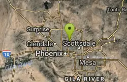
Dreamy Draw Loop Trail
Phoenix, Arizona
2.0 miles NWThe Dreamy Draw Nature Trail is a short multi-access loop trail that provides a true Sonoran Desert experience. The trail crosses a number of desert washes and, at times, becomes somewhat rocky....
Hike, Horseback, Mountain Bike 4.6 mi
Perl Charles Memorial Trail (#1A)
Phoenix, Arizona
2.1 miles WThis is a technical singletrack loop with some very steep up and down sections located in the Phoenix Mountain Preserves. This trail is for advanced riders who like to bleed and leave their skin on...
Hike, Horseback, Mountain Bike 7.1 mi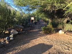
Trail 100
Phoenix, Arizona
2.1 miles NEMountain Bikers and Hikers in Phoenix, Arizona can rejoice in the challenge that is Trail 100. Trail 100, or Charles M. Christensen Memorial Trail, is a little over 14 miles out and back in the...
Hike, Mountain Bike 3.6 mi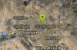
Charles M. Christiansen Memorial Trail
Phoenix, Arizona
2.2 miles NEPhoenix, Arizona is home to some of the best and largest city parks in the country and the Charles M. Christiansen Memorial Trail is a great introduction to this fantastic park system. Also known as...
Hike, Horseback, Mountain Bike 1.0-1.2 mi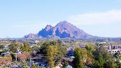
Camelback Mountain
Phoenix, Arizona
2.4 miles SEHiking After Camelback became a park in 1968, TripAdvisor advertised the hikes as one of the top 10 things to do when in Phoenix. Located right in the middle of Phoenix, Scottsdale and...
Hike, Rock Climb
North Mountain National Trail
Phoenix, Arizona
4.7 miles NWNorth Mountain National Trail is a 2.3 mile moderate, loop trail near Phoenix. It's easy to travel on if you go up the paved sections. The inclines are steep in parts, making it a real...
Hike
Maxine Lakin Nature Trail
Phoenix, Arizona
5.1 miles NWHike near Phoenix, Arizona
Hike
Shaw Butte and Charles M Christiansen Loop Trail
Phoenix, Arizona
5.2 miles NWWhen you say "North Mountain," I think most Arizonans know where it is or can find it. When you say "Shaw Butte," it seems like you get a lot more questioning glances and "huh?". Shaw...
Hike, Mountain Bike
Shadow Mountain Trail
Phoenix, Arizona
5.4 miles NThis particular route trailhead starts at 23rd place and Sweetwater rd it's a great wildlife trail.
Hike
Papago to Tempe Town Lake
Phoenix, Arizona
6.0 miles SThere are many paths that interconnect within Papago park and the nearby Tempe Town Lake. Any of these in combination provide a good walk or bike riding experience with a variety of views. Papago...
Hike
Lookout Mountain Circumference Trail
Phoenix, Arizona
6.3 miles NWHike near Phoenix, Arizona
Hike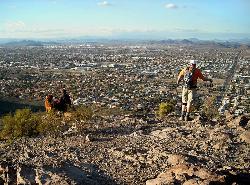
Lookout Mountain Summit Trail
Phoenix, Arizona
6.3 miles NWLookout Mountain Summit Trail is a short, 1 mile trail in Phoenix, Arizona. The trail is steep, especially towards the summit, but it's manageable, and well worth the...
Hike
Double Butte Loop Trail
Phoenix, Arizona
6.8 miles SEDouble Butte Loop Trail is one of the trails within Papago Park in Phoenix, Arizona. The Double Butte Loop Trail is a natural trail that traverses the circumference of both the small butte...
Hike, Mountain Bike


