


25 Hiking Trails near Thunder Mountain Trail
first prev 1 2 next lastShowing Hiking Trails within 50 miles Distance miles of Thunder Mountain Trailhead Rd, Panguitch, UT 84759, USA City, Zip, or Address
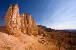
Fairyland Loop Trail
Bryce, Utah
11.9 miles SEFairyland Loop Trail is one of the most scenic hikes available in Bryce Canyon. Hiking this loop allows you to see many of Bryce Canyon’s well-known sights from several...
Hike 1.8 mi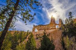
Tower Bridge
Bryce, Utah
12.0 miles SETower Bridge is a unique and uncrowded trail in Bryce Canyon. Tower Bridge gets its name from the prominent rock formation the trail leads to. The rock formation resembles London Bridge and is a...
Hike 2.3 mi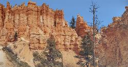
Queens Garden Trail
Bryce, Utah
12.1 miles SEThe Queen's Garden Trail is the hike to see the wonders of Bryce Canyon's main amphitheater from all angles. Starting at Sunrise Point, you'll have a great view from the rim before...
Hike 0.5-5.4 mi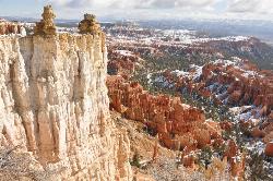
Rim Trail
Bryce, Utah
12.1 miles SERim Trail is a wonderful way for hikers to explore the breathtaking views of Bryce Canyon from above the canyon. The trail curves around the park allowing hikers to view the spectacular, red rock...
Hike 1.2 mi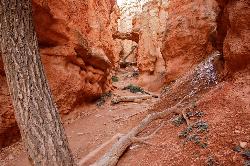
Navajo Trail
Bryce, Utah
12.2 miles SENavajo Trail explores the main amphitheater of Bryce Canyon National park in a short but winding hike. The hike begins at Sunset Point and splits off into a loop. The loop can be taken in either...
Hike 4.1 mi
Swamp Canyon Overlook and Trail
Bryce, Utah
12.5 miles SESwamp Canyon Trail is a wonderful, lesser-explored trail of moderate difficulty. Hikers in this area can expect to see some of Bryce Canyon’s famous rock formations, while also experiencing the...
Hike 0.1-0.3 mi
Mossy Cave
Tropic, Utah
13.0 miles SEMossy Cave Trail is perfect for Bryce Canyon Visitors who want to experience the wonderful rock formations, like the Hoodoos, without steep and strenuous climbing. This trail is just over a mile and...
Hike 3.1 mi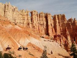
Peek-a-boo Loop
Bryce, Utah
13.5 miles SEPeek-a-boo Loop Trail is one of the more strenuous hikes available in Bryce Canyon. The unique challenge this loop provides has beautiful views that are well worth the hike. This three-mile loop can...
Hike 1.6 mi
Hat Shop
Bryce, Utah
13.5 miles SEHat Shop Trail is a moderately difficult hike with the view of some delicately balanced rock formations. These rock formations are where the Hat Shop Trail got its name. Huge gray boulders can be...
Hike 1.0 mi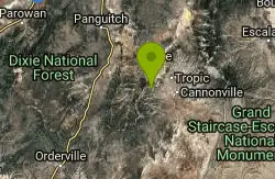
Bristlecone Loop
Kanab, Utah
19.2 miles SBristlecone Loop is a one-mile trail from Rainbow Point. Rainbow Point is located at the southern end of Bryce Canyon National Park and is the highest point in the park. The spectacular views...
Hike 8.1 mi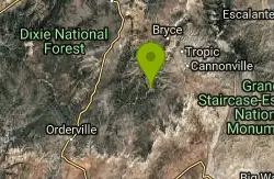
Riggs Spring Loop Trail
Kanab, Utah
19.2 miles SRiggs Spring Loop Trail is the perfect trail for hikers wishing to escape to the wilderness. This is one of the least trafficked trails in Bryce Canyon and one of the most forested. The ponderosa...
Hike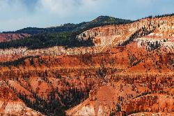
Dixie National Forest
Cedar City, Utah
19.6 miles WDixie National Forest is an often forgotten/hidden gem in Cedar City. It is over 2 million acres of beautiful red rock canyons and trees. Dixie Forest isn't only limited to rocks and...
Backpack, Camp, Hike 1.1 mi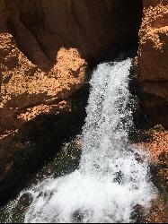
Cascade Falls
Cedar City, Utah
28.8 miles SWCascade Falls, located outside of Cedar City, Utah, is a beautiful waterfall that is just a 1.2 mile hike round trip, ending at Cascade Falls. It is somewhat of a hidden local hotspot that not...
Hike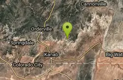
Montezuma Mines
Kanab, Utah
36.6 miles SA bunch of sand caves/mines. There are some pits with old ladders, and at least one pit in particular that you can descend with a rope.
Cave, Hike 12.1 mi
Escalante River
Escalante, Utah
41.0 miles EHike and Horseback near Escalante, Utah
Hike, Horseback 7.4 mi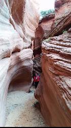
Red Slot Canyon AKA Peek-a-boo
Kanab, Utah
42.8 miles SThis great little slot canyon is officially Red Slot Canyon but is also referred to as Peekaboo Canyon. It is not to be confused with Peek-a-boo Canyon near Spooky Gulch. It's not really very...
Hike 0.8 mi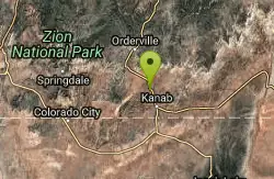
Moqui Caverns
Kanab, Utah
45.1 miles SLocated near the small town of Kanab, Utah, The Moqui Caverns are a rare sight to behold. With bright flourescent rocks, Moqui Caverns is one of the more unique hikes not only in the state of Utah,...
Cave, Hike
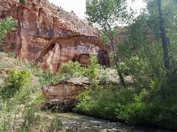
Riverside Walk
Springdale, Utah
46.2 miles SWThe Virgin River has many moods, from quiet and slow to a raging torrent. This beautiful, shaded walk meanders through forested glens, following the path of the stream ever deeper into the...
Hike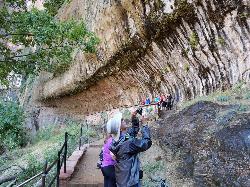
Weeping Rock
Springdale, Utah
46.8 miles SWExpect to get wet on this short hike! Weeping Rock gets its name from the continuous "weeping" of water that seeps through sandstone and drips from the cliffs above. Seasonal flowers...
Hike 2.6 mi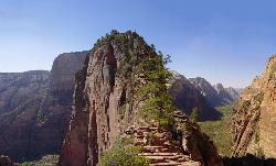
Angels Landing
Springdale, Utah
47.9 miles SWAngels Landing is one of the park's most strenuous day hikes, but it offers spectacular vistas. It follows the West Rim Trail through the famous switchbacks of Walters Wiggles, past dramatic...
Hike


